|
|
| Greenville Airport |
| IATA: GRE â ICAO: KGRE â FAA LID: GRE |
| Summary |
| Airport type |
Public |
| Owner |
Greenville Airport Authority |
| Serves |
Greenville, Illinois |
| Elevation AMSL |
541 ft / 165 m |
| Coordinates |
38°50â²10â³N 089°22â²42â³W / 38.83611°N 89.37833°W / 38.83611; -89.37833 |
| Runways |
| Direction |
Length |
Surface |
| ft |
m |
| 18/36 |
4,002 |
1,220 |
Asphalt |
| 9/27 |
3,200 |
975 |
Turf |
| Statistics (2007) |
| Aircraft operations |
25,000 |
| Based aircraft |
43 |
| Source: Federal Aviation Administration |
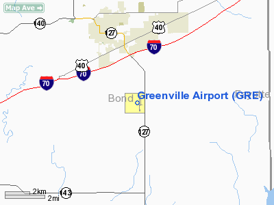
Greenville Airport (IATA: GRE, ICAO: KGRE, FAA LID: GRE) is a public airport located three miles (5 km) south of the central business district of Greenville, a city in Bond County, Illinois, United States. It is owned by the Greenville Airport Authority.
Facilities and aircraft
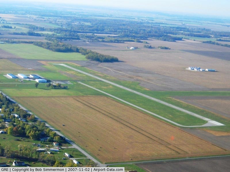
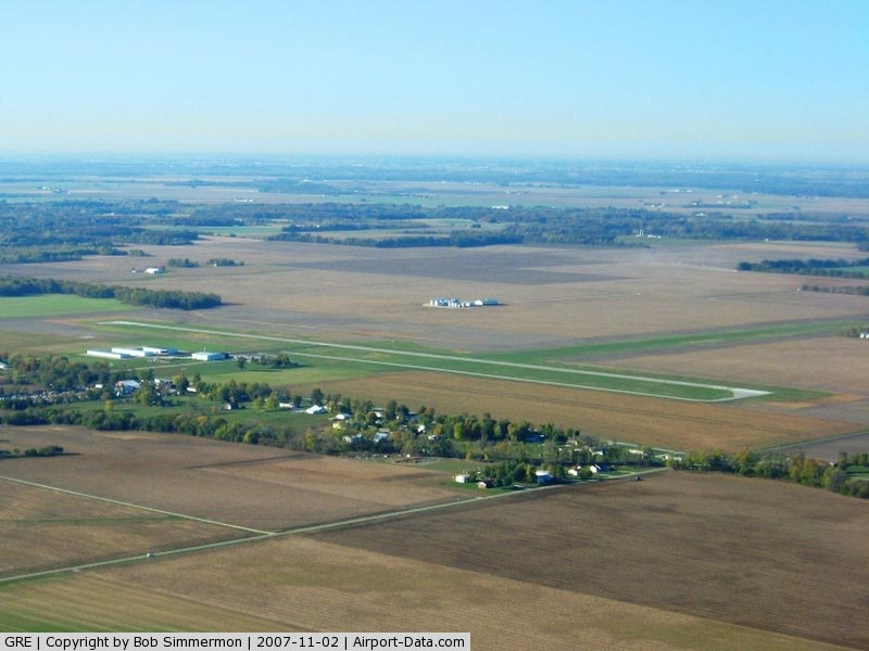
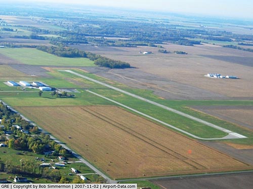
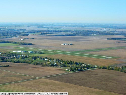
Greenville Airport covers an area of 492 acres (199 ha) which contains two runways: 18/36 with a 4,002 x 75 ft (1,220 x 23 m) asphalt pavement and 9/27 with a 3,200 x 250 ft (975 x 76 m) turf surface.
For the 12-month period ending August 31, 2007, the airport had 25,000 aircraft operations, an average of 68 per day: 88% general aviation, 8% air taxi and 4% military. At that time there were 43 aircraft based at this airport: 77% single-engine, 5% multi-engine and 19% ultralight.
The above content comes from Wikipedia and is published under free licenses – click here to read more.
|
 |
(Click on the photo to enlarge) |
|
 |
(Click on the photo to enlarge) |
|
 |
(Click on the photo to enlarge) |
|
 |
(Click on the photo to enlarge) |
Location
& QuickFacts
|
FAA
Information Effective: |
2007-12-20 |
|
Airport
Identifier: |
GRE |
|
Airport
Status: |
Operational |
|
Longitude/Latitude: |
089-22-42.2800W/38-50-10.1680N
-89.378411/38.836158 (Estimated) |
|
Elevation: |
541 ft / 164.90 m (Surveyed) |
|
Land: |
492 acres |
|
From
nearest city: |
3 nautical miles S of Greenville, IL |
|
Location: |
Bond County, IL |
|
Magnetic Variation: |
01E (1985) |
Owner & Manager
|
Ownership: |
Publicly owned |
|
Owner: |
The Greenville Arpt Authority |
|
Address: |
1374 Sky Lane
Greenville, IL 62246 |
|
Phone number: |
618-664-0926
FAX 618-664-0929 |
|
Manager: |
Troy Walker |
|
Address: |
1374 Sky Lane
Greenville, IL 62246 |
|
Phone number: |
618-664-0926
OR
618-664-3476 |
Airport
Operations and Facilities
|
Airport
Use: |
Open
to public |
|
Wind
indicator: |
Yes |
|
Segmented Circle: |
Yes |
|
Control
Tower: |
No |
|
Lighting
Schedule: |
DUSK-DAWN
MIRL RY 18/36 PRESET ON LOW INTST; TO INCR INTST ACTVT -
CTAF. |
|
Beacon
Color: |
Clear-Green (lighted land airport) |
|
Landing
fee charge: |
No |
|
Sectional chart: |
St Louis |
|
Region: |
AGL - Great Lakes |
|
Traffic
Pattern Alt: |
800 ft |
|
Boundary
ARTCC: |
ZKC - Kansas City |
|
Tie-in
FSS: |
STL - Saint Louis |
|
FSS
on Airport: |
No |
|
FSS
Toll Free: |
1-800-WX-BRIEF |
|
NOTAMs
Facility: |
STL (NOTAM-d service avaliable) |
|
Federal Agreements: |
NGY |
Airport Communications
|
CTAF: |
123.050 |
|
Unicom: |
123.050
AUTOMATED UNICOM.
618-664-1939. |
Airport Services
|
Fuel
available: |
100LLA |
|
Airframe
Repair: |
MINOR |
|
Power
Plant Repair: |
MINOR |
|
Bottled
Oxygen: |
NONE |
|
Bulk
Oxygen: |
NONE |
|
Runway Information
Runway 09/27
|
Dimension: |
3200
x 250 ft / 975.4 x 76.2 m |
|
Surface: |
TURF, Good Condition |
|
|
Runway 09 |
Runway 27 |
|
Longitude: |
089-23-11.2810W |
089-22-31.0600W |
|
Latitude: |
38-50-12.1680N |
38-50-12.1680N |
|
Traffic
Pattern: |
Left |
Left |
|
Displaced
threshold: |
0.00 ft |
600.00 ft
DSPLCD THLD MKD WITH 5 FT VEE BOARD PAINTED YELLOW. |
|
Obstruction: |
70 ft tree, 3190.0 ft from runway, 294 ft right
of centerline, 45:1 slope to clear |
58 ft tree, 1206.0 ft from runway, 67 ft right
of centerline, 20:1 slope to clear
RWY 27 APCH SLOPE 31:1 TO DSPLCD THLD. |
|
Runway 18/36
|
Dimension: |
4002
x 75 ft / 1219.8 x 22.9 m |
|
Surface: |
ASPH, Good Condition |
|
Weight
Limit: |
Single wheel: 7500 lbs. |
|
Edge
Lights: |
Medium |
|
|
Runway 18 |
Runway 36 |
|
Longitude: |
089-22-35.2549W |
089-22-35.0202W |
|
Latitude: |
38-50-28.2528N |
38-49-48.6980N |
|
Elevation: |
540.00 ft |
531.00 ft |
|
Alignment: |
127 |
127 |
|
Traffic
Pattern: |
Left |
Left |
|
Markings: |
Basic, Good Condition |
Basic, Good Condition |
|
Crossing
Height: |
25.00 ft |
0.00 ft |
|
VASI: |
pulsating/steady burning on left side |
|
|
Visual
Glide Angle: |
3.00° |
0.00° |
|
Runway
End Identifier: |
Yes
REIL OTS INDEFLY. |
|
|
Radio Navigation
Aids
|
ID |
Type |
Name |
Ch |
Freq |
Var |
Dist |
|
SLO |
NDB |
Salem |
|
400.00 |
01W |
22.5
nm |
|
LTD |
NDB |
Litchfield |
|
371.00 |
01E |
24.2
nm |
|
BL |
NDB |
Belleville |
|
362.00 |
02E |
28.5
nm |
|
CVM |
NDB |
Civic
Memorial |
|
263.00 |
02E |
31.9
nm |
|
TAZ |
NDB |
Taylorville |
|
395.00 |
00E |
42.1
nm |
|
SYZ |
NDB |
Shelbyville |
|
365.00 |
01E |
42.4
nm |
|
SAR |
NDB |
Sparta |
|
239.00 |
01E |
44.2
nm |
|
FOA |
NDB |
Elm
River |
|
353.00 |
00E |
44.5
nm |
|
SKE |
TACAN |
Scott |
059X |
|
02E |
28.3
nm |
|
VNN |
VOR/DME |
Mount
Vernon |
085X |
113.80 |
02E |
39.1
nm |
|
CSX |
VOR/DME |
Cardinal |
111Y |
116.45 |
00E |
46.3
nm |
|
VLA |
VORTAC |
Vandalia |
090X |
114.30 |
04E |
18.5
nm |
|
TOY |
VORTAC |
Troy |
107X |
116.00 |
04E |
26.0
nm |
|
ENL |
VORTAC |
Centralia |
097X |
115.00 |
04E |
27.1
nm |
|
BIB |
VORTAC |
Bible
Grove |
027X |
109.00 |
03E |
42.3
nm |
|
STL |
VOT |
St
Louis Lambert |
|
111.00 |
|
46.4
nm |
Remarks
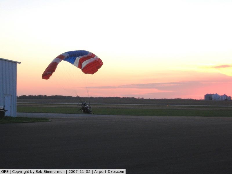
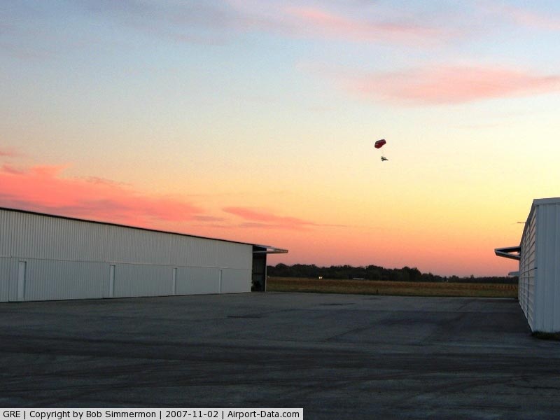
- INTENSIVE
POWERED PARACHUTE OPERATIONS DURING EARLY MORNING AND LATE AFTERNOON/EVENING.
Based
Aircraft
|
Aircraft
based on field: |
43 |
|
Single
Engine Airplanes: |
33 |
|
Multi
Engine Airplanes: |
2 |
|
Ultralights: |
8 |
Operational Statistics
Time Period: 2006-09-01 - 2007-08-31
|
Aircraft
Operations: |
69/Day |
|
Air
Taxi: |
8.0% |
|
General
Aviation Local: |
80.0% |
|
General
Aviation Itinerant: |
8.0% |
|
Military: |
4.0% |
Greenville Airport
Address:
Bond County, IL
Tel:
618-664-0926,
618-664-3476
Fax:
618-664-0929
Images
and information placed above are from
http://www.airport-data.com/airport/GRE/
We
thank them for the data!
| General
Info |
| Country |
United
States |
| State |
ILLINOIS
|
| FAA ID |
GRE |
| Latitude |
38-50-10.168N
|
| Longitude |
089-22-42.280W
|
| Elevation |
541 feet
|
| Near City |
GREENVILLE
|
We don't guarantee the information is fresh and accurate. The data may
be wrong or outdated.
For more up-to-date information please refer to other sources.
|
|