 |
|
Coordinates: 41°04â²17â³N 087°50â²47â³W / 41.07139°N 87.84639°W / 41.07139; -87.84639
| Greater Kankakee Airport |
| IATA: IKK â ICAO: KIKK â FAA LID: IKK |
| Summary |
| Airport type |
Public |
| Owner/Operator |
Kankakee Valley Airport Authority |
| Serves |
Kankakee, Illinois |
| Elevation AMSL |
630 ft / 192 m |
| Website |
www.kvaa.com |
| Runways |
| Direction |
Length |
Surface |
| ft |
m |
| 4/22 |
5,979 |
1,822 |
Asphalt |
| 16/34 |
4,399 |
1,341 |
Asphalt |
| Statistics (2005) |
| Aircraft operations |
50,000 |
| Based aircraft |
135 |
| Source: Federal Aviation Administration |
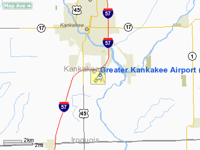
Greater Kankakee Airport (IATA: IKK, ICAO: KIKK, FAA LID: IKK) is a public airport located three miles (5 km) south of the central business district of Kankakee, in Kankakee County, Illinois, United States.
The airport was opened in 1962 and continues to operate as a general aviation facility serving the Kankakee area and South Chicago. It is 60 miles (97 km) south of Chicago and 75 miles (121 km) north of Champaign, Illinois. It is the largest Airport between the Chicago Midway Airport and the Champaign Airport. Greater Kankakee is a general aviation airport, consisting of mostly private aircraft with a mix of corporate and business aircraft usage.
The airport is owned and operated by the Kankakee Valley Airport Authority. The Authority has an appointed board of directors totaling six members. Members are appointed one each from the local communities of Kankakee, Bradley, and Bourbonnais and three members from the Kankakee County Board.
Facilities and airports
Greater Kankakee Airport covers an area of 950 acres (384 ha) which contains two asphalt paved runways: 4/22 measuring 5,979 x 100 ft (1,822 x 30 m) and 16/34 measuring 4,399 x 75 ft (1,341 x 23 m).
For the 12-month period ending December 31, 2005, the airport had 50,000 aircraft operations, an average of 136 per day: 92% general aviation, 6% military and 2% air taxi. There are 135 aircraft based at this airport: 73% single engine, 13% multi-engine, 11% ultralight, 1% jet and 1% helicopter.
The above content comes from Wikipedia and is published under free licenses – click here to read more.
Location
& QuickFacts
|
FAA
Information Effective: |
2007-12-20 |
|
Airport
Identifier: |
IKK |
|
Airport
Status: |
Operational |
|
Longitude/Latitude: |
087-50-46.6000W/41-04-17.0000N
-87.846278/41.071389 (Estimated) |
|
Elevation: |
630 ft / 192.02 m (Surveyed) |
|
Land: |
950 acres |
|
From
nearest city: |
3 nautical miles S of Kankakee, IL |
|
Location: |
Kankakee County, IL |
|
Magnetic Variation: |
00E (1980) |
Owner
& Manager
|
Ownership: |
Publicly
owned |
|
Owner: |
Kankakee Valley Arpt Auth |
|
Address: |
813a E. 4000 S. Rd
Kankakee, IL 60901 |
|
Phone
number: |
815-939-1422 |
|
Manager: |
Jason Licon |
|
Address: |
813a E. 4000 S. Road
Kankakee, IL 60901 |
|
Phone number: |
815-939-1422 |
Airport Operations and Facilities
|
Airport
Use: |
Open
to public |
|
Wind
indicator: |
Yes |
|
Segmented Circle: |
Yes |
|
Control
Tower: |
No |
|
Lighting
Schedule: |
DUSK-DAWN
HIRL RY 04/22 PRESET ON LOW INTST; TO INCR INTST & ACTVT
MALSR RY 04 & MIRL RY 16/34 & REIL RYS 04 &
22 - CTAF. |
|
Beacon
Color: |
Clear-Green (lighted land airport) |
|
Landing
fee charge: |
No |
|
Sectional chart: |
Chicago |
|
Region: |
AGL - Great Lakes |
|
Traffic
Pattern Alt: |
800 ft |
|
Boundary
ARTCC: |
ZAU - Chicago |
|
Tie-in
FSS: |
IKK - Kankakee |
|
FSS
on Airport: |
Yes |
|
FSS
Toll Free: |
1-800-WX-BRIEF
LOCAL CALL TO AFSS 935-5761. |
|
NOTAMs
Facility: |
IKK (NOTAM-d service avaliable) |
|
Federal Agreements: |
NGY |
Airport Communications
|
CTAF: |
123.000 |
|
Unicom: |
123.000
|
Airport
Services
|
Fuel
available: |
100LLA |
|
Airframe
Repair: |
MAJOR |
|
Power
Plant Repair: |
MAJOR |
|
Bottled
Oxygen: |
NONE |
|
Bulk
Oxygen: |
NONE |
|
Runway Information
Runway 04/22
|
Dimension: |
5979
x 100 ft / 1822.4 x 30.5 m |
|
Surface: |
ASPH, Fair Condition |
|
Surface
Treatment: |
Porous Friction Course |
|
Weight
Limit: |
Single wheel: 60000 lbs.
Dual wheel: 95000 lbs. |
|
Edge
Lights: |
High |
|
|
Runway 04 |
Runway 22 |
|
Longitude: |
087-51-17.5620W |
087-50-29.1484W |
|
Latitude: |
41-03-56.8540N |
41-04-43.1978N |
|
Elevation: |
625.00 ft |
630.00 ft |
|
Alignment: |
38 |
127 |
|
ILS
Type: |
ILS |
|
|
Traffic
Pattern: |
Left |
Left |
|
Markings: |
Precision instrument, Fair Condition |
Non-precision instrument, Fair Condition |
|
Crossing
Height: |
49.00 ft |
35.00 ft |
|
VASI: |
4-light PAPI on left side |
4-light PAPI on left side |
|
Visual
Glide Angle: |
3.00° |
3.00° |
|
Approach
lights: |
MALSR |
|
|
Runway
End Identifier: |
No |
Yes |
|
Runway 16/34
|
Dimension: |
4399
x 75 ft / 1340.8 x 22.9 m |
|
Surface: |
ASPH, Good Condition |
|
Weight
Limit: |
Single wheel: 30000 lbs.
Dual wheel: 40000 lbs. |
|
Edge
Lights: |
Medium |
|
|
Runway 16 |
Runway 34 |
|
Longitude: |
087-50-46.6386W |
087-50-28.0121W |
|
Latitude: |
41-04-33.5389N |
41-03-52.4305N |
|
Elevation: |
622.00 ft |
618.00 ft |
|
Alignment: |
127 |
127 |
|
Traffic
Pattern: |
Left |
Left |
|
Markings: |
Basic, Good Condition |
Basic, Good Condition |
|
Crossing
Height: |
35.00 ft |
35.00 ft |
|
VASI: |
4-light PAPI on left side |
4-light PAPI on left side |
|
Visual
Glide Angle: |
3.00° |
3.00° |
|
Obstruction: |
17 ft road, 800.0 ft from runway, 35:1 slope
to clear |
13 ft road, 730.0 ft from runway, 181 ft left
of centerline, 40:1 slope to clear |
|
Radio Navigation
Aids
|
ID |
Type |
Name |
Ch |
Freq |
Var |
Dist |
|
RZL |
NDB |
Rensselaer |
|
362.00 |
02W |
31.0
nm |
|
HK |
NDB |
Ermin |
|
332.00 |
01W |
38.9
nm |
|
MX |
NDB |
Kedzi |
|
248.00 |
01W |
40.9
nm |
|
OIX |
NDB |
Ottawa |
|
266.00 |
01E |
48.8
nm |
|
VP |
NDB |
Sedly |
|
212.00 |
02W |
49.4
nm |
|
IKK |
VOR/DME |
Kankakee |
053X |
111.60 |
00E |
0.2
nm |
|
RBS |
VOR/DME |
Roberts |
115X |
116.80 |
02E |
32.8
nm |
|
PNT |
VOR/DME |
Pontiac |
033X |
109.60 |
03E |
43.0
nm |
|
EON |
VORTAC |
Peotone |
079X |
113.20 |
02E |
12.2
nm |
|
CGT |
VORTAC |
Chicago
Heights |
089X |
114.20 |
02E |
29.1
nm |
|
JOT |
VORTAC |
Joliet |
070X |
112.30 |
02E |
35.6
nm |
|
BVT |
VORTAC |
Boiler |
098X |
115.10 |
01E |
47.0
nm |
|
DNV |
VORTAC |
Danville |
047X |
111.00 |
02E |
48.6
nm |
|
MDW |
VOT |
Chicago
Midway |
|
111.00 |
|
43.2
nm |
Remarks
- FOR
ULTRALIGHT OPNS PPR CALL
815-939-1422.
- DEER
& WATERFOWL ON & INVOF ARPT.
- ULTRALIGHT
ACTIVITW IN GRASS AREA W OF RY 04/22.
Based
Aircraft
|
Aircraft
based on field: |
135 |
|
Single
Engine Airplanes: |
99 |
|
Multi
Engine Airplanes: |
17 |
|
Jet
Engine Airplanes: |
2 |
|
Helicopters: |
2 |
|
Ultralights: |
15 |
Operational Statistics
Time Period: 2005-01-01 - 2005-12-31
|
Aircraft
Operations: |
137/Day |
|
Air
Taxi: |
2.0% |
|
General
Aviation Local: |
50.0% |
|
General
Aviation Itinerant: |
42.0% |
|
Military: |
6.0% |
Greater Kankakee Airport
Address:
Kankakee County, IL
Tel:
815-939-1422
Images
and information placed above are from
http://www.airport-data.com/airport/IKK/
We
thank them for the data!
| General
Info |
| Country |
United
States |
| State |
ILLINOIS
|
| FAA ID |
IKK |
| Latitude |
41-04-17.000N
|
| Longitude |
087-50-46.600W
|
| Elevation |
630 feet
|
| Near City |
KANKAKEE
|
We don't guarantee the information is fresh and accurate. The data may
be wrong or outdated.
For more up-to-date information please refer to other sources.
|
|


