 |
|
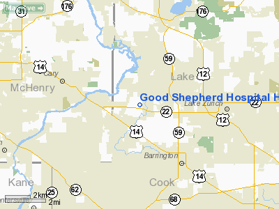
Good Shepherd Hospital Heliport |
Location
& QuickFacts
|
FAA
Information Effective: |
2007-12-20 |
|
Airport
Identifier: |
IL08 |
|
Airport
Status: |
Operational |
|
Longitude/Latitude: |
088-10-22.2880W/42-11-45.0870N
-88.172858/42.195858 (Estimated) |
|
Elevation: |
793 ft / 241.71 m (Estimated) |
|
Land: |
86 acres |
|
From
nearest city: |
2 nautical miles W of Barrington, IL |
|
Location: |
Mc Henry County, IL |
|
Magnetic Variation: |
01W (1985) |
Owner & Manager
|
Ownership: |
Privately owned |
|
Owner: |
Good Shepherd Hospital |
|
Address: |
450 West Highway 22
Barrington, IL 60010 |
|
Phone number: |
847-381-9600 |
|
Manager: |
Paul Drake |
|
Address: |
450 West Highway 22
Barrington, IL 60010 |
|
Phone number: |
847-842-4258
EXT. 5258 |
Airport
Operations and Facilities
|
Airport
Use: |
Private
MEDICAL USE |
|
Wind
indicator: |
Yes |
|
Segmented Circle: |
No |
|
Control
Tower: |
No |
|
Lighting
Schedule: |
DUSK-DAWN |
|
Beacon
Color: |
Clear-Green-Yellow (heliport) |
|
Sectional chart: |
Chicago |
|
Region: |
AGL - Great Lakes |
|
Boundary
ARTCC: |
ZAU - Chicago |
|
Tie-in
FSS: |
IKK - Kankakee |
|
FSS
Toll Free: |
1-800-WX-BRIEF |
|
Runway Information
Helipad H1
|
Dimension: |
40
x 21 ft / 12.2 x 6.4 m |
|
Surface: |
CONC, |
|
|
Runway H1 |
Runway |
|
Traffic
Pattern: |
Left |
Left |
|
Radio Navigation
Aids
|
ID |
Type |
Name |
Ch |
Freq |
Var |
Dist |
|
ME |
NDB |
Deana |
|
350.00 |
00E |
15.2 nm |
|
DKB |
NDB |
Dekalb |
|
209.00 |
02W |
28.6 nm |
|
RA |
NDB |
Paser |
|
206.00 |
00E |
31.7 nm |
|
HK |
NDB |
Ermin |
|
332.00 |
01W |
32.4 nm |
|
MX |
NDB |
Kedzi |
|
248.00 |
01W |
34.8 nm |
|
LVV |
NDB |
Lake Lawn |
|
404.00 |
00W |
35.5 nm |
|
GM |
NDB |
Teels |
|
242.00 |
02W |
43.3 nm |
|
JVL |
NDB |
Janesville |
|
375.00 |
03E |
46.1 nm |
|
OBK |
VOR/DME |
Northbrook |
077X |
113.00 |
02W |
10.0 nm |
|
ORD |
VOR/DME |
Chicago O'hare |
086X |
113.90 |
02E |
17.3 nm |
|
DPA |
VOR/DME |
Dupage |
021X |
108.40 |
02E |
20.0 nm |
|
ENW |
VOR/DME |
Kenosha |
029X |
109.20 |
02W |
26.5 nm |
|
BUU |
VOR/DME |
Burbun |
092X |
114.50 |
01W |
30.2 nm |
|
HRK |
VOR/DME |
Horlick |
124X |
117.70 |
02W |
37.6 nm |
|
RFD |
VOR/DME |
Rockford |
045X |
110.80 |
01E |
45.7 nm |
|
JVL |
VOR/DME |
Janesville |
090X |
114.30 |
03E |
46.8 nm |
|
JOT |
VORTAC |
Joliet |
070X |
112.30 |
02E |
39.6 nm |
|
CGT |
VORTAC |
Chicago Heights |
089X |
114.20 |
02E |
49.2 nm |
|
ORD |
VOT |
Chicago O'hare Intl |
|
112.00 |
|
17.5 nm |
|
MDW |
VOT |
Chicago Midway |
|
111.00 |
|
31.0 nm |
|
MKE |
VOT |
Milwaukee |
|
109.00 |
|
46.8 nm |
Remarks
- PROVIDED
INGRESS/EGRESS FROM 300 TO 150; AREA IS MARKED; WIND INDICATOR IS MAINTAINED.
Good Shepherd Hospital Heliport
Address:
Mc Henry County, IL
Tel:
847-381-9600, 847-842-4258
Images
and information placed above are from
http://www.airport-data.com/airport/IL08/
We
thank them for the data!
| General
Info |
| Country |
United
States |
| State |
ILLINOIS
|
| FAA ID |
IL08 |
| Latitude |
42-11-45.087N
|
| Longitude |
088-10-22.288W
|
| Elevation |
797 feet
|
| Near City |
BARRINGTON
|
We don't guarantee the information is fresh and accurate. The data may
be wrong or outdated.
For more up-to-date information please refer to other sources.
|
|


