 |
|
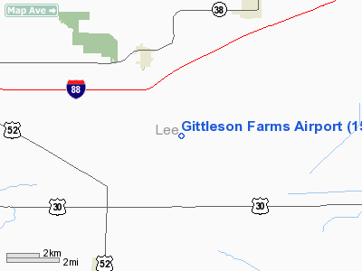
Location
& QuickFacts
|
FAA
Information Effective: |
2007-12-20 |
|
Airport
Identifier: |
15IL |
|
Airport
Status: |
Operational |
|
Longitude/Latitude: |
089-16-23.3460W/41-47-50.1140N
-89.273152/41.797254 (Estimated) |
|
Elevation: |
836 ft / 254.81 m (Estimated) |
|
Land: |
3 acres |
|
From
nearest city: |
3 nautical miles SE of Franklin Grove, IL |
|
Location: |
Lee County, IL |
|
Magnetic Variation: |
01E (1985) |
Owner
& Manager
|
Ownership: |
Privately
owned |
|
Owner: |
Vern Gittleson |
|
Address: |
1867 Herman Rd
Franklin Grove, IL |
|
Phone
number: |
815-456-2531 |
|
Manager: |
Vern Gittleson |
|
Address: |
1867 Herman Rd
Franklin Grove, IL |
|
Phone number: |
815-456-2531 |
Airport Operations and Facilities
|
Airport
Use: |
Private |
|
Wind
indicator: |
Yes |
|
Segmented Circle: |
No |
|
Control
Tower: |
No |
|
Sectional chart: |
Chicago |
|
Region: |
AGL - Great Lakes |
|
Boundary
ARTCC: |
ZAU - Chicago |
|
Tie-in
FSS: |
IKK - Kankakee |
|
FSS
on Airport: |
No |
|
FSS
Toll Free: |
1-800-WX-BRIEF |
|
Runway Information
Runway 18/36
|
Dimension: |
2300
x 90 ft / 701.0 x 27.4 m |
|
Surface: |
TURF, |
|
|
Runway 18 |
Runway 36 |
|
Traffic
Pattern: |
Left |
Left |
|
Displaced
threshold: |
300.00 ft |
0.00 ft |
|
Obstruction: |
25 ft bldg |
|
|
Radio Navigation
Aids
|
ID |
Type |
Name |
Ch |
Freq |
Var |
Dist |
|
BOZ |
NDB |
Whiteside |
|
254.00 |
01E |
23.6 nm |
|
DKB |
NDB |
Dekalb |
|
209.00 |
02W |
26.6 nm |
|
VYS |
NDB |
Valley |
|
230.00 |
00W |
27.2 nm |
|
FEP |
NDB |
Freeport |
|
335.00 |
00E |
30.4 nm |
|
OIX |
NDB |
Ottawa |
|
266.00 |
01E |
32.2 nm |
|
CWI |
NDB |
Clinton |
|
377.00 |
01E |
47.3 nm |
|
EZI |
NDB |
Kewanee |
|
245.00 |
01E |
47.3 nm |
|
PLL |
VOR/DME |
Polo |
049X |
111.20 |
03E |
15.1 nm |
|
RFD |
VOR/DME |
Rockford |
045X |
110.80 |
01E |
26.0 nm |
|
DPA |
VOR/DME |
Dupage |
021X |
108.40 |
02E |
41.7 nm |
|
JVL |
VOR/DME |
Janesville |
090X |
114.30 |
03E |
46.3 nm |
|
BDF |
VORTAC |
Bradford |
094X |
114.70 |
00E |
40.9 nm |
|
JOT |
VORTAC |
Joliet |
070X |
112.30 |
02E |
45.4 nm |
Remarks
- PROVIDED
OBSTRUCTIONS IN APCH AREA ARE REMOVED/LOWERED TO PROVIDE 20:1 CLEARANCE.
Based Aircraft
|
Aircraft
based on field: |
1 |
|
Single
Engine Airplanes: |
1 |
Gittleson Farms Airport
Address:
Lee County, IL
Tel:
815-456-2531
Images
and information placed above are from
http://www.airport-data.com/airport/15IL/
We
thank them for the data!
| General
Info |
| Country |
United
States |
| State |
ILLINOIS
|
| FAA ID |
15IL |
| Latitude |
41-47-50.114N
|
| Longitude |
089-16-23.346W
|
| Elevation |
836 feet
|
| Near City |
FRANKLIN
GROVE |
We don't guarantee the information is fresh and accurate. The data may
be wrong or outdated.
For more up-to-date information please refer to other sources.
|
|


