 |
|
Location
& QuickFacts
|
FAA
Information Effective: |
2007-12-20 |
|
Airport
Identifier: |
47IS |
|
Airport
Status: |
Operational |
|
Longitude/Latitude: |
089-21-25.0000W/42-29-30.0000N
-89.356944/42.491667 (Estimated) |
|
Elevation: |
945 ft / 288.04 m (Estimated) |
|
Land: |
0 acres |
|
From
nearest city: |
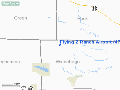
5 nautical miles N of Durand, IL |
|
Location: |
Winnebago County, IL |
|
Magnetic
Variation: |
() |
Owner
& Manager
|
Ownership: |
Privately
owned |
|
Owner: |
David E. Zigmont |
|
Address: |
16530 Eicks Road
Durand, IL 61024 |
|
Phone
number: |
815-248-3512 |
|
Manager: |
David E. Zigmont |
|
Address: |
16530 Eicks Road
Durand, IL 61024 |
|
Phone
number: |
815-248-3512 |
Airport
Operations and Facilities
|
Airport
Use: |
Private |
|
Wind
indicator: |
No |
|
Segmented Circle: |
No |
|
Control
Tower: |
No |
|
Sectional chart: |
Chicago |
|
Region: |
AGL - Great Lakes |
|
Boundary
ARTCC: |
ZAU - Chicago |
|
Tie-in
FSS: |
IKK - Kankakee |
|
FSS
Toll Free: |
1-800-WX-BRIEF |
|
Runway Information
Runway 11/29
|
Dimension: |
1600
x 80 ft / 487.7 x 24.4 m |
|
Surface: |
TURF, |
|
|
Runway 11 |
Runway 29 |
|
Traffic
Pattern: |
Left |
Left |
|
Obstruction: |
|
25 ft trees, 375.0 ft from runway |
|
Radio Navigation
Aids
|
ID |
Type |
Name |
Ch |
Freq |
Var |
Dist |
|
JVL |
NDB |
Janesville |
|
375.00 |
03E |
15.8 nm |
|
FEP |
NDB |
Freeport |
|
335.00 |
00E |
18.0 nm |
|
MS |
NDB |
Monah |
|
400.00 |
00E |
34.3 nm |
|
LVV |
NDB |
Lake Lawn |
|
404.00 |
00W |
36.0 nm |
|
DKB |
NDB |
Dekalb |
|
209.00 |
02W |
44.3 nm |
|
MRJ |
NDB |
Mineral Point |
|
365.00 |
00W |
45.2 nm |
|
PVB |
NDB |
Platteville |
|
203.00 |
01E |
49.2 nm |
|
RYV |
NDB |
Rock River |
|
371.00 |
01W |
49.6 nm |
|
JVL |
VOR/DME |
Janesville |
090X |
114.30 |
03E |
11.8 nm |
|
RFD |
VOR/DME |
Rockford |
045X |
110.80 |
01E |
17.5 nm |
|
PLL |
VOR/DME |
Polo |
049X |
111.20 |
03E |
32.5 nm |
|
BUU |
VOR/DME |
Burbun |
092X |
114.50 |
01W |
48.2 nm |
|
MSN |
VORTAC |
Madison |
023X |
108.60 |
03E |
39.3 nm |
Remarks
- PRVDD
THE PROPONET REMOVE THE TREES 375 FT FM RY 29 THLD.
Flying Z Ranch Airport
Address:
Winnebago County, IL
Tel:
815-248-3512
Images
and information placed above are from
http://www.airport-data.com/airport/47IS/
We
thank them for the data!
We don't guarantee the information is fresh and accurate. The data may
be wrong or outdated.
For more up-to-date information please refer to other sources.
|
|


