 |
|
|
|
|
|
Location
& QuickFacts
|
FAA
Information Effective: |
2007-12-20 |
|
Airport
Identifier: |
FOA |
|
Airport
Status: |
Operational |
|
Longitude/Latitude: |
088-27-10.7840W/38-39-53.8030N
-88.452996/38.664945 (Estimated) |
|
Elevation: |
473 ft / 144.17 m (Surveyed) |
|
Land: |
249 acres |
|
From
nearest city: |
2 nautical miles E of Flora, IL |
|
Location: |
Clay County, IL |
|
Magnetic
Variation: |
01W (2000) |
Owner
& Manager
|
Ownership: |
Publicly
owned |
|
Owner: |
Flora Airport Authority |
|
Address: |
Box 577
Flora, IL 62839 |
|
Phone
number: |
618-662-2174 |
|
Manager: |
Warren Webster |
|
Address: |
One Airport Road
Flora, IL 62839 |
|
Phone
number: |
618-662-2823 |
Airport
Operations and Facilities
|
Airport
Use: |
Open
to public |
|
Wind
indicator: |
Yes |
|
Segmented Circle: |
No |
|
Control
Tower: |
No |
|
Lighting
Schedule: |
DUSK-DAWN
MIRL RY 03/21 PRESET ON LOW INTST; TO INCR INTST & ACTVT
REIL RY 21; PLASI RYS 03; VASI RY 21 & TWY LGTS - CTAF. |
|
Beacon
Color: |
Clear-Green (lighted land airport) |
|
Landing
fee charge: |
No |
|
Sectional chart: |
St Louis |
|
Region: |
AGL - Great Lakes |
|
Boundary
ARTCC: |
ZKC - Kansas City |
|
Tie-in
FSS: |
STL - Saint Louis |
|
FSS
on Airport: |
No |
|
FSS
Toll Free: |
1-800-WX-BRIEF |
|
NOTAMs
Facility: |
FOA (NOTAM-d service avaliable) |
|
Federal
Agreements: |
NGY |
Airport
Communications
|
CTAF: |
122.700 |
|
Unicom: |
122.700
|
Airport
Services
|
Fuel
available: |
100LLA |
|
Airframe
Repair: |
MAJOR |
|
Power
Plant Repair: |
MAJOR |
|
Bottled
Oxygen: |
NONE |
|
Bulk
Oxygen: |
NONE |
|
Runway Information
Runway 03/21
|
Dimension: |
5003
x 75 ft / 1524.9 x 22.9 m |
|
Surface: |
ASPH, Fair Condition |
|
Weight
Limit: |
Single wheel: 30000 lbs.
Dual wheel: 40000 lbs. |
|
Edge
Lights: |
Medium |
|
|
Runway 03 |
Runway 21 |
|
Longitude: |
088-27-25.5077W |
088-26-54.3022W |
|
Latitude: |
38-39-29.8129N |
38-40-12.7907N |
|
Elevation: |
473.00 ft |
467.00 ft |
|
Alignment: |
30 |
127 |
|
ILS
Type: |
|
LOC/DME |
|
Traffic
Pattern: |
Left |
Left |
|
Markings: |
Non-precision instrument, Good Condition |
Non-precision instrument, Fair Condition |
|
Crossing
Height: |
26.00 ft |
20.00 ft |
|
VASI: |
pulsating/steady burning on left side
PSIL OTS INDEFLY. |
2-box on left side |
|
Visual
Glide Angle: |
3.00° |
3.00° |
|
Runway
End Identifier: |
No |
Yes |
|
Centerline
Lights: |
No |
No |
|
Touchdown
Lights: |
No |
No |
|
Obstruction: |
90 ft tree, 2844.0 ft from runway, 109 ft right
of centerline, 29:1 slope to clear |
27 ft pole, 974.0 ft from runway, 287 ft right
of centerline, 28:1 slope to clear |
|
Runway 15/33
|
Dimension: |
2700
x 100 ft / 823.0 x 30.5 m |
|
Surface: |
TURF, Good Condition |
|
|
Runway 15 |
Runway 33 |
|
Longitude: |
088-27-21.6400W |
088-27-03.2000W |
|
Latitude: |
38-40-09.6400N |
38-39-47.2000N |
|
Alignment: |
127 |
127 |
|
Traffic
Pattern: |
Left |
Left |
|
Displaced
threshold: |
160.00 ft |
0.00 ft |
|
Runway
End Identifier: |
No |
No |
|
Centerline
Lights: |
No |
No |
|
Touchdown
Lights: |
No |
No |
|
Obstruction: |
33 ft tree, 501.0 ft from runway, 169 ft left
of centerline, 15:1 slope to clear
APCH SLOPE IS 20:1 TO DSPLCD THLD. |
16 ft tree, 643.0 ft from runway, 21 ft right
of centerline, 40:1 slope to clear |
|
Radio Navigation
Aids
|
ID |
Type |
Name |
Ch |
Freq |
Var |
Dist |
|
FOA |
NDB |
Elm River |
|
353.00 |
00E |
0.2 nm |
|
OLY |
NDB |
Olney |
|
272.00 |
00W |
13.5 nm |
|
FWC |
NDB |
Wayne County |
|
257.00 |
01E |
17.2 nm |
|
SLO |
NDB |
Salem |
|
400.00 |
01W |
24.2 nm |
|
AJG |
NDB |
Mount Carmel |
|
524.00 |
02W |
34.3 nm |
|
CUL |
NDB |
Carmi |
|
332.00 |
01W |
37.8 nm |
|
OEA |
NDB |
Vincennes |
|
251.00 |
00E |
42.2 nm |
|
PLX |
NDB |
Palestine |
|
391.00 |
00W |
43.4 nm |
|
CZB |
NDB |
Casey |
|
359.00 |
00E |
43.9 nm |
|
SYZ |
NDB |
Shelbyville |
|
365.00 |
01E |
48.2 nm |
|
MT |
NDB |
Zebre |
|
347.00 |
00E |
48.5 nm |
|
SAM |
VOR/DME |
Samsville |
113X |
116.60 |
03E |
20.4 nm |
|
VNN |
VOR/DME |
Mount Vernon |
085X |
113.80 |
02E |
24.7 nm |
|
LWV |
VOR/DME |
Lawrenceville |
025X |
108.80 |
01W |
40.3 nm |
|
RSV |
VOR/DME |
Robinson |
021X |
108.40 |
02E |
43.2 nm |
|
MTO |
VOR/DME |
Mattoon |
031X |
109.40 |
03E |
49.5 nm |
|
BIB |
VORTAC |
Bible Grove |
027X |
109.00 |
03E |
15.4 nm |
|
ENL |
VORTAC |
Centralia |
097X |
115.00 |
04E |
36.3 nm |
|
VLA |
VORTAC |
Vandalia |
090X |
114.30 |
04E |
42.0 nm |
Remarks
Based Aircraft
|
Aircraft
based on field: |
15 |
|
Single
Engine Airplanes: |
14 |
|
Multi
Engine Airplanes: |
1 |
Operational Statistics
Time Period: 2005-08-01 - 2006-07-31
|
Aircraft
Operations: |
193/Week |
|
Air
Taxi: |
5.0% |
|
General
Aviation Local: |
60.0% |
|
General
Aviation Itinerant: |
35.0% |
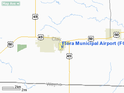
Flora Municipal Airport
Address:
Clay County, IL
Tel:
618-662-2174,
618-662-2823
Images
and information placed above are from
http://www.airport-data.com/airport/FOA/
We
thank them for the data!
| General
Info |
| Country |
United
States |
| State |
ILLINOIS
|
| FAA ID |
FOA |
| Latitude |
38-39-53.803N
|
| Longitude |
088-27-10.784W
|
| Elevation |
472 feet
|
| Near City |
FLORA
|
We don't guarantee the information is fresh and accurate. The data may
be wrong or outdated.
For more up-to-date information please refer to other sources.
|
|


