 |
|
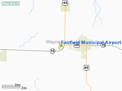
Fairfield Municipal Airport |
| Fairfield Municipal Airport |
| IATA: none â ICAO: KFWC â FAA LID: FWC |
| Summary |
| Airport type |
Public |
| Owner |
City of Fairfield |
| Serves |
Fairfield, Illinois |
| Elevation AMSL |
436 ft / 133 m |
| Coordinates |
38°22â²43â³N 088°24â²46â³W / 38.37861°N 88.41278°W / 38.37861; -88.41278 |
| Runways |
| Direction |
Length |
Surface |
| ft |
m |
| 9/27 |
4,000 |
1,219 |
Asphalt |
| 18/36 |
1,999 |
609 |
Asphalt |
| Statistics (2007) |
| Aircraft operations |
8,000 |
| Source: Federal Aviation Administration |
Fairfield Municipal Airport (ICAO: KFWC, FAA LID: FWC) is a city-owned, public-use airport located two nautical miles (3.7 km) west of the central business district of Fairfield, in Wayne County, Illinois, United States. According to the FAA's National Plan of Integrated Airport Systems for 2009-2013, it was classified as a general aviation airport.
Although most U.S. airports use the same three-letter location identifier for the FAA and IATA, this airport is assigned FWC by the FAA but has no designation from the IATA.
Facilities and aircraft
Fairfield Municipal Airport covers an area of 173 acres (70 ha) at an elevation of 436 feet (133 m) above mean sea level. It has two asphalt paved runways: 9/27 is 4,000 by 75 feet (1,219 x 23 m) and 18/36 is 1,999 by 60 feet (609 x 18 m). For the 12-month period ending August 31, 2007, the airport had 8,000 aircraft operations, an average of 21 per day: 94% general aviation and 6% air taxi.
The above content comes from Wikipedia and is published under free licenses – click here to read more.
Location
& QuickFacts
|
FAA
Information Effective: |
2007-12-20 |
|
Airport
Identifier: |
FWC |
|
Airport
Status: |
Operational |
|
Longitude/Latitude: |
088-24-45.5480W/38-22-43.0790N
-88.412652/38.378633 (Estimated) |
|
Elevation: |
436 ft / 132.89 m (Surveyed) |
|
Land: |
173 acres |
|
From
nearest city: |
2 nautical miles W of Fairfield, IL |
|
Location: |
Wayne County, IL |
|
Magnetic
Variation: |
01W (2000) |
Owner
& Manager
|
Ownership: |
Publicly
owned |
|
Owner: |
City Of Fairfield |
|
Address: |
City Hall,109 Ne 2nd St
Fairfield, IL 62837 |
|
Phone
number: |
618-842-3871 |
|
Manager: |
George Bone |
|
Address: |
City Hall 109 Ne 2nd St
Fairfield, IL 62837 |
|
Phone
number: |
618-842-9587 |
Airport
Operations and Facilities
|
Airport
Use: |
Open
to public |
|
Wind
indicator: |
Yes |
|
Segmented Circle: |
No |
|
Control
Tower: |
No |
|
Lighting
Schedule: |
DUSK-DAWN
MIRL RY 18/36 PRESET ON LOW INTST; TO INCR INTST & ACTVT
MIRL RY 09/27; REIL RY 09 - 123.05. |
|
Beacon
Color: |
Clear-Green (lighted land airport) |
|
Landing
fee charge: |
No |
|
Sectional chart: |
St Louis |
|
Region: |
AGL - Great Lakes |
|
Boundary
ARTCC: |
ZKC - Kansas City |
|
Tie-in
FSS: |
STL - Saint Louis |
|
FSS
on Airport: |
No |
|
FSS
Toll Free: |
1-800-WX-BRIEF |
|
NOTAMs
Facility: |
FWC (NOTAM-d service avaliable) |
|
Federal
Agreements: |
NGY |
Airport
Communications
|
CTAF: |
123.050 |
|
Unicom: |
123.050
|
Airport
Services
|
Fuel
available: |
100LLA |
|
Bottled
Oxygen: |
NONE |
|
Bulk
Oxygen: |
NONE |
|
Runway Information
Runway 09/27
|
Dimension: |
4000
x 75 ft / 1219.2 x 22.9 m |
|
Surface: |
ASPH, Good Condition |
|
Weight
Limit: |
Single wheel: 12000 lbs. |
|
Edge
Lights: |
Medium |
|
|
Runway 09 |
Runway 27 |
|
Longitude: |
088-25-19.8980W |
088-24-29.6730W |
|
Latitude: |
38-22-40.7430N |
38-22-40.4660N |
|
Elevation: |
436.00 ft |
413.00 ft |
|
Alignment: |
90 |
127 |
|
Traffic
Pattern: |
Left |
Left |
|
Markings: |
Non-precision instrument, Good Condition |
Non-precision instrument, Good Condition |
|
Crossing
Height: |
25.00 ft |
25.00 ft |
|
VASI: |
pulsating/steady burning on left side |
pulsating/steady burning on left side |
|
Visual
Glide Angle: |
3.00° |
3.00° |
|
Runway
End Identifier: |
Yes |
|
|
Centerline
Lights: |
No |
No |
|
Touchdown
Lights: |
No |
No |
|
Obstruction: |
86 ft tree, 2051.0 ft from runway, 388 ft right
of centerline, 21:1 slope to clear |
32 ft pole, 843.0 ft from runway, 169 ft right
of centerline, 20:1 slope to clear |
|
Runway 18/36
|
Dimension: |
1999
x 60 ft / 609.3 x 18.3 m |
|
Surface: |
ASPH, |
|
Weight
Limit: |
Single wheel: 16000 lbs. |
|
Edge
Lights: |
Medium |
|
|
Runway 18 |
Runway 36 |
|
Longitude: |
088-24-26.9260W |
088-24-27.2030W |
|
Latitude: |
38-22-57.8760N |
38-22-38.1170N |
|
Elevation: |
416.00 ft |
414.00 ft |
|
Alignment: |
127 |
1 |
|
Traffic
Pattern: |
Left |
Left |
|
Markings: |
Basic, Good Condition |
Basic, Good Condition |
|
Runway
End Identifier: |
No |
No |
|
Centerline
Lights: |
No |
No |
|
Touchdown
Lights: |
No |
No |
|
Obstruction: |
16 ft road, 485.0 ft from runway, 152 ft right
of centerline, 17:1 slope to clear
18/36 APPROACH SLOPE IS 30:1 TO RUNWAY 18 END. |
14 ft road, 323.0 ft from runway, 136 ft right
of centerline, 8:1 slope to clear
18/36 APPROACH SLOPE IS 23:1 TO RUNWAY 36 END. |
|
Radio Navigation
Aids
|
ID |
Type |
Name |
Ch |
Freq |
Var |
Dist |
|
FWC |
NDB |
Wayne County |
|
257.00 |
01E |
0.2 nm |
|
FOA |
NDB |
Elm River |
|
353.00 |
00E |
17.6 nm |
|
CUL |
NDB |
Carmi |
|
332.00 |
01W |
22.0 nm |
|
OLY |
NDB |
Olney |
|
272.00 |
00W |
23.3 nm |
|
SLO |
NDB |
Salem |
|
400.00 |
01W |
30.6 nm |
|
HSB |
NDB |
Harrisburg-raleigh |
|
230.00 |
00E |
34.7 nm |
|
AJG |
NDB |
Mount Carmel |
|
524.00 |
02W |
35.2 nm |
|
OEA |
NDB |
Vincennes |
|
251.00 |
00E |
44.5 nm |
|
GVA |
NDB |
Geneva |
|
224.00 |
01W |
46.0 nm |
|
PDW |
NDB |
Evansville |
|
284.00 |
00E |
46.3 nm |
|
SAM |
VOR/DME |
Samsville |
113X |
116.60 |
03E |
16.7 nm |
|
VNN |
VOR/DME |
Mount Vernon |
085X |
113.80 |
02E |
18.6 nm |
|
LWV |
VOR/DME |
Lawrenceville |
025X |
108.80 |
01W |
44.7 nm |
|
MWA |
VOR/DME |
Marion |
041X |
110.40 |
04E |
47.0 nm |
|
BIB |
VORTAC |
Bible Grove |
027X |
109.00 |
03E |
32.7 nm |
|
ENL |
VORTAC |
Centralia |
097X |
115.00 |
04E |
35.2 nm |
|
PXV |
VORTAC |
Pocket City |
080X |
113.30 |
03E |
41.0 nm |
Based Aircraft
|
Aircraft
based on field: |
9 |
|
Single
Engine Airplanes: |
9 |
Operational Statistics
Time Period: 2006-09-01 - 2007-08-31
|
Aircraft
Operations: |
154/Week |
|
Air
Taxi: |
6.3% |
|
General
Aviation Local: |
75.0% |
|
General
Aviation Itinerant: |
18.8% |
Fairfield Municipal Airport
Address:
Wayne County, IL
Tel:
618-842-3871,
618-842-9587
Images
and information placed above are from
http://www.airport-data.com/airport/FWC/
We
thank them for the data!
| General
Info |
| Country |
United
States |
| State |
ILLINOIS
|
| FAA ID |
FWC |
| Latitude |
38-22-43.079N
|
| Longitude |
088-24-45.548W
|
| Elevation |
436 feet
|
| Near City |
FAIRFIELD
|
We don't guarantee the information is fresh and accurate. The data may
be wrong or outdated.
For more up-to-date information please refer to other sources.
|
|


