 |
|
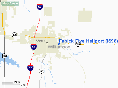
Location
& QuickFacts
|
FAA
Information Effective: |
2007-12-20 |
|
Airport
Identifier: |
IS98 |
|
Airport
Status: |
Operational |
|
Longitude/Latitude: |
088-54-18.2460W/37-43-46.1780N
-88.905068/37.729494 (Estimated) |
|
Elevation: |
440 ft / 134.11 m (Estimated) |
|
Land: |
0 acres |
|
From
nearest city: |
1 nautical miles E of Marion, IL |
|
Location: |
Williamson County, IL |
|
Magnetic
Variation: |
01E (1985) |
Owner
& Manager
|
Ownership: |
Privately
owned |
|
Owner: |
Construction Investment Co |
|
Address: |
1 Fabick Drive
Fenton, MO 63026 |
|
Phone
number: |
314-343-5900 |
|
Manager: |
Jerry Kaemmer |
|
Address: |
|
|
Phone
number: |
618-997-1881 |
Airport
Operations and Facilities
|
Airport
Use: |
Private |
|
Wind
indicator: |
Yes |
|
Segmented Circle: |
No |
|
Control
Tower: |
No |
|
Landing
fee charge: |
No |
|
Sectional chart: |
St Louis |
|
Region: |
AGL - Great Lakes |
|
Boundary
ARTCC: |
ZKC - Kansas City |
|
Tie-in
FSS: |
COU - Columbia |
|
FSS
Toll Free: |
1-800-WX-BRIEF |
|
Runway Information
Helipad H1
|
Dimension: |
40
x 40 ft / 12.2 x 12.2 m |
|
Surface: |
ASPH, |
|
|
Runway H1 |
Runway |
|
Traffic
Pattern: |
Left |
Left |
|
Radio Navigation
Aids
|
ID |
Type |
Name |
Ch |
Freq |
Var |
Dist |
|
HSB |
NDB |
Harrisburg-raleigh |
|
230.00 |
00E |
17.8 nm |
|
PJY |
NDB |
Pinckneyville |
|
215.00 |
00E |
26.3 nm |
|
BDD |
NDB |
Bellgrade |
|
254.00 |
00E |
36.8 nm |
|
CIR |
NDB |
Cairo |
|
397.00 |
00E |
42.9 nm |
|
CUL |
NDB |
Carmi |
|
332.00 |
01W |
43.2 nm |
|
SAR |
NDB |
Sparta |
|
239.00 |
01E |
45.3 nm |
|
FWC |
NDB |
Wayne County |
|
257.00 |
01E |
45.6 nm |
|
TWT |
NDB |
Tradewater |
|
276.00 |
00E |
48.3 nm |
|
MWA |
VOR/DME |
Marion |
041X |
110.40 |
04E |
5.3 nm |
|
VNN |
VOR/DME |
Mount Vernon |
085X |
113.80 |
02E |
38.3 nm |
|
CGI |
VOR/DME |
Cape Girardeau |
076X |
112.90 |
01E |
43.9 nm |
|
ENL |
VORTAC |
Centralia |
097X |
115.00 |
04E |
43.2 nm |
|
CNG |
VORTAC |
Cunningham |
078X |
113.10 |
03E |
43.5 nm |
Remarks
- ALL
APP/DEP OPERATIONS ARE CONDUCTED IN AN AREA FROM 80 DEG CLOCKWISE TO
200 DEG USING PAD AS CENTER OF A COMPASS ROSE; AREA IS APPROPRIATELY
MARKED; WIND INDICATOR IS MAINTAINED.
Based Aircraft
|
Aircraft
based on field: |
1 |
|
Helicopters: |
1 |
Fabick Five Heliport
Address:
Williamson County, IL
Tel:
314-343-5900,
618-997-1881
Images
and information placed above are from
http://www.airport-data.com/airport/IS98/
We
thank them for the data!
| General
Info |
| Country |
United
States |
| State |
ILLINOIS
|
| FAA ID |
IS98 |
| Latitude |
37-43-46.178N
|
| Longitude |
088-54-18.246W
|
| Elevation |
440 feet
|
| Near City |
MARION
|
We don't guarantee the information is fresh and accurate. The data may
be wrong or outdated.
For more up-to-date information please refer to other sources.
|
|


