 |
|
Location
& QuickFacts
|
FAA
Information Effective: |
2007-12-20 |
|
Airport
Identifier: |
LL65 |
|
Airport
Status: |
Operational |
|
Longitude/Latitude: |
089-27-00.3280W/41-11-40.1320N
-89.450091/41.194481 (Estimated) |
|
Elevation: |
690 ft / 210.31 m (Estimated) |
|
Land: |
0 acres |
|
From
nearest city: |
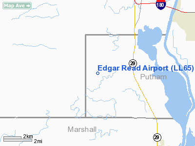
3 nautical miles W of Putnam, IL |
|
Location: |
Putnam County, IL |
|
Magnetic
Variation: |
01E (1985) |
Owner
& Manager
|
Ownership: |
Privately
owned |
|
Owner: |
Edgar Read |
|
Address: |
Rr 1, Box 85
Putnam, IL 61560 |
|
Phone
number: |
815-437-2279 |
|
Address: |
|
Airport
Operations and Facilities
|
Airport Use: |
Private |
|
Wind
indicator: |
Yes |
|
Segmented
Circle: |
No |
|
Control
Tower: |
No |
|
Landing
fee charge: |
No |
|
Sectional
chart: |
Chicago |
|
Region: |
AGL - Great Lakes |
|
Boundary
ARTCC: |
ZAU - Chicago |
|
Tie-in
FSS: |
IKK - Kankakee |
|
FSS
on Airport: |
No |
|
FSS
Toll Free: |
1-800-WX-BRIEF |
Airport
Services
|
Airframe
Repair: |
NONE |
|
Power
Plant Repair: |
NONE |
|
Runway Information
Runway 18/36
|
Dimension: |
1600
x 100 ft / 487.7 x 30.5 m |
|
Surface: |
TURF, |
|
|
Runway 18 |
Runway 36 |
|
Traffic
Pattern: |
Left |
Left |
|
Obstruction: |
|
60 ft bldgs trees, 300.0 ft from runway |
|
Radio Navigation
Aids
|
ID |
Type |
Name |
Ch |
Freq |
Var |
Dist |
|
VYS |
NDB |
Valley |
|
230.00 |
00W |
16.7 nm |
|
EZI |
NDB |
Kewanee |
|
245.00 |
01E |
23.0 nm |
|
OIX |
NDB |
Ottawa |
|
266.00 |
01E |
28.7 nm |
|
BOZ |
NDB |
Whiteside |
|
254.00 |
01E |
34.5 nm |
|
PI |
NDB |
Tungg |
|
356.00 |
01E |
36.0 nm |
|
CTK |
NDB |
Canton |
|
236.00 |
02E |
47.3 nm |
|
PNT |
VOR/DME |
Pontiac |
033X |
109.60 |
03E |
39.5 nm |
|
PLL |
VOR/DME |
Polo |
049X |
111.20 |
03E |
46.5 nm |
|
GBG |
VOR/DME |
Galesburg |
035X |
109.80 |
03E |
47.2 nm |
|
BMI |
VOR/DME |
Bloomington |
019X |
108.20 |
03E |
49.0 nm |
|
BDF |
VORTAC |
Bradford |
094X |
114.70 |
00E |
6.6 nm |
|
PIA |
VORTAC |
Peoria |
099X |
115.20 |
04E |
34.6 nm |
Based Aircraft
|
Aircraft
based on field: |
2 |
|
Single
Engine Airplanes: |
2 |
Edgar Read Airport
Address:
Putnam County, IL
Tel:
815-437-2279
Images
and information placed above are from
http://www.airport-data.com/airport/LL65/
We
thank them for the data!
| General
Info |
| Country |
United
States |
| State |
ILLINOIS
|
| FAA ID |
LL65 |
| Latitude |
41-11-40.132N
|
| Longitude |
089-27-00.328W
|
| Elevation |
690 feet
|
| Near City |
PUTNAM
|
We don't guarantee the information is fresh and accurate. The data may
be wrong or outdated.
For more up-to-date information please refer to other sources.
|
|


