 |
|
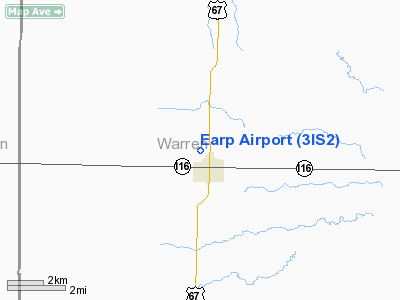
Location
& QuickFacts
|
FAA
Information Effective: |
2007-07-05 |
|
Airport
Identifier: |
3IS2 |
|
Airport
Status: |
Operational |
|
Longitude/Latitude: |
090-40-10.4820W/40-44-26.1420N
-90.669578/40.740595 (Estimated) |
|
Elevation: |
740 ft / 225.55 m (Estimated) |
|
Land: |
4 acres |
|
From
nearest city: |
1 nautical miles N of Roseville, IL |
|
Location: |
Warren County, IL |
|
Magnetic
Variation: |
02E (1985) |
Owner
& Manager
|
Ownership: |
Privately
owned |
|
Owner: |
Donald L. Earp |
|
Address: |
Rr 1
Roseville, IL 61473 |
|
Phone
number: |
309-426-2576 |
|
Address: |
|
Airport
Operations and Facilities
|
Airport
Use: |
Private |
|
Wind
indicator: |
Yes |
|
Segmented Circle: |
No |
|
Control
Tower: |
No |
|
Sectional chart: |
Chicago |
|
Region: |
AGL - Great Lakes |
|
Boundary
ARTCC: |
ZAU - Chicago |
|
Tie-in
FSS: |
IKK - Kankakee |
|
FSS
on Airport: |
No |
|
FSS
Toll Free: |
1-800-WX-BRIEF |
|
Runway Information
Runway E/W
|
Dimension: |
2250
x 80 ft / 685.8 x 24.4 m |
|
Surface: |
TURF, |
|
|
Runway E |
Runway W |
|
Traffic
Pattern: |
Left |
Left |
|
Obstruction: |
|
10 ft pline, 400.0 ft from runway |
|
Radio Navigation
Aids
|
ID |
Type |
Name |
Ch |
Freq |
Var |
Dist |
|
JZY |
NDB |
Macomb |
|
251.00 |
01E |
14.3 nm |
|
CTK |
NDB |
Canton |
|
236.00 |
02E |
29.0 nm |
|
EOK |
NDB |
Keokuk |
|
366.00 |
02E |
38.6 nm |
|
MPZ |
NDB |
Mount Pleasant |
|
212.00 |
02E |
40.1 nm |
|
EZI |
NDB |
Kewanee |
|
245.00 |
01E |
42.5 nm |
|
PI |
NDB |
Tungg |
|
356.00 |
01E |
49.7 nm |
|
GBG |
VOR/DME |
Galesburg |
035X |
109.80 |
03E |
15.9 nm |
|
DDD |
VOR/DME |
Port City |
112X |
116.50 |
01E |
43.4 nm |
|
BRL |
VORTAC |
Burlington |
051X |
111.40 |
05E |
11.7 nm |
|
MZV |
VORTAC |
Moline |
091X |
114.40 |
05E |
34.9 nm |
|
PIA |
VORTAC |
Peoria |
099X |
115.20 |
04E |
40.1 nm |
Based
Aircraft
|
Aircraft
based on field: |
1 |
|
Single
Engine Airplanes: |
1 |
Earp Airport
Address:
Warren County, IL
Tel:
309-426-2576
Images
and information placed above are from
http://www.airport-data.com/airport/3IS2/
We
thank them for the data!
| General
Info |
| Country |
United
States |
| State |
ILLINOIS
|
| FAA ID |
3IS2 |
| Latitude |
40-44-26.142N
|
| Longitude |
090-40-10.482W
|
| Elevation |
740 feet
|
| Near City |
ROSEVILLE
|
We don't guarantee the information is fresh and accurate. The data may
be wrong or outdated.
For more up-to-date information please refer to other sources.
|
|


