 |
|
|
|
|
|
Location
& QuickFacts
|
FAA
Information Effective: |
2007-07-05 |
|
Airport
Identifier: |
C94 |
|
Airport
Status: |
Operational |
|
Longitude/Latitude: |
088-56-52.2950W/41-34-01.1120N
-88.947860/41.566976 (Estimated) |
|
Elevation: |
690 ft / 210.31 m (Estimated) |
|
Land: |
12 acres |
|
From
nearest city: |
2 nautical miles SW of Earlville, IL |
|
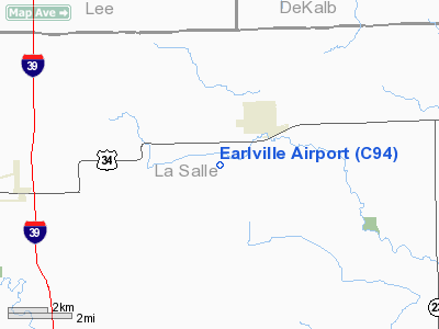
Location: |
La Salle County, IL |
|
Magnetic
Variation: |
00E (1985) |
Owner
& Manager
|
Ownership: |
Privately
owned |
|
Owner: |
John Weidner |
|
Address: |
Rr 2
Earlville, IL 60518 |
|
Phone
number: |
815-246-9870 |
|
Manager: |
Lyle Younglove |
|
Address: |
1131 N 4350th Rd
Earlville, IL 60518 |
|
Phone
number: |
815-246-9870 |
Airport
Operations and Facilities
|
Airport
Use: |
Open
to public |
|
Wind
indicator: |
Yes |
|
Segmented Circle: |
No |
|
Control
Tower: |
No |
|
Lighting
Schedule: |
PHONE REQ
FOR RWY LGTS CALL 815-246-9870. |
|
Landing
fee charge: |
No |
|
Sectional chart: |
Chicago |
|
Region: |
AGL - Great Lakes |
|
Traffic
Pattern Alt: |
800 ft |
|
Boundary
ARTCC: |
ZAU - Chicago |
|
Tie-in
FSS: |
IKK - Kankakee |
|
FSS
on Airport: |
No |
|
FSS
Toll Free: |
1-800-WX-BRIEF |
|
NOTAMs
Facility: |
IKK (NOTAM-d service avaliable) |
Airport
Communications
Airport
Services
|
Airframe
Repair: |
NONE |
|
Power
Plant Repair: |
NONE |
|
Bottled
Oxygen: |
NONE |
|
Bulk
Oxygen: |
NONE |
|
Runway Information
Runway 04/22
|
Dimension: |
3400
x 100 ft / 1036.3 x 30.5 m |
|
Surface: |
TURF, Good Condition |
|
Edge
Lights: |
Non-standard lighting system
NSTD LIRL; LGTS ON SE SIDE OF RY ONLY. |
|
|
Runway 04 |
Runway 22 |
|
Traffic
Pattern: |
Left |
Left |
|
Displaced
threshold: |
400.00 ft
DSPLCD THR MARKED WITH PAINTED WOOD MARKERS. |
160.00 ft
DSPLCD THR MARKED WITH PAINTED WOOD MARKERS. |
|
Obstruction: |
22 ft pline, 40.0 ft from runway, 1:1 slope
to clear
APCH RATIO 20:1 TO DSPLCD THR. |
, 50:1 slope to clear |
|
Radio Navigation
Aids
|
ID |
Type |
Name |
Ch |
Freq |
Var |
Dist |
|
OIX |
NDB |
Ottawa |
|
266.00 |
01E |
13.0 nm |
|
VYS |
NDB |
Valley |
|
230.00 |
00W |
15.6 nm |
|
DKB |
NDB |
Dekalb |
|
209.00 |
02W |
24.6 nm |
|
BOZ |
NDB |
Whiteside |
|
254.00 |
01E |
38.6 nm |
|
ME |
NDB |
Deana |
|
350.00 |
00E |
47.8 nm |
|
FEP |
NDB |
Freeport |
|
335.00 |
00E |
49.8 nm |
|
DPA |
VOR/DME |
Dupage |
021X |
108.40 |
02E |
33.1 nm |
|
PLL |
VOR/DME |
Polo |
049X |
111.20 |
03E |
35.2 nm |
|
RFD |
VOR/DME |
Rockford |
045X |
110.80 |
01E |
41.2 nm |
|
PNT |
VOR/DME |
Pontiac |
033X |
109.60 |
03E |
45.9 nm |
|
JOT |
VORTAC |
Joliet |
070X |
112.30 |
02E |
28.3 nm |
|
BDF |
VORTAC |
Bradford |
094X |
114.70 |
00E |
37.9 nm |
Remarks
- EXTENSIVE
CROP DUSTING ACTIVITY DURING SUMMER MONTHS.
Based
Aircraft
|
Aircraft
based on field: |
5 |
|
Single
Engine Airplanes: |
5 |
Operational Statistics
Time Period: 2004-01-02
- 2004-12-31
|
Aircraft
Operations: |
39/Week |
|
General
Aviation Local: |
75.0% |
|
General
Aviation Itinerant: |
25.0% |
Earlville Airport
Address:
La Salle County, IL
Tel:
815-246-9870
Images
and information placed above are from
http://www.airport-data.com/airport/C94/
We
thank them for the data!
| General
Info |
| Country |
United
States |
| State |
ILLINOIS
|
| FAA ID |
C94 |
| Latitude |
41-34-01.112N
|
| Longitude |
088-56-52.295W
|
| Elevation |
690 feet
|
| Near City |
EARLVILLE
|
We don't guarantee the information is fresh and accurate. The data may
be wrong or outdated.
For more up-to-date information please refer to other sources.
|
|


