 |
|
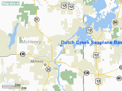
Dutch Creek Seaplane Base |
Location
& QuickFacts
|
FAA
Information Effective: |
2007-07-05 |
|
Airport
Identifier: |
8IL7 |
|
Airport
Status: |
Operational |
|
Longitude/Latitude: |
088-14-49.3130W/42-22-16.0760N
-88.247031/42.371132 (Estimated) |
|
Elevation: |
737 ft / 224.64 m (Estimated) |
|
Land: |
0 acres |
|
From
nearest city: |
2 nautical miles NE of Mc Henry, IL |
|
Location: |
Mc Henry County, IL |
|
Magnetic Variation: |
01W (1990) |
Owner
& Manager
|
Ownership: |
Privately
owned |
|
Owner: |
Verne Jobst |
|
Address: |
2921 Sterling Drive
Mc Henry, IL 60050-2662 |
|
Phone
number: |
815-385-7277 |
|
Manager: |
Verne Jobst |
|
Address: |
2921 Sterling Drive
Mc Henry, IL 60050-2662 |
|
Phone number: |
815-385-7277 |
Airport Operations and Facilities
|
Airport Use: |
Private |
|
Segmented Circle: |
No |
|
Control Tower: |
No |
|
Sectional chart: |
Chicago |
|
Region: |
AGL - Great Lakes |
|
Boundary ARTCC: |
ZAU - Chicago |
|
Tie-in FSS: |
IKK - Kankakee |
|
FSS Toll Free: |
1-800-WX-BRIEF |
Airport
Communications
|
Runway Information
Runway 02W/20W
|
Dimension: |
3500
x 300 ft / 1066.8 x 91.4 m |
|
Surface: |
WATER, |
|
|
Runway 02W |
Runway 20W |
|
Traffic
Pattern: |
Right |
Right |
|
Runway 05W/23W
|
Dimension: |
4000
x 400 ft / 1219.2 x 121.9 m |
|
Surface: |
WATER, |
|
|
Runway 05W |
Runway 23W |
|
Traffic
Pattern: |
Right |
Right |
|
Runway 09W/27W
|
Dimension: |
2500
x 200 ft / 762.0 x 61.0 m |
|
Surface: |
WATER, |
|
|
Runway 09W |
Runway 27W |
|
Traffic
Pattern: |
Left |
Right |
|
Radio Navigation
Aids
|
ID |
Type |
Name |
Ch |
Freq |
Var |
Dist |
|
RA |
NDB |
Paser |
|
206.00 |
00E |
24.2 nm |
|
LVV |
NDB |
Lake Lawn |
|
404.00 |
00W |
25.0 nm |
|
ME |
NDB |
Deana |
|
350.00 |
00E |
26.2 nm |
|
DKB |
NDB |
Dekalb |
|
209.00 |
02W |
33.3 nm |
|
GM |
NDB |
Teels |
|
242.00 |
02W |
33.6 nm |
|
JVL |
NDB |
Janesville |
|
375.00 |
03E |
38.1 nm |
|
UES |
NDB |
Waukesha |
|
359.00 |
01W |
40.5 nm |
|
HK |
NDB |
Ermin |
|
332.00 |
01W |
43.3 nm |
|
BL |
NDB |
Yanks |
|
260.00 |
02W |
44.5 nm |
|
MX |
NDB |
Kedzi |
|
248.00 |
01W |
45.3 nm |
|
OBK |
VOR/DME |
Northbrook |
077X |
113.00 |
02W |
15.9 nm |
|
BUU |
VOR/DME |
Burbun |
092X |
114.50 |
01W |
19.3 nm |
|
ENW |
VOR/DME |
Kenosha |
029X |
109.20 |
02W |
19.6 nm |
|
ORD |
VOR/DME |
Chicago O'hare |
086X |
113.90 |
02E |
27.6 nm |
|
DPA |
VOR/DME |
Dupage |
021X |
108.40 |
02E |
29.3 nm |
|
HRK |
VOR/DME |
Horlick |
124X |
117.70 |
02W |
30.3 nm |
|
JVL |
VOR/DME |
Janesville |
090X |
114.30 |
03E |
39.7 nm |
|
RFD |
VOR/DME |
Rockford |
045X |
110.80 |
01E |
43.2 nm |
|
LJT |
VOR/DME |
Timmerman |
072X |
112.50 |
02W |
45.4 nm |
|
BAE |
VORTAC |
Badger |
111X |
116.40 |
02E |
44.9 nm |
|
JOT |
VORTAC |
Joliet |
070X |
112.30 |
02E |
49.7 nm |
|
ORD |
VOT |
Chicago O'hare Intl |
|
112.00 |
|
27.8 nm |
|
MKE |
VOT |
Milwaukee |
|
109.00 |
|
38.0 nm |
|
MDW |
VOT |
Chicago Midway |
|
111.00 |
|
41.5 nm |
Based
Aircraft
|
Aircraft
based on field: |
1 |
|
Single
Engine Airplanes: |
1 |
Dutch Creek Seaplane Base
Address:
Mc Henry County, IL
Tel:
815-385-7277
Images
and information placed above are from
http://www.airport-data.com/airport/8IL7/
We
thank them for the data!
| General
Info |
| Country |
United
States |
| State |
ILLINOIS
|
| FAA ID |
8IL7 |
| Latitude |
42-22-16.076N
|
| Longitude |
088-14-49.313W
|
| Elevation |
737 feet
|
| Near City |
MC HENRY
|
We don't guarantee the information is fresh and accurate. The data may
be wrong or outdated.
For more up-to-date information please refer to other sources.
|
|


