 |
|
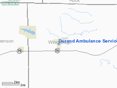
Durand Ambulance Service Heliport |
Location
& QuickFacts
|
FAA
Information Effective: |
2007-07-05 |
|
Airport
Identifier: |
9IL1 |
|
Airport
Status: |
Operational |
|
Longitude/Latitude: |
089-19-43.0000W/42-25-50.0000N
-89.328611/42.430556 (Estimated) |
|
Elevation: |
775 ft / 236.22 m (Estimated) |
|
Land: |
0 acres |
|
From
nearest city: |
0 nautical miles N of Durand, IL |
|
Location: |
Winnebago County, IL |
|
Magnetic Variation: |
01W (1995) |
Owner
& Manager
|
Ownership: |
Privately
owned |
|
Owner: |
Durand Ambulance Service |
|
Address: |
115 W Howard St
Durand, IL 61024 |
|
Phone
number: |
815-248-7696 |
|
Manager: |
Kurt Ditzler |
|
Address: |
507 Fairview St Po Box 849
Durand, IL 61024 |
|
Phone number: |
815-248-4615 |
Airport Operations and Facilities
|
Airport
Use: |
Private
MEDICAL USE. |
|
Segmented Circle: |
No |
|
Control
Tower: |
No |
|
Sectional chart: |
Chicago |
|
Region: |
AGL - Great Lakes |
|
Boundary
ARTCC: |
ZAU - Chicago |
|
Tie-in
FSS: |
IKK - Kankakee |
|
FSS
on Airport: |
No |
|
FSS
Toll Free: |
1-800-WX-BRIEF |
|
Runway Information
Helipad H1
|
Dimension: |
25
x 25 ft / 7.6 x 7.6 m |
|
Surface: |
CONC, Good Condition |
|
|
Runway H1 |
Runway |
|
Traffic
Pattern: |
Left |
Left |
|
Radio Navigation
Aids
|
ID |
Type |
Name |
Ch |
Freq |
Var |
Dist |
|
FEP |
NDB |
Freeport |
|
335.00 |
00E |
15.9 nm |
|
JVL |
NDB |
Janesville |
|
375.00 |
03E |
16.9 nm |
|
LVV |
NDB |
Lake Lawn |
|
404.00 |
00W |
36.3 nm |
|
MS |
NDB |
Monah |
|
400.00 |
00E |
38.0 nm |
|
DKB |
NDB |
Dekalb |
|
209.00 |
02W |
40.7 nm |
|
BOZ |
NDB |
Whiteside |
|
254.00 |
01E |
47.8 nm |
|
MRJ |
NDB |
Mineral Point |
|
365.00 |
00W |
48.3 nm |
|
JVL |
VOR/DME |
Janesville |
090X |
114.30 |
03E |
12.5 nm |
|
RFD |
VOR/DME |
Rockford |
045X |
110.80 |
01E |
13.6 nm |
|
PLL |
VOR/DME |
Polo |
049X |
111.20 |
03E |
29.3 nm |
|
BUU |
VOR/DME |
Burbun |
092X |
114.50 |
01W |
48.0 nm |
|
MSN |
VORTAC |
Madison |
023X |
108.60 |
03E |
42.9 nm |
Remarks
- PRVDD
APCH RTE FM 180 DEG AND 360 DEG USING A ONE MI CORRIDOR; DEP RTE FM
360 DEG AND 180 DEG OUT TO ONE MILE; AREA IS MKD; WIND INDICATOR IS
MAINTAINED; COMPLY WITH 14 CFR 91.123 (B)(2).
Durand Ambulance Service Heliport
Address:
Winnebago County, IL
Tel:
815-248-7696,
815-248-4615
Images
and information placed above are from
http://www.airport-data.com/airport/9IL1/
We
thank them for the data!
| General
Info |
| Country |
United
States |
| State |
ILLINOIS
|
| FAA ID |
9IL1 |
| Latitude |
42-25-50.000N
|
| Longitude |
089-19-43.000W
|
| Elevation |
775 feet
|
| Near City |
DURAND
|
We don't guarantee the information is fresh and accurate. The data may
be wrong or outdated.
For more up-to-date information please refer to other sources.
|
|


