 |
|
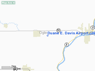
Location
& QuickFacts
|
FAA
Information Effective: |
2007-07-05 |
|
Airport
Identifier: |
26IL |
|
Airport
Status: |
Operational |
|
Longitude/Latitude: |
089-22-24.3910W/42-07-11.0920N
-89.373442/42.119748 (Estimated) |
|
Elevation: |
741 ft / 225.86 m (Surveyed) |
|
Land: |
0 acres |
|
From
nearest city: |
2 nautical miles SE of Leaf River, IL |
|
Location: |
Ogle County, IL |
|
Magnetic Variation: |
00E (1985) |
Owner
& Manager
|
Ownership: |
Privately
owned |
|
Owner: |
Duane Davis |
|
Address: |
1615 W. Townline Road
Leaf River, IL 61047-0054 |
|
Phone number: |
815-738-2397 |
|
Address: |
|
Airport Operations and Facilities
|
Airport Use: |
Private |
|
Wind indicator: |
Yes |
|
Segmented Circle: |
No |
|
Control Tower: |
No |
|
Landing fee charge: |
No |
|
Sectional chart: |
Chicago |
|
Region: |
AGL - Great Lakes |
|
Boundary ARTCC: |
ZAU - Chicago |
|
Tie-in FSS: |
IKK - Kankakee |
|
FSS on Airport: |
No |
|
FSS Toll Free: |
1-800-WX-BRIEF |
Airport Services
|
Airframe
Repair: |
NONE |
|
Power
Plant Repair: |
NONE |
|
Runway Information
Runway 18/36
|
Dimension: |
2200
x 150 ft / 670.6 x 45.7 m |
|
Surface: |
TURF, |
|
|
Runway 18 |
Runway 36 |
|
Traffic
Pattern: |
Left |
Left |
|
Radio Navigation
Aids
|
ID |
Type |
Name |
Ch |
Freq |
Var |
Dist |
|
FEP |
NDB |
Freeport |
|
335.00 |
00E |
12.1 nm |
|
BOZ |
NDB |
Whiteside |
|
254.00 |
01E |
30.7 nm |
|
DKB |
NDB |
Dekalb |
|
209.00 |
02W |
31.8 nm |
|
JVL |
NDB |
Janesville |
|
375.00 |
03E |
33.2 nm |
|
CWI |
NDB |
Clinton |
|
377.00 |
01E |
46.1 nm |
|
VYS |
NDB |
Valley |
|
230.00 |
00W |
47.1 nm |
|
LVV |
NDB |
Lake Lawn |
|
404.00 |
00W |
49.1 nm |
|
RFD |
VOR/DME |
Rockford |
045X |
110.80 |
01E |
10.0 nm |
|
PLL |
VOR/DME |
Polo |
049X |
111.20 |
03E |
11.5 nm |
|
JVL |
VOR/DME |
Janesville |
090X |
114.30 |
03E |
28.9 nm |
|
DPA |
VOR/DME |
Dupage |
021X |
108.40 |
02E |
47.7 nm |
Remarks
Based
Aircraft
|
Aircraft
based on field: |
2 |
|
Single
Engine Airplanes: |
2 |
Duane E. Davis Airport
Address:
Ogle County, IL
Tel:
815-738-2397
Images
and information placed above are from
http://www.airport-data.com/airport/26IL/
We
thank them for the data!
| General
Info |
| Country |
United
States |
| State |
ILLINOIS
|
| FAA ID |
26IL |
| Latitude |
42-07-11.092N
|
| Longitude |
089-22-24.391W
|
| Elevation |
741 feet
|
| Near City |
LEAF RIVER
|
We don't guarantee the information is fresh and accurate. The data may
be wrong or outdated.
For more up-to-date information please refer to other sources.
|
|


