 |
|
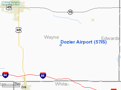
Location
& QuickFacts
|
FAA
Information Effective: |
2007-07-05 |
|
Airport
Identifier: |
57IS |
|
Airport
Status: |
Operational |
|
Longitude/Latitude: |
088-16-20.1560W/38-19-00.1710N
-88.272266/38.316714 (Estimated) |
|
Elevation: |
420 ft / 128.02 m (Estimated) |
|
Land: |
0 acres |
|
From
nearest city: |
6 nautical miles SE of Fairfield, IL |
|
Location: |
Wayne County, IL |
|
Magnetic Variation: |
00E (1985) |
Owner & Manager
|
Ownership: |
Privately owned |
|
Owner: |
R. Scott Dozier |
|
Address: |
Rt 5
Fairfield, IL 62837 |
|
Phone number: |
618-842-5412 |
|
Manager: |
R. Scott Dozier |
|
Address: |
Rt 5
Fairfield, IL 62837 |
|
Phone number: |
618-842-5412 |
Airport
Operations and Facilities
|
Airport
Use: |
Private |
|
Wind
indicator: |
Yes |
|
Segmented Circle: |
No |
|
Control
Tower: |
No |
|
Sectional chart: |
St Louis |
|
Region: |
AGL - Great Lakes |
|
Boundary
ARTCC: |
ZKC - Kansas City |
|
Tie-in
FSS: |
COU - Columbia |
|
FSS
Toll Free: |
1-800-WX-BRIEF |
|
Runway
Information
Runway E/W
|
Dimension: |
1600
x 70 ft / 487.7 x 21.3 m |
|
Surface: |
TURF, |
|
|
Runway E |
Runway W |
|
Traffic
Pattern: |
Left |
Left |
|
Radio Navigation
Aids
|
ID |
Type |
Name |
Ch |
Freq |
Var |
Dist |
|
FWC |
NDB |
Wayne County |
|
257.00 |
01E |
7.5 nm |
|
CUL |
NDB |
Carmi |
|
332.00 |
01W |
15.2 nm |
|
FOA |
NDB |
Elm River |
|
353.00 |
00E |
22.8 nm |
|
OLY |
NDB |
Olney |
|
272.00 |
00W |
24.6 nm |
|
AJG |
NDB |
Mount Carmel |
|
524.00 |
02W |
31.2 nm |
|
HSB |
NDB |
Harrisburg-raleigh |
|
230.00 |
00E |
33.0 nm |
|
SLO |
NDB |
Salem |
|
400.00 |
01W |
38.2 nm |
|
PDW |
NDB |
Evansville |
|
284.00 |
00E |
38.8 nm |
|
GVA |
NDB |
Geneva |
|
224.00 |
01W |
38.9 nm |
|
OEA |
NDB |
Vincennes |
|
251.00 |
00E |
40.6 nm |
|
SAM |
VOR/DME |
Samsville |
113X |
116.60 |
03E |
13.4 nm |
|
VNN |
VOR/DME |
Mount Vernon |
085X |
113.80 |
02E |
25.4 nm |
|
LWV |
VOR/DME |
Lawrenceville |
025X |
108.80 |
01W |
41.6 nm |
|
MWA |
VOR/DME |
Marion |
041X |
110.40 |
04E |
48.7 nm |
|
PXV |
VORTAC |
Pocket City |
080X |
113.30 |
03E |
33.6 nm |
|
BIB |
VORTAC |
Bible Grove |
027X |
109.00 |
03E |
37.6 nm |
|
ENL |
VORTAC |
Centralia |
097X |
115.00 |
04E |
42.2 nm |
Based
Aircraft
|
Aircraft
based on field: |
1 |
|
Single
Engine Airplanes: |
1 |
Dozier Airport
Address:
Wayne County, IL
Tel:
618-842-5412
Images
and information placed above are from
http://www.airport-data.com/airport/57IS/
We
thank them for the data!
| General
Info |
| Country |
United
States |
| State |
ILLINOIS
|
| FAA ID |
57IS |
| Latitude |
38-19-00.171N
|
| Longitude |
088-16-20.156W
|
| Elevation |
420 feet
|
| Near City |
FAIRFIELD
|
We don't guarantee the information is fresh and accurate. The data may
be wrong or outdated.
For more up-to-date information please refer to other sources.
|
|


