|
|
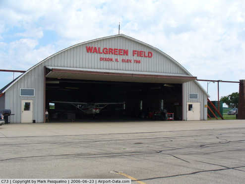
Dixon Municipal - Charles R. Walgreen Field Airport |
|
 |
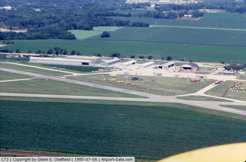
(Click on the photo to enlarge) |
|
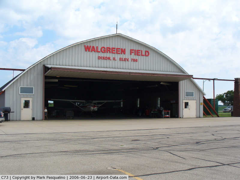
 |
(Click on the photo to enlarge) |
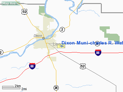
|
 |
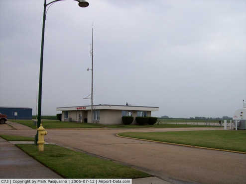
(Click on the photo to enlarge) |
Location
& QuickFacts
|
FAA
Information Effective: |
2007-07-05 |
|
Airport
Identifier: |
C73 |
|
Airport
Status: |
Operational |
|
Longitude/Latitude: |
089-26-46.3680W/41-50-01.3160N
-89.446213/41.833699 (Estimated) |
|
Elevation: |
785 ft / 239.27 m (Surveyed) |
|
Land: |
206 acres |
|
From
nearest city: |
1 nautical miles E of Dixon, IL |
|
Location: |
Lee County, IL |
|
Magnetic Variation: |
03E (1965) |
Owner
& Manager
|
Ownership: |
Publicly
owned |
|
Owner: |
City Of Dixon |
|
Address: |
Po Box 386
Dixon, IL 61021 |
|
Phone
number: |
815-288-1485 |
|
Manager: |
Larry Haley |
|
Address: |
1650 Franklin Grove Rd
Dixon, IL 61021 |
|
Phone number: |
815-288-4095 |
Airport Operations and Facilities
|
Airport
Use: |
Open
to public |
|
Wind
indicator: |
Yes |
|
Segmented Circle: |
Yes |
|
Control
Tower: |
No |
|
Lighting
Schedule: |
DUSK-DAWN
MIRL RY 12/30 PRESET ON LOW INTST SS-SR; TO INCR INTST &
ACTVT MIRL RY 08/26, REIL RY 08, PAPI RY 26 - CTAF. |
|
Beacon
Color: |
Clear-Green (lighted land airport) |
|
Landing
fee charge: |
No |
|
Sectional chart: |
Chicago |
|
Region: |
AGL - Great Lakes |
|
Traffic
Pattern Alt: |
800 ft |
|
Boundary
ARTCC: |
ZAU - Chicago |
|
Tie-in
FSS: |
IKK - Kankakee |
|
FSS
on Airport: |
No |
|
FSS
Toll Free: |
1-800-WX-BRIEF |
|
NOTAMs
Facility: |
IKK (NOTAM-d service avaliable) |
|
Federal Agreements: |
NGY |
Airport Communications
|
CTAF: |
123.050 |
|
Unicom: |
123.050
|
Airport
Services
|
Fuel
available: |
100LLA
SELF FUELING AVBL 24 HRS. |
|
Airframe
Repair: |
MAJOR |
|
Power
Plant Repair: |
MAJOR |
|
Bottled
Oxygen: |
NONE |
|
Bulk
Oxygen: |
NONE |
|
Runway Information
Runway 08/26
|
Dimension: |
3899
x 75 ft / 1188.4 x 22.9 m |
|
Surface: |
ASPH, Good Condition |
|
Weight
Limit: |
Single wheel: 12000 lbs. |
|
Edge
Lights: |
Medium |
|
|
Runway 08 |
Runway 26 |
|
Longitude: |
089-27-16.1460W |
089-26-25.4410W |
|
Latitude: |
41-49-56.8470N |
41-50-03.6100N |
|
Elevation: |
781.00 ft |
785.00 ft |
|
Alignment: |
80 |
127 |
|
Traffic
Pattern: |
Left |
Left |
|
Markings: |
Non-precision instrument, Good Condition |
Non-precision instrument, Good Condition |
|
Crossing
Height: |
0.00 ft |
20.00 ft |
|
VASI: |
|
4-light PAPI on left side |
|
Visual
Glide Angle: |
0.00° |
3.00° |
|
Runway
End Identifier: |
Yes |
|
|
Centerline
Lights: |
No |
No |
|
Touchdown
Lights: |
No |
No |
|
Obstruction: |
42 ft trees, 1260.0 ft from runway, 125 ft
right of centerline, 25:1 slope to clear |
5 ft gnd, 350.0 ft from runway, 100 ft left
of centerline, 30:1 slope to clear |
|
Runway 12/30
|
Dimension: |
2803
x 75 ft / 854.4 x 22.9 m |
|
Surface: |
ASPH, Fair Condition |
|
Weight
Limit: |
Single wheel: 12000 lbs. |
|
Edge
Lights: |
Medium |
|
|
Runway 12 |
Runway 30 |
|
Longitude: |
089-26-56.1330W |
089-26-24.5210W |
|
Latitude: |
41-50-10.0390N |
41-49-55.6290N |
|
Elevation: |
777.00 ft |
785.00 ft |
|
Alignment: |
121 |
127 |
|
Traffic
Pattern: |
Left |
Left |
|
Markings: |
Basic, Good Condition |
Basic, Good Condition |
|
Runway
End Identifier: |
No |
No |
|
Centerline
Lights: |
No |
No |
|
Touchdown
Lights: |
No |
No |
|
Obstruction: |
24 ft stack, 682.0 ft from runway, 6 ft left
of centerline, 20:1 slope to clear |
23 ft rr, 690.0 ft from runway, 174 ft left
of centerline, 21:1 slope to clear |
|
Radio Navigation
Aids
|
ID |
Type |
Name |
Ch |
Freq |
Var |
Dist |
|
BOZ |
NDB |
Whiteside |
|
254.00 |
01E |
16.9 nm |
|
FEP |
NDB |
Freeport |
|
335.00 |
00E |
25.5 nm |
|
VYS |
NDB |
Valley |
|
230.00 |
00W |
31.8 nm |
|
DKB |
NDB |
Dekalb |
|
209.00 |
02W |
33.6 nm |
|
OIX |
NDB |
Ottawa |
|
266.00 |
01E |
38.9 nm |
|
CWI |
NDB |
Clinton |
|
377.00 |
01E |
39.5 nm |
|
EZI |
NDB |
Kewanee |
|
245.00 |
01E |
44.5 nm |
|
PLL |
VOR/DME |
Polo |
049X |
111.20 |
03E |
8.7 nm |
|
RFD |
VOR/DME |
Rockford |
045X |
110.80 |
01E |
26.0 nm |
|
JVL |
VOR/DME |
Janesville |
090X |
114.30 |
03E |
46.1 nm |
|
DPA |
VOR/DME |
Dupage |
021X |
108.40 |
02E |
49.2 nm |
|
BDF |
VORTAC |
Bradford |
094X |
114.70 |
00E |
41.0 nm |
|
CVA |
VORTAC |
Davenport |
085X |
113.80 |
04E |
47.1 nm |
Remarks
- TWYS
HAVE IN-PAVEMENT CNTRLN REFLECTORS & EDGE REFLECTORS WITH NO LIGHTS.
Based Aircraft
|
Aircraft
based on field: |
38 |
|
Single
Engine Airplanes: |
34 |
|
Multi
Engine Airplanes: |
3 |
|
Helicopters: |
1 |
Operational Statistics
Time Period: 2005-01-01
- 2005-12-31
|
Aircraft
Operations: |
110/Day |
|
General
Aviation Local: |
30.0% |
|
General
Aviation Itinerant: |
70.0% |
Dixon Municipal-charles R. Walgreen Field
Airport
Address:
Lee County, IL
Tel:
815-288-1485,
815-288-4095
Images
and information placed above are from
http://www.airport-data.com/airport/C73/
We
thank them for the data!
| General
Info |
| Country |
United
States |
| State |
ILLINOIS
|
| FAA ID |
C73 |
| Latitude |
41-50-01.316N
|
| Longitude |
089-26-46.368W
|
| Elevation |
785 feet
|
| Near City |
DIXON
|
We don't guarantee the information is fresh and accurate. The data may
be wrong or outdated.
For more up-to-date information please refer to other sources.
|
|