 |
|
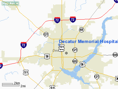
Decatur Memorial Hospital Heliport |
|
|
Location
& QuickFacts
|
FAA
Information Effective: |
2007-07-05 |
|
Airport
Identifier: |
8IS6 |
|
Airport
Status: |
Operational |
|
Longitude/Latitude: |
088-57-41.0000W/39-52-02.0000N
-88.961389/39.867222 (Estimated) |
|
Elevation: |
750 ft / 228.60 m (Estimated) |
|
Land: |
0 acres |
|
From
nearest city: |
5 nautical miles SE of Decatur, IL |
|
Location: |
Macon County, IL |
|
Magnetic Variation: |
01E (1985) |
Owner
& Manager
|
Ownership: |
Privately
owned |
|
Owner: |
Decatur Memorial Hospital |
|
Address: |
2300 N. Edward St
Decatur, IL 62526 |
|
Phone
number: |
217-877-8121 |
|
Manager: |
Wayne Longwill |
|
Address: |
Decatur Memorial Hospital, 2300 N. Edward
St
Decatur, IL 62526 |
|
Phone number: |
217-876-2202 |
Airport Operations and Facilities
|
Airport Use: |
Private
MEDICAL USE. |
|
Wind indicator: |
Yes |
|
Segmented Circle: |
No |
|
Control Tower: |
No |
|
Lighting Schedule: |
DUSK-DAWN |
|
Beacon Color: |
Clear-Green-Yellow (heliport) |
|
Landing fee charge: |
No |
|
Sectional chart: |
St Louis |
|
Region: |
AGL - Great Lakes |
|
Boundary ARTCC: |
ZKC - Kansas City |
|
Tie-in FSS: |
STL - Saint Louis |
|
FSS on Airport: |
No |
|
FSS Phone: |
636-536-2980 |
|
FSS Toll Free: |
1-800-WX-BRIEF |
Airport Services
|
Airframe
Repair: |
NONE |
|
Power
Plant Repair: |
NONE |
|
Runway Information
Helipad H1
|
Dimension: |
45
x 45 ft / 13.7 x 13.7 m |
|
Surface: |
MATS, Good Condition
RY H1 IS ELEVATED ROOFTOP STEEL DECK. |
|
|
Runway H1 |
Runway |
|
Traffic
Pattern: |
Left |
Left |
|
Radio Navigation
Aids
|
ID |
Type |
Name |
Ch |
Freq |
Var |
Dist |
|
AAA |
NDB |
Abraham |
|
329.00 |
00E |
24.7 nm |
|
TAZ |
NDB |
Taylorville |
|
395.00 |
00E |
26.0 nm |
|
SYZ |
NDB |
Shelbyville |
|
365.00 |
01E |
28.2 nm |
|
LQ |
NDB |
Licol |
|
375.00 |
01W |
29.7 nm |
|
SP |
NDB |
Huskk |
|
382.00 |
01W |
37.3 nm |
|
MT |
NDB |
Zebre |
|
347.00 |
00E |
44.5 nm |
|
HMJ |
NDB |
Homer |
|
281.00 |
01E |
47.4 nm |
|
BMI |
VOR/DME |
Bloomington |
019X |
108.20 |
03E |
36.9 nm |
|
MTO |
VOR/DME |
Mattoon |
031X |
109.40 |
03E |
39.0 nm |
|
DEC |
VORTAC |
Decatur |
119X |
117.20 |
03E |
9.2 nm |
|
CAP |
VORTAC |
Capital |
074X |
112.70 |
04E |
30.7 nm |
|
SPI |
VORTAC |
Spinner |
74X |
112.70 |
01W |
33.1 nm |
|
CMI |
VORTAC |
Champaign |
037X |
110.00 |
03E |
33.1 nm |
|
VLA |
VORTAC |
Vandalia |
090X |
114.30 |
04E |
47.4 nm |
Remarks
- HELIPORT
USED FOR EMERGENCY EVACUATION OF PATIENTS VIA THE TRAUMA NETWORK OF
ILLINOIS EMERGENCY MEDICAL SERVICES.
- PRVDD
APCH/DEP FROM 085 DEG TO 095 DEG AND FROM 265 TO 275 DEG; AREA IS MARKED;
WIND INDICATOR IS MAINTAINED; AND COMPLY WITH FAR PART 91.126(B)(2).
Decatur Memorial Hospital Heliport
Address:
Macon County, IL
Tel:
217-877-8121,
217-876-2202
Images
and information placed above are from
http://www.airport-data.com/airport/8IS6/
We
thank them for the data!
| General
Info |
| Country |
United
States |
| State |
ILLINOIS
|
| FAA ID |
8IS6 |
| Latitude |
39-52-02.000N
|
| Longitude |
088-57-41.000W
|
| Elevation |
750 feet
|
| Near City |
DECATUR
|
We don't guarantee the information is fresh and accurate. The data may
be wrong or outdated.
For more up-to-date information please refer to other sources.
|
|


