|
|
De Kalb Taylor Municipal Airport |
Coordinates: 39°04â²14â³N 088°32â²01â³W / 39.07056°N 88.53361°W / 39.07056; -88.53361
| DeKalb Taylor Municipal Airport |
| IATA: DTMA â ICAO: KDKB â FAA LID: DKB |
| Summary |
| Airport type |
Public |
| Owner |
City of DeKalb |
| Location |
DeKalb, Illinois |
| Elevation AMSL |
914 ft / 279 m |
| Website |
[1] |
| Runways |
| Direction |
Length |
Surface |
| ft |
m |
| 2/20 |
7,025 |
2,141 |
Asphalt |
| 9/27 |
4,200 |
1,280 |
Asphalt |
| Statistics (na) |
| Aircraft operations |
na |
| Source: [2] |
Opened in April 1944, DeKalb Taylor Municipal Airport (FAA LID: DKB, ICAO: KDKB, IATA: DTMA) is a general aviation airport and is situated on 920 acres at an elevation of 914 ft (279 m) and located two miles (3.2 km) east of DeKalb, Illinois, United States. DTMA is located approx. 60 mi west of Chicago. The airport is open 24-hours a day and is owned by the city of DeKalb. Airport Operational Statistics
Currently, 70 aircraft (61 single engine, four twin engine, three turbo prop, one jet and one helicopter) are based at the airport. In 2007, there was an average of 74 daily aircraft operations (73% transient general aviation, 23% local general aviation and 4% air taxi operations).
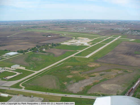
Runways
KDMA has four runways: runway 2/20 measures 7,025 ft x 100 ft (2,141 m x 30 m) and runway 9/27 measures 4,200 ft x 75 ft (1,280 m x 23 m). Furthermore, all runways are surfaced with asphalt and grooved. Runway 02 is equipped with an instrument landing system (ILS), which allows for instrument approaches. Moreover, GPS approaches can be made to all runways. Runway 2/20 is fully suitable for take-offs of corporate aircraft, such as the Boeing Business Jet, for non-stop flights to Europe and China.
Fixed Base Operator
DeKalb Aviation, which is the airport's fixed base operator (FBO), provides a wide-range of airport services, including the following: Aviation fuel Avgas 100LL, Jet A, aircraft parking (ramp or tiedown), aircraft de-icing, hangars, hangar leasing / sales, GPU / power cart, flight training, charter services, aircraft rental and aircraft parts. Furthermore, wireless LAN (WLAN) access is available to all DeKalb Aviation customers.
The above content comes from Wikipedia and is published under free licenses – click here to read more.
|
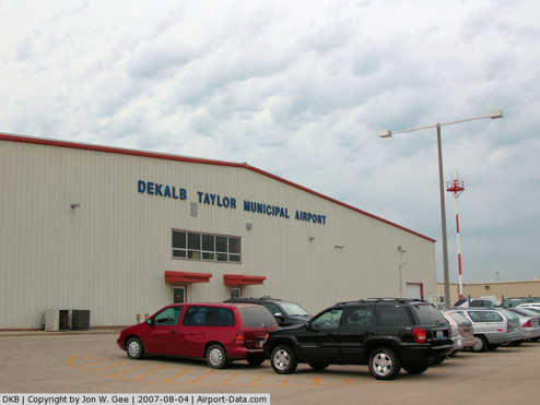 |
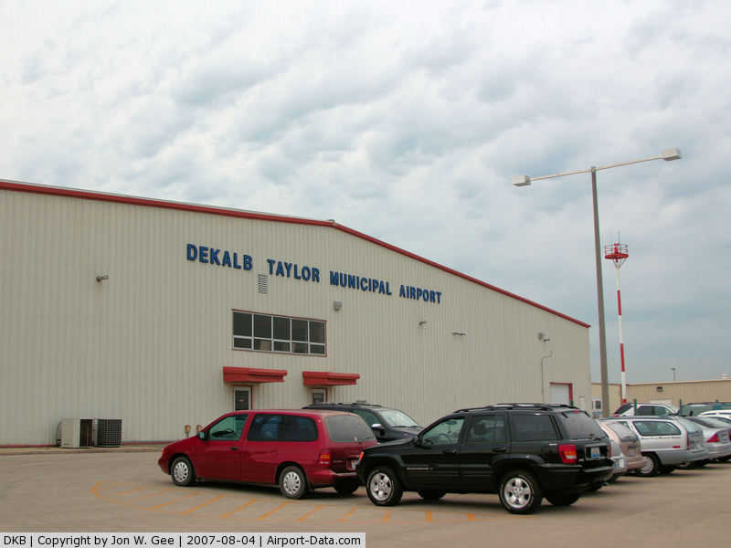
(Click on the photo to enlarge) |
|
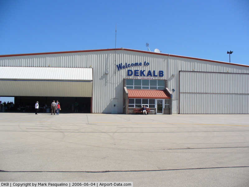
 |
(Click on the photo to enlarge) |
|
 |
(Click on the photo to enlarge) |
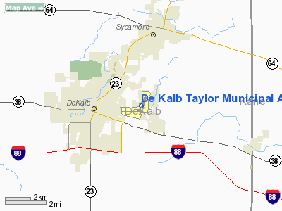
Location
& QuickFacts
|
FAA
Information Effective: |
2007-07-05 |
|
Airport
Identifier: |
DKB |
|
Airport
Status: |
Operational |
|
Longitude/Latitude: |
088-42-20.6000W/41-56-01.4000N
-88.705722/41.933722 (Estimated) |
|
Elevation: |
914 ft / 278.59 m (Surveyed) |
|
Land: |
316 acres |
|
From
nearest city: |
2 nautical miles E of De Kalb, IL |
|
Location: |
De Kalb County, IL |
|
Magnetic Variation: |
02W (2005) |
Owner
& Manager
|
Ownership: |
Publicly
owned |
|
Owner: |
City Of Dekalb |
|
Address: |
200 S 4th St
Dekalb, IL 60115 |
|
Phone number: |
815-748-2000 |
|
Manager: |
Tom Cleveland |
|
Address: |
3232 Pleasant Street
Dekalb, IL 60115 |
|
Phone number: |
815-748-2020 |
Airport
Operations and Facilities
|
Airport
Use: |
Open
to public |
|
Wind
indicator: |
Yes |
|
Segmented Circle: |
No |
|
Control
Tower: |
No |
|
Lighting
Schedule: |
DUSK-DAWN
MIRL RY 02/20 PRESET LOW INTST, TO INCR INTST & ACTVT
MIRL RY 09/27, PAPI RYS 09 & 27, REIL RYS, 9, 27, 02
& 20 - CTAF. PAPI
RYS 02 & 20 OPERATE 24 HRS. |
|
Beacon
Color: |
Clear-Green (lighted land airport) |
|
Landing
fee charge: |
No |
|
Sectional chart: |
Chicago |
|
Region: |
AGL - Great Lakes |
|
Boundary
ARTCC: |
ZAU - Chicago |
|
Tie-in
FSS: |
IKK - Kankakee |
|
FSS
on Airport: |
No |
|
FSS
Toll Free: |
1-800-WX-BRIEF |
|
NOTAMs
Facility: |
DKB (NOTAM-d service avaliable) |
|
Federal Agreements: |
NGRY |
Airport Communications
|
CTAF: |
122.700 |
|
Unicom: |
122.700
|
Airport
Services
|
Fuel
available: |
100LLA1+ |
|
Airframe
Repair: |
MINOR |
|
Power
Plant Repair: |
MINOR |
|
Runway Information
Runway 02/20
|
Dimension: |
7226
x 100 ft / 2202.5 x 30.5 m |
|
Surface: |
ASPH, Good Condition |
|
Surface
Treatment: |
Saw-cut or plastic Grooved |
|
Weight
Limit: |
Single wheel: 25000 lbs.
Dual wheel: 80000 lbs. |
|
Edge
Lights: |
Medium |
|
|
Runway 02 |
Runway 20 |
|
Longitude: |
088-42-25.3109W |
088-41-53.3942W |
|
Latitude: |
41-55-37.6168N |
41-56-44.9074N |
|
Elevation: |
914.00 ft |
904.00 ft |
|
Alignment: |
19 |
127 |
|
ILS
Type: |
LOC/DME |
|
|
Traffic
Pattern: |
Left |
Left |
|
Markings: |
Non-precision instrument, Good Condition |
Non-precision instrument, Good Condition |
|
Crossing
Height: |
21.00 ft |
27.00 ft |
|
VASI: |
2-light PAPI on left side |
2-light PAPI on left side |
|
Visual
Glide Angle: |
3.00° |
3.25° |
|
Runway
End Identifier: |
Yes |
Yes |
|
Obstruction: |
74 ft tree, 3185.0 ft from runway, 125 ft right
of centerline, 40:1 slope to clear |
48 ft tree, 1425.0 ft from runway, 64 ft right
of centerline, 25:1 slope to clear |
|
Runway 09/27
|
Dimension: |
4201
x 75 ft / 1280.5 x 22.9 m |
|
Surface: |
ASPH, Good Condition |
|
Surface
Treatment: |
Saw-cut or plastic Grooved |
|
Weight
Limit: |
Single wheel: 25000 lbs.
Dual wheel: 80000 lbs. |
|
Edge
Lights: |
Medium |
|
|
Runway 09 |
Runway 27 |
|
Longitude: |
088-43-07.5961W |
088-42-12.0179W |
|
Latitude: |
41-55-44.3858N |
41-55-44.4725N |
|
Elevation: |
911.00 ft |
912.00 ft |
|
Alignment: |
89 |
127 |
|
Traffic
Pattern: |
Left |
Left |
|
Markings: |
Non-precision instrument, Fair Condition |
Non-precision instrument, Fair Condition |
|
Crossing
Height: |
30.00 ft |
21.00 ft |
|
VASI: |
4-light PAPI on left side
OTS INDEFLY. |
4-light PAPI on left side |
|
Visual
Glide Angle: |
3.00° |
3.00° |
|
Runway
End Identifier: |
Yes
OTS INDEFLY. |
Yes
RY 27 REIL OTS INDEFLY. |
|
Obstruction: |
67 ft tree, 1754.0 ft from runway, 301 ft right
of centerline, 23:1 slope to clear |
23 ft tree, 1160.0 ft from runway, 36 ft left
of centerline, 41:1 slope to clear |
|
Radio Navigation
Aids
|
ID |
Type |
Name |
Ch |
Freq |
Var |
Dist |
|
ME |
NDB |
Deana |
|
350.00 |
00E |
30.4 nm |
|
OIX |
NDB |
Ottawa |
|
266.00 |
01E |
35.0 nm |
|
VYS |
NDB |
Valley |
|
230.00 |
00W |
40.1 nm |
|
HK |
NDB |
Ermin |
|
332.00 |
01W |
41.0 nm |
|
FEP |
NDB |
Freeport |
|
335.00 |
00E |
43.5 nm |
|
JVL |
NDB |
Janesville |
|
375.00 |
03E |
43.6 nm |
|
LVV |
NDB |
Lake Lawn |
|
404.00 |
00W |
46.3 nm |
|
MX |
NDB |
Kedzi |
|
248.00 |
01W |
46.9 nm |
|
DPA |
VOR/DME |
Dupage |
021X |
108.40 |
02E |
16.1 nm |
|
RFD |
VOR/DME |
Rockford |
045X |
110.80 |
01E |
28.2 nm |
|
ORD |
VOR/DME |
Chicago O'hare |
086X |
113.90 |
02E |
35.9 nm |
|
PLL |
VOR/DME |
Polo |
049X |
111.20 |
03E |
36.6 nm |
|
OBK |
VOR/DME |
Northbrook |
077X |
113.00 |
02W |
37.8 nm |
|
JVL |
VOR/DME |
Janesville |
090X |
114.30 |
03E |
41.5 nm |
|
BUU |
VOR/DME |
Burbun |
092X |
114.50 |
01W |
48.8 nm |
|
JOT |
VORTAC |
Joliet |
070X |
112.30 |
02E |
29.0 nm |
|
ORD |
VOT |
Chicago O'hare Intl |
|
112.00 |
|
35.8 nm |
|
MDW |
VOT |
Chicago Midway |
|
111.00 |
|
43.6 nm |
Remarks
- GCO
FREQ 121.725 OTS INDEFLY.
- TWY
C CLSD BTN TWYS B & C3. TWY
A CLSD INDEFLY.
Based
Aircraft
|
Aircraft
based on field: |
62 |
|
Single
Engine Airplanes: |
52 |
|
Multi
Engine Airplanes: |
7 |
|
Jet
Engine Airplanes: |
1 |
|
Helicopters: |
2 |
Operational Statistics
Time Period: 2005-01-01
- 2005-12-31
|
Aircraft
Operations: |
118/Day |
|
Air
Taxi: |
4.7% |
|
General
Aviation Local: |
22.1% |
|
General
Aviation Itinerant: |
73.3% |
De Kalb Taylor Municipal Airport
Address:
De Kalb County, IL
Tel:
815-748-2000, 815-748-2020
Images
and information placed above are from
http://www.airport-data.com/airport/DKB/
We
thank them for the data!
| General
Info |
| Country |
United
States |
| State |
ILLINOIS
|
| FAA ID |
DKB |
| Latitude |
41-55-54.772N
|
| Longitude |
088-42-29.875W
|
| Elevation |
915 feet
|
| Near City |
DE KALB
|
We don't guarantee the information is fresh and accurate. The data may
be wrong or outdated.
For more up-to-date information please refer to other sources.
|
|