 |
|
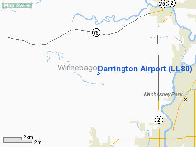
Location
& QuickFacts
|
FAA
Information Effective: |
2007-07-05 |
|
Airport
Identifier: |
LL80 |
|
Airport
Status: |
Operational |
|
Longitude/Latitude: |
089-09-40.3950W/42-22-55.0600N
-89.161221/42.381961 (Estimated) |
|
Elevation: |
862 ft / 262.74 m (Surveyed) |
|
Land: |
0 acres |
|
From
nearest city: |
7 nautical miles NW of Rockford, IL |
|
Location: |
Winnebago County, IL |
|
Magnetic Variation: |
00E (1985) |
Owner & Manager
|
Ownership: |
Privately owned |
|
Owner: |
Wilfried Jury |
|
Address: |
8484 Tate Road
Rockford, IL 61101 |
|
Phone number: |
815-965-6044 |
|
Address: |
|
Airport Operations and Facilities
|
Airport Use: |
Private |
|
Wind indicator: |
Yes |
|
Segmented Circle: |
No |
|
Control Tower: |
No |
|
Landing fee charge: |
No |
|
Sectional chart: |
Chicago |
|
Region: |
AGL - Great Lakes |
|
Boundary ARTCC: |
ZAU - Chicago |
|
Tie-in FSS: |
IKK - Kankakee |
|
FSS on Airport: |
No |
|
FSS Toll Free: |
1-800-WX-BRIEF |
Airport Services
|
Airframe
Repair: |
NONE |
|
Power
Plant Repair: |
MINOR |
|
Runway
Information
Runway E/W
|
Dimension: |
2200
x 90 ft / 670.6 x 27.4 m |
|
Surface: |
TURF, |
|
|
Runway E |
Runway W |
|
Traffic
Pattern: |
Left |
Left |
|
Radio Navigation
Aids
|
ID |
Type |
Name |
Ch |
Freq |
Var |
Dist |
|
JVL |
NDB |
Janesville |
|
375.00 |
03E |
15.0 nm |
|
FEP |
NDB |
Freeport |
|
335.00 |
00E |
20.6 nm |
|
LVV |
NDB |
Lake Lawn |
|
404.00 |
00W |
31.6 nm |
|
DKB |
NDB |
Dekalb |
|
209.00 |
02W |
33.7 nm |
|
MS |
NDB |
Monah |
|
400.00 |
00E |
41.7 nm |
|
BOZ |
NDB |
Whiteside |
|
254.00 |
01E |
49.0 nm |
|
RFD |
VOR/DME |
Rockford |
045X |
110.80 |
01E |
9.6 nm |
|
JVL |
VOR/DME |
Janesville |
090X |
114.30 |
03E |
10.9 nm |
|
PLL |
VOR/DME |
Polo |
049X |
111.20 |
03E |
29.8 nm |
|
BUU |
VOR/DME |
Burbun |
092X |
114.50 |
01W |
42.3 nm |
|
DPA |
VOR/DME |
Dupage |
021X |
108.40 |
02E |
46.7 nm |
|
MSN |
VORTAC |
Madison |
023X |
108.60 |
03E |
46.5 nm |
Remarks
- ARPT
LCTD AT 8484 TATE ROAD.
Based
Aircraft
|
Aircraft
based on field: |
1 |
|
Single
Engine Airplanes: |
1 |
Darrington Airport
Address:
Winnebago County, IL
Tel:
815-965-6044
Images
and information placed above are from
http://www.airport-data.com/airport/LL80/
We
thank them for the data!
| General
Info |
| Country |
United
States |
| State |
ILLINOIS
|
| FAA ID |
LL80 |
| Latitude |
42-22-55.060N
|
| Longitude |
089-09-40.395W
|
| Elevation |
862 feet
|
| Near City |
ROCKFORD
|
We don't guarantee the information is fresh and accurate. The data may
be wrong or outdated.
For more up-to-date information please refer to other sources.
|
|


