 |
|
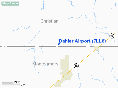
Location
& QuickFacts
|
FAA
Information Effective: |
2007-07-05 |
|
Airport
Identifier: |
7LL8 |
|
Airport
Status: |
Operational |
|
Longitude/Latitude: |
089-18-03.3110W/39-21-09.1650N
-89.300920/39.352546 (Estimated) |
|
Elevation: |
659 ft / 200.86 m (Surveyed) |
|
Land: |
0 acres |
|
From
nearest city: |
3 nautical miles NW of Nokomis, IL |
|
Location: |
Christian County, IL |
|
Magnetic Variation: |
01E (1985) |
Owner
& Manager
|
Ownership: |
Privately
owned |
|
Owner: |
Harley Dahler |
|
Address: |
26 N 1100 E Road
Nokomis, IL 62075 |
|
Phone
number: |
217-563-8607 |
|
Manager: |
Harley Dahler |
|
Address: |
26 N 1100 E Road
Nokomis, IL 62075 |
|
Phone number: |
217-563-8607 |
Airport Operations and Facilities
|
Airport
Use: |
Private |
|
Wind
indicator: |
Yes |
|
Segmented Circle: |
No |
|
Control
Tower: |
No |
|
Landing
fee charge: |
No |
|
Sectional chart: |
St Louis |
|
Region: |
AGL - Great Lakes |
|
Boundary
ARTCC: |
ZKC - Kansas City |
|
Tie-in
FSS: |
STL - Saint Louis |
|
FSS
on Airport: |
No |
|
FSS
Phone: |
636-536-2980 |
|
FSS
Toll Free: |
1-800-WX-BRIEF |
|
Runway Information
Runway 09/27
|
Dimension: |
2200
x 70 ft / 670.6 x 21.3 m |
|
Surface: |
TURF, |
|
|
Runway 09 |
Runway 27 |
|
Traffic
Pattern: |
Right |
Left |
|
Radio Navigation
Aids
|
ID |
Type |
Name |
Ch |
Freq |
Var |
Dist |
|
TAZ |
NDB |
Taylorville |
|
395.00 |
00E |
11.1 nm |
|
LTD |
NDB |
Litchfield |
|
371.00 |
01E |
20.7 nm |
|
SYZ |
NDB |
Shelbyville |
|
365.00 |
01E |
21.5 nm |
|
SP |
NDB |
Huskk |
|
382.00 |
01W |
33.0 nm |
|
LQ |
NDB |
Licol |
|
375.00 |
01W |
36.4 nm |
|
CVM |
NDB |
Civic Memorial |
|
263.00 |
02E |
44.8 nm |
|
SLO |
NDB |
Salem |
|
400.00 |
01W |
45.3 nm |
|
AAA |
NDB |
Abraham |
|
329.00 |
00E |
48.6 nm |
|
MTO |
VOR/DME |
Mattoon |
031X |
109.40 |
03E |
47.7 nm |
|
VLA |
VORTAC |
Vandalia |
090X |
114.30 |
04E |
16.8 nm |
|
DEC |
VORTAC |
Decatur |
119X |
117.20 |
03E |
31.0 nm |
|
SPI |
VORTAC |
Spinner |
74X |
112.70 |
01W |
34.1 nm |
|
CAP |
VORTAC |
Capital |
074X |
112.70 |
04E |
35.7 nm |
|
BIB |
VORTAC |
Bible Grove |
027X |
109.00 |
03E |
46.2 nm |
|
TOY |
VORTAC |
Troy |
107X |
116.00 |
04E |
46.8 nm |
Remarks
- PROVIDED
OPNS S SIDE OF E/W RWY & OPNS AT J&J FARMS ARPT ON W SIDE OF
N/S RWY.
Based
Aircraft
|
Aircraft
based on field: |
3 |
|
Single
Engine Airplanes: |
3 |
Dahler Airport
Address:
Christian County, IL
Tel:
217-563-8607
Images
and information placed above are from
http://www.airport-data.com/airport/7LL8/
We
thank them for the data!
| General
Info |
| Country |
United
States |
| State |
ILLINOIS
|
| FAA ID |
7LL8 |
| Latitude |
39-21-09.165N
|
| Longitude |
089-18-03.311W
|
| Elevation |
659 feet
|
| Near City |
NOKOMIS
|
We don't guarantee the information is fresh and accurate. The data may
be wrong or outdated.
For more up-to-date information please refer to other sources.
|
|


