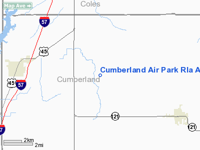
Cumberland Air Park Rla Airport |
Location
& QuickFacts
|
FAA
Information Effective: |
2007-07-05 |
|
Airport
Identifier: |
6LL1 |
|
Airport
Status: |
Operational |
|
Longitude/Latitude: |
088-20-40.1610W/39-18-50.1340N
-88.344489/39.313926 (Estimated) |
|
Elevation: |
631 ft / 192.33 m (Estimated) |
|
Land: |
0 acres |
|
From
nearest city: |
5 nautical miles E of Neoga, IL |
|
Location: |
Cumberland County, IL |
|
Magnetic Variation: |
00E (1985) |
Owner & Manager
|
Ownership: |
Privately owned |
|
Owner: |
R Watson |
|
Address: |
Rte 2
Neoga, IL 62447 |
|
Phone number: |
217-895-2140 |
|
Address: |
|
Airport Operations and Facilities
|
Airport Use: |
Private |
|
Wind indicator: |
Yes |
|
Segmented Circle: |
No |
|
Control Tower: |
No |
|
Landing fee charge: |
No |
|
Sectional chart: |
St Louis |
|
Region: |
AGL - Great Lakes |
|
Boundary ARTCC: |
ZKC - Kansas City |
|
Tie-in FSS: |
STL - Saint Louis |
|
FSS on Airport: |
No |
|
FSS Phone: |
636-536-2980 |
|
FSS Toll Free: |
1-800-WX-BRIEF |
Airport Services
|
Airframe
Repair: |
MAJOR |
|
Power
Plant Repair: |
MAJOR |
|
Runway Information
Runway 09/27
|
Dimension: |
1775
x 70 ft / 541.0 x 21.3 m |
|
Surface: |
TURF, |
|
|
Runway 09 |
Runway 27 |
|
Traffic
Pattern: |
Right |
Right |
|
Radio Navigation
Aids
|
ID |
Type |
Name |
Ch |
Freq |
Var |
Dist |
|
MT |
NDB |
Zebre |
|
347.00 |
00E |
11.1 nm |
|
CZB |
NDB |
Casey |
|
359.00 |
00E |
15.9 nm |
|
SYZ |
NDB |
Shelbyville |
|
365.00 |
01E |
23.9 nm |
|
OLY |
NDB |
Olney |
|
272.00 |
00W |
36.7 nm |
|
PLX |
NDB |
Palestine |
|
391.00 |
00W |
37.4 nm |
|
PRG |
NDB |
Paris |
|
341.00 |
01E |
38.7 nm |
|
FOA |
NDB |
Elm River |
|
353.00 |
00E |
39.1 nm |
|
SIV |
NDB |
Sullivan |
|
326.00 |
02W |
43.5 nm |
|
HU |
NDB |
Yinno |
|
245.00 |
02W |
44.2 nm |
|
HMJ |
NDB |
Homer |
|
281.00 |
01E |
46.5 nm |
|
TAZ |
NDB |
Taylorville |
|
395.00 |
00E |
47.4 nm |
|
SLO |
NDB |
Salem |
|
400.00 |
01W |
49.7 nm |
|
MTO |
VOR/DME |
Mattoon |
031X |
109.40 |
03E |
10.2 nm |
|
RSV |
VOR/DME |
Robinson |
021X |
108.40 |
02E |
37.0 nm |
|
LWV |
VOR/DME |
Lawrenceville |
025X |
108.80 |
01W |
47.6 nm |
|
BIB |
VORTAC |
Bible Grove |
027X |
109.00 |
03E |
24.5 nm |
|
DEC |
VORTAC |
Decatur |
119X |
117.20 |
03E |
34.8 nm |
|
VLA |
VORTAC |
Vandalia |
090X |
114.30 |
04E |
40.3 nm |
|
CMI |
VORTAC |
Champaign |
037X |
110.00 |
03E |
43.4 nm |
Cumberland Air Park Rla Airport
Address:
Cumberland County, IL
Tel:
217-895-2140
Images
and information placed above are from
http://www.airport-data.com/airport/6LL1/
We
thank them for the data!
| General
Info |
| Country |
United
States |
| State |
ILLINOIS
|
| FAA ID |
6LL1 |
| Latitude |
39-18-50.134N
|
| Longitude |
088-20-40.161W
|
| Elevation |
631 feet
|
| Near City |
NEOGA
|
We don't guarantee the information is fresh and accurate. The data may
be wrong or outdated.
For more up-to-date information please refer to other sources.
|


