 |
|
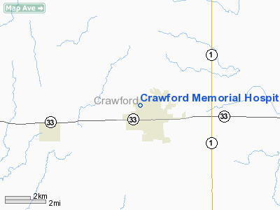
Crawford Memorial Hospital Heliport |
|
|
Location
& QuickFacts
|
FAA
Information Effective: |
2007-07-05 |
|
Airport
Identifier: |
35LL |
|
Airport
Status: |
Operational |
|
Longitude/Latitude: |
087-45-00.0970W/39-00-57.1510N
-87.750027/39.015875 (Estimated) |
|
Elevation: |
550 ft / 167.64 m (Estimated) |
|
Land: |
0 acres |
|
From
nearest city: |
0 nautical miles NW of Robinson, IL |
|
Location: |
Crawford County, IL |
|
Magnetic Variation: |
00W (1985) |
Owner
& Manager
|
Ownership: |
Publicly
owned |
|
Owner: |
Crawford Memorial Hospital |
|
Address: |
1000 North Allen St
Robinson, IL 62454 |
|
Phone
number: |
618-544-3131 |
|
Manager: |
Randy Simmons |
|
Address: |
1000 North Allen St
Robinson, IL 62454 |
|
Phone number: |
618-544-3131 |
Airport Operations and Facilities
|
Airport
Use: |
Private
MEDICAL USE. |
|
Wind
indicator: |
Yes |
|
Segmented Circle: |
No |
|
Control
Tower: |
No |
|
Lighting
Schedule: |
PHONE REQ
FOR PERIMETER LGTS PHONE 618-544-3131. |
|
Beacon Color: |
Clear-Green-Yellow (heliport) |
|
Sectional chart: |
St Louis |
|
Region: |
AGL - Great Lakes |
|
Boundary ARTCC: |
ZID - Indianapolis |
|
Tie-in FSS: |
COU - Columbia |
|
FSS on Airport: |
No |
|
FSS Toll Free: |
1-800-WX-BRIEF |
Airport Services
|
Airframe
Repair: |
NONE |
|
Power
Plant Repair: |
NONE |
|
Runway Information
Helipad H1
|
Dimension: |
42
x 42 ft / 12.8 x 12.8 m |
|
Surface: |
CONC, |
|
|
Runway H1 |
Runway |
|
Traffic
Pattern: |
Left |
Left |
|
Radio Navigation
Aids
|
ID |
Type |
Name |
Ch |
Freq |
Var |
Dist |
|
PLX |
NDB |
Palestine |
|
391.00 |
00W |
5.1 nm |
|
SIV |
NDB |
Sullivan |
|
326.00 |
02W |
15.3 nm |
|
CZB |
NDB |
Casey |
|
359.00 |
00E |
21.0 nm |
|
OEA |
NDB |
Vincennes |
|
251.00 |
00E |
21.5 nm |
|
AJG |
NDB |
Mount Carmel |
|
524.00 |
02W |
24.3 nm |
|
OLY |
NDB |
Olney |
|
272.00 |
00W |
26.7 nm |
|
HU |
NDB |
Yinno |
|
245.00 |
02W |
27.7 nm |
|
MT |
NDB |
Zebre |
|
347.00 |
00E |
32.3 nm |
|
DCY |
NDB |
Washington |
|
212.00 |
03W |
34.7 nm |
|
FOA |
NDB |
Elm River |
|
353.00 |
00E |
39.0 nm |
|
PRG |
NDB |
Paris |
|
341.00 |
01E |
41.2 nm |
|
FWC |
NDB |
Wayne County |
|
257.00 |
01E |
49.2 nm |
|
RSV |
VOR/DME |
Robinson |
021X |
108.40 |
02E |
4.7 nm |
|
LWV |
VOR/DME |
Lawrenceville |
025X |
108.80 |
01W |
16.3 nm |
|
SAM |
VOR/DME |
Samsville |
113X |
116.60 |
03E |
35.6 nm |
|
MTO |
VOR/DME |
Mattoon |
031X |
109.40 |
03E |
37.3 nm |
|
BIB |
VORTAC |
Bible Grove |
027X |
109.00 |
03E |
34.7 nm |
|
TTH |
VORTAC |
Terre Haute |
100X |
115.30 |
02E |
36.8 nm |
Remarks
- PROVIDED
APCH/DEP OPS 230-330 DEGS & 060-090 DEGS TAKEOFF/LDG AREA APPROPRIATELY
MARKED; NON-OBSTN WIND INDICATOR MAINTAINED.
Crawford Memorial Hospital Heliport
Address:
Crawford County, IL
Tel:
618-544-3131
Images
and information placed above are from
http://www.airport-data.com/airport/35LL/
We
thank them for the data!
| General
Info |
| Country |
United
States |
| State |
ILLINOIS
|
| FAA ID |
35LL |
| Latitude |
39-00-57.151N
|
| Longitude |
087-45-00.097W
|
| Elevation |
550 feet
|
| Near City |
ROBINSON
|
We don't guarantee the information is fresh and accurate. The data may
be wrong or outdated.
For more up-to-date information please refer to other sources.
|
|


