 |
|
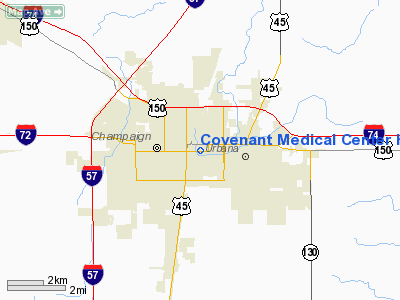
Covenant Medical Center Heliport |
|
|
Location
& QuickFacts
|
FAA
Information Effective: |
2007-07-05 |
|
Airport
Identifier: |
4LL2 |
|
Airport
Status: |
Operational |
|
Longitude/Latitude: |
088-14-03.1760W/40-06-47.1140N
-88.234216/40.113087 (Estimated) |
|
Elevation: |
728 ft / 221.89 m (Estimated) |
|
Land: |
0 acres |
|
From
nearest city: |
0 nautical miles N of Champaign, IL |
|
Location: |
Champaign County, IL |
|
Magnetic Variation: |
00W (1985) |
Owner & Manager
|
Ownership: |
Privately owned |
|
Owner: |
Covenant Medical Center |
|
Address: |
1400 W. Park
Urbana, IL 61801 |
|
Phone number: |
217-337-2000 |
|
Manager: |
Sandi Jones |
|
Address: |
1400 W. Park
Urbana, IL 61801 |
|
Phone number: |
217-337-2000 |
Airport
Operations and Facilities
|
Airport
Use: |
Private |
|
Wind
indicator: |
Yes |
|
Segmented Circle: |
No |
|
Control
Tower: |
No |
|
Lighting
Schedule: |
PHONE REQ
FOR ROTG BCN PHONE 217-337-2500. |
|
Beacon
Color: |
Clear-Green-Yellow (heliport) |
|
Sectional chart: |
Chicago |
|
Region: |
AGL - Great Lakes |
|
Boundary
ARTCC: |
ZAU - Chicago |
|
Tie-in
FSS: |
STL - Saint Louis |
|
FSS
on Airport: |
No |
|
FSS
Phone: |
636-536-2980 |
|
FSS
Toll Free: |
1-800-WX-BRIEF |
|
Runway Information
Helipad H1
|
Dimension: |
90
x 90 ft / 27.4 x 27.4 m |
|
Surface: |
ASPH, |
|
|
Runway H1 |
Runway |
|
Traffic
Pattern: |
Left |
Left |
|
Radio Navigation
Aids
|
ID |
Type |
Name |
Ch |
Freq |
Var |
Dist |
|
HMJ |
NDB |
Homer |
|
281.00 |
01E |
13.9 nm |
|
PRG |
NDB |
Paris |
|
341.00 |
01E |
35.9 nm |
|
MT |
NDB |
Zebre |
|
347.00 |
00E |
40.4 nm |
|
CZB |
NDB |
Casey |
|
359.00 |
00E |
49.7 nm |
|
RBS |
VOR/DME |
Roberts |
115X |
116.80 |
02E |
28.3 nm |
|
MTO |
VOR/DME |
Mattoon |
031X |
109.40 |
03E |
38.2 nm |
|
BMI |
VOR/DME |
Bloomington |
019X |
108.20 |
03E |
38.9 nm |
|
PNT |
VOR/DME |
Pontiac |
033X |
109.60 |
03E |
48.3 nm |
|
CMI |
VORTAC |
Champaign |
037X |
110.00 |
03E |
5.1 nm |
|
DNV |
VORTAC |
Danville |
047X |
111.00 |
02E |
32.9 nm |
|
DEC |
VORTAC |
Decatur |
119X |
117.20 |
03E |
36.5 nm |
Remarks
- PROVIDED
APP/DEP FROM 180 DEGS TO 200 DEGS AND 300 DEGS TO 330 DEGS.
Covenant Medical Center Heliport
Address:
Champaign County, IL
Tel:
217-337-2000
Images
and information placed above are from
http://www.airport-data.com/airport/4LL2/
We
thank them for the data!
| General
Info |
| Country |
United
States |
| State |
ILLINOIS
|
| FAA ID |
4LL2 |
| Latitude |
40-06-47.114N
|
| Longitude |
088-14-03.176W
|
| Elevation |
728 feet
|
| Near City |
CHAMPAIGN
|
We don't guarantee the information is fresh and accurate. The data may
be wrong or outdated.
For more up-to-date information please refer to other sources.
|
|


