 |
|
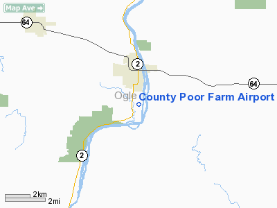
Location
& QuickFacts
|
FAA
Information Effective: |
2007-07-05 |
|
Airport
Identifier: |
67LL |
|
Airport
Status: |
Operational |
|
Longitude/Latitude: |
089-19-53.3780W/41-59-25.1070N
-89.331494/41.990308 (Estimated) |
|
Elevation: |
695 ft / 211.84 m (Surveyed) |
|
Land: |
0 acres |
|
From
nearest city: |
1 nautical miles NE of Oregon, IL |
|
Location: |
Ogle County, IL |
|
Magnetic Variation: |
00E (1985) |
Owner
& Manager
|
Ownership: |
Privately owned |
|
Owner: |
Charles I. Turner |
|
Address: |
4825 Gulf Of Mexico Dr
Longboat Key, FL 33548 |
|
Manager: |
Charles P. Turner |
|
Address: |
Rte 1, Box 6
Monroe Center, IL 61052 |
|
Phone number: |
815-393-3106 |
Airport Operations and Facilities
|
Airport
Use: |
Private |
|
Segmented Circle: |
No |
|
Control
Tower: |
No |
|
Sectional chart: |
Chicago |
|
Region: |
AGL - Great Lakes |
|
Boundary
ARTCC: |
ZAU - Chicago |
|
Tie-in
FSS: |
IKK - Kankakee |
|
FSS
on Airport: |
No |
|
FSS
Toll Free: |
1-800-WX-BRIEF |
|
Runway
Information
Runway E/W
|
Dimension: |
1600
x 70 ft / 487.7 x 21.3 m |
|
Surface: |
TURF, |
|
|
Runway E |
Runway W |
|
Traffic
Pattern: |
Left |
Left |
|
Obstruction: |
30 ft trees, 400.0 ft from runway |
|
|
Radio Navigation
Aids
|
ID |
Type |
Name |
Ch |
Freq |
Var |
Dist |
|
FEP |
NDB |
Freeport |
|
335.00 |
00E |
19.1 nm |
|
BOZ |
NDB |
Whiteside |
|
254.00 |
01E |
26.4 nm |
|
DKB |
NDB |
Dekalb |
|
209.00 |
02W |
28.1 nm |
|
VYS |
NDB |
Valley |
|
230.00 |
00W |
39.1 nm |
|
JVL |
NDB |
Janesville |
|
375.00 |
03E |
39.7 nm |
|
OIX |
NDB |
Ottawa |
|
266.00 |
01E |
43.4 nm |
|
CWI |
NDB |
Clinton |
|
377.00 |
01E |
45.6 nm |
|
PLL |
VOR/DME |
Polo |
049X |
111.20 |
03E |
8.7 nm |
|
RFD |
VOR/DME |
Rockford |
045X |
110.80 |
01E |
15.3 nm |
|
JVL |
VOR/DME |
Janesville |
090X |
114.30 |
03E |
35.6 nm |
|
DPA |
VOR/DME |
Dupage |
021X |
108.40 |
02E |
44.3 nm |
Based
Aircraft
|
Aircraft
based on field: |
3 |
|
Single
Engine Airplanes: |
3 |
County Poor Farm Airport
Address:
Ogle County, IL
Tel:
815-393-3106
Images
and information placed above are from
http://www.airport-data.com/airport/67LL/
We
thank them for the data!
| General
Info |
| Country |
United
States |
| State |
ILLINOIS
|
| FAA ID |
67LL |
| Latitude |
41-59-25.107N
|
| Longitude |
089-19-53.378W
|
| Elevation |
695 feet
|
| Near City |
OREGON
|
We don't guarantee the information is fresh and accurate. The data may
be wrong or outdated.
For more up-to-date information please refer to other sources.
|
|


