 |
|
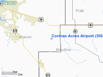
Location
& QuickFacts
|
FAA
Information Effective: |
2007-07-05 |
|
Airport
Identifier: |
5IS4 |
|
Airport
Status: |
Operational |
|
Longitude/Latitude: |
088-46-46.2560W/39-45-58.1270N
-88.779516/39.766146 (Estimated) |
|
Elevation: |
710 ft / 216.41 m (Estimated) |
|
Land: |
8 acres |
|
From
nearest city: |
3 nautical miles W of Lake City, IL |
|
Location: |
Macon County, IL |
|
Magnetic Variation: |
00E (1985) |
Owner & Manager
|
Ownership: |
Privately owned |
|
Owner: |
David L. Corman |
|
Address: |
R1
Lovington, IL 61937 |
|
Phone number: |
217-864-2214 |
|
Manager: |
David L. Corman |
|
Address: |
R1
Lovington, IL 61937 |
|
Phone number: |
217-864-2223 |
Airport
Operations and Facilities
|
Airport
Use: |
Private |
|
Wind
indicator: |
Yes |
|
Segmented Circle: |
No |
|
Control
Tower: |
No |
|
Landing
fee charge: |
Yes |
|
Sectional chart: |
St Louis |
|
Region: |
AGL - Great Lakes |
|
Boundary
ARTCC: |
ZKC - Kansas City |
|
Tie-in
FSS: |
STL - Saint Louis |
|
FSS
on Airport: |
No |
|
FSS
Phone: |
636-536-2980 |
|
FSS
Toll Free: |
1-800-WX-BRIEF |
|
Runway Information
Runway 18/36
|
Dimension: |
1990
x 70 ft / 606.6 x 21.3 m |
|
Surface: |
TURF, |
|
|
Runway 18 |
Runway 36 |
|
Traffic
Pattern: |
Left |
Left |
|
Displaced
threshold: |
0.00 ft |
500.00 ft |
|
Obstruction: |
|
50 ft pline, 500.0 ft from runway |
|
Radio Navigation
Aids
|
ID |
Type |
Name |
Ch |
Freq |
Var |
Dist |
|
SYZ |
NDB |
Shelbyville |
|
365.00 |
01E |
21.8 nm |
|
TAZ |
NDB |
Taylorville |
|
395.00 |
00E |
28.7 nm |
|
MT |
NDB |
Zebre |
|
347.00 |
00E |
34.2 nm |
|
AAA |
NDB |
Abraham |
|
329.00 |
00E |
35.0 nm |
|
LQ |
NDB |
Licol |
|
375.00 |
01W |
39.0 nm |
|
HMJ |
NDB |
Homer |
|
281.00 |
01E |
41.2 nm |
|
SP |
NDB |
Huskk |
|
382.00 |
01W |
45.3 nm |
|
CZB |
NDB |
Casey |
|
359.00 |
00E |
45.5 nm |
|
MTO |
VOR/DME |
Mattoon |
031X |
109.40 |
03E |
28.7 nm |
|
BMI |
VOR/DME |
Bloomington |
019X |
108.20 |
03E |
43.5 nm |
|
DEC |
VORTAC |
Decatur |
119X |
117.20 |
03E |
3.9 nm |
|
CMI |
VORTAC |
Champaign |
037X |
110.00 |
03E |
28.3 nm |
|
CAP |
VORTAC |
Capital |
074X |
112.70 |
04E |
39.8 nm |
|
SPI |
VORTAC |
Spinner |
74X |
112.70 |
01W |
41.7 nm |
|
VLA |
VORTAC |
Vandalia |
090X |
114.30 |
04E |
44.2 nm |
Based
Aircraft
|
Aircraft
based on field: |
1 |
|
Single
Engine Airplanes: |
1 |
Corman Acres Airport
Address:
Macon County, IL
Tel:
217-864-2214, 217-864-2223
Images
and information placed above are from
http://www.airport-data.com/airport/5IS4/
We
thank them for the data!
| General
Info |
| Country |
United
States |
| State |
ILLINOIS
|
| FAA ID |
5IS4 |
| Latitude |
39-45-58.127N
|
| Longitude |
088-46-46.256W
|
| Elevation |
710 feet
|
| Near City |
LAKE CITY
|
We don't guarantee the information is fresh and accurate. The data may
be wrong or outdated.
For more up-to-date information please refer to other sources.
|
|


