 |
|
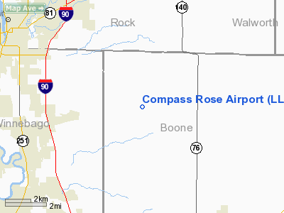
Location
& QuickFacts
|
FAA
Information Effective: |
2007-07-05 |
|
Airport
Identifier: |
LL87 |
|
Airport
Status: |
Operational |
|
Longitude/Latitude: |
088-54-10.3820W/42-27-20.0600N
-88.902884/42.455572 (Estimated) |
|
Elevation: |
970 ft / 295.66 m (Estimated) |
|
Land: |
0 acres |
|
From
nearest city: |
8 nautical miles E of Rockton, IL |
|
Location: |
Boone County, IL |
|
Magnetic Variation: |
00W (1985) |
Owner & Manager
|
Ownership: |
Privately owned |
|
Owner: |
Paul & Nancy Carner |
|
Address: |
1819 Rockton Road
Caledonia, IL 61011 |
|
Phone number: |
815-389-1905 |
|
Manager: |
Paul & Nancy Carner |
|
Address: |
1819 Rockton Road
Caledonia, IL 61011 |
|
Phone number: |
815-389-1905 |
Airport Operations and Facilities
|
Airport Use: |
Private |
|
Wind indicator: |
Yes |
|
Segmented Circle: |
No |
|
Control Tower: |
No |
|
Landing fee charge: |
No |
|
Sectional chart: |
Chicago |
|
Region: |
AGL - Great Lakes |
|
Boundary ARTCC: |
ZAU - Chicago |
|
Tie-in FSS: |
IKK - Kankakee |
|
FSS on Airport: |
No |
|
FSS Toll Free: |
1-800-WX-BRIEF |
Airport Services
|
Airframe
Repair: |
NONE |
|
Power
Plant Repair: |
NONE |
|
Runway Information
Runway NE/SW
|
Dimension: |
1900
x 100 ft / 579.1 x 30.5 m |
|
Surface: |
TURF, |
|
|
Runway NE |
Runway SW |
|
Traffic
Pattern: |
Left |
Left |
|
Radio Navigation
Aids
|
ID |
Type |
Name |
Ch |
Freq |
Var |
Dist |
|
JVL |
NDB |
Janesville |
|
375.00 |
03E |
11.4 nm |
|
LVV |
NDB |
Lake Lawn |
|
404.00 |
00W |
20.0 nm |
|
DKB |
NDB |
Dekalb |
|
209.00 |
02W |
32.5 nm |
|
FEP |
NDB |
Freeport |
|
335.00 |
00E |
32.9 nm |
|
MS |
NDB |
Monah |
|
400.00 |
00E |
41.4 nm |
|
RYV |
NDB |
Rock River |
|
371.00 |
01W |
43.9 nm |
|
UES |
NDB |
Waukesha |
|
359.00 |
01W |
46.1 nm |
|
RA |
NDB |
Paser |
|
206.00 |
00E |
46.5 nm |
|
GM |
NDB |
Teels |
|
242.00 |
02W |
46.8 nm |
|
ME |
NDB |
Deana |
|
350.00 |
00E |
48.8 nm |
|
JVL |
VOR/DME |
Janesville |
090X |
114.30 |
03E |
10.9 nm |
|
RFD |
VOR/DME |
Rockford |
045X |
110.80 |
01E |
19.1 nm |
|
BUU |
VOR/DME |
Burbun |
092X |
114.50 |
01W |
30.1 nm |
|
PLL |
VOR/DME |
Polo |
049X |
111.20 |
03E |
40.4 nm |
|
DPA |
VOR/DME |
Dupage |
021X |
108.40 |
02E |
42.0 nm |
|
ENW |
VOR/DME |
Kenosha |
029X |
109.20 |
02W |
43.9 nm |
|
OBK |
VOR/DME |
Northbrook |
077X |
113.00 |
02W |
44.5 nm |
|
MSN |
VORTAC |
Madison |
023X |
108.60 |
03E |
45.7 nm |
|
BAE |
VORTAC |
Badger |
111X |
116.40 |
02E |
48.2 nm |
Remarks
Based Aircraft
|
Aircraft
based on field: |
1 |
|
Single
Engine Airplanes: |
1 |
Compass Rose Airport
Address:
Boone County, IL
Tel:
815-389-1905
Images
and information placed above are from
http://www.airport-data.com/airport/LL87/
We
thank them for the data!
| General
Info |
| Country |
United
States |
| State |
ILLINOIS
|
| FAA ID |
LL87 |
| Latitude |
42-27-20.060N
|
| Longitude |
088-54-10.382W
|
| Elevation |
970 feet
|
| Near City |
ROCKTON
|
We don't guarantee the information is fresh and accurate. The data may
be wrong or outdated.
For more up-to-date information please refer to other sources.
|
|


