 |
|
Community Hospital Of Ottawa Heliport |
|
|
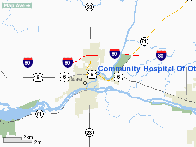
Location
& QuickFacts
|
FAA
Information Effective: |
2007-07-05 |
|
Airport
Identifier: |
LL25 |
|
Airport
Status: |
Operational |
|
Longitude/Latitude: |
088-49-30.2750W/41-21-26.1190N
-88.825076/41.357255 (Estimated) |
|
Elevation: |
480 ft / 146.30 m (Estimated) |
|
Land: |
0 acres |
|
From
nearest city: |
0 nautical miles N of Ottawa, IL |
|
Location: |
La Salle County, IL |
|
Magnetic Variation: |
00E (1985) |
Owner
& Manager
|
Ownership: |
Privately
owned |
|
Owner: |
Community Hospital Of Ottawa |
|
Address: |
1100 East Norris Drive
Ottawa, IL 61350 |
|
Phone
number: |
815-433-3100 |
|
Manager: |
Robert I Schmelter |
|
Address: |
1100 East Norris Drive
Ottawa, IL 61350 |
|
Phone number: |
815-433-3100 |
Airport Operations and Facilities
|
Airport
Use: |
Private
MEDICAL USE. |
|
Wind
indicator: |
Yes |
|
Segmented Circle: |
No |
|
Control
Tower: |
No |
|
Lighting
Schedule: |
PHONE REQ
FOR BEACON PHONE 815-433-3100. |
|
Beacon
Color: |
Clear-Green-Yellow (heliport) |
|
Sectional chart: |
Chicago |
|
Region: |
AGL - Great Lakes |
|
Boundary
ARTCC: |
ZAU - Chicago |
|
Tie-in
FSS: |
IKK - Kankakee |
|
FSS
on Airport: |
No |
|
FSS
Toll Free: |
1-800-WX-BRIEF |
|
Runway Information
Helipad H1
|
Dimension: |
40
x 40 ft / 12.2 x 12.2 m |
|
Surface: |
TURF, |
|
|
Runway H1 |
Runway |
|
Traffic
Pattern: |
Left |
Left |
|
Radio Navigation
Aids
|
ID |
Type |
Name |
Ch |
Freq |
Var |
Dist |
|
OIX |
NDB |
Ottawa |
|
266.00 |
01E |
1.4 nm |
|
VYS |
NDB |
Valley |
|
230.00 |
00W |
14.6 nm |
|
DKB |
NDB |
Dekalb |
|
209.00 |
02W |
35.1 nm |
|
BOZ |
NDB |
Whiteside |
|
254.00 |
01E |
48.2 nm |
|
HK |
NDB |
Ermin |
|
332.00 |
01W |
49.5 nm |
|
PNT |
VOR/DME |
Pontiac |
033X |
109.60 |
03E |
32.5 nm |
|
DPA |
VOR/DME |
Dupage |
021X |
108.40 |
02E |
38.5 nm |
|
IKK |
VOR/DME |
Kankakee |
053X |
111.60 |
00E |
47.3 nm |
|
PLL |
VOR/DME |
Polo |
049X |
111.20 |
03E |
48.2 nm |
|
JOT |
VORTAC |
Joliet |
070X |
112.30 |
02E |
25.5 nm |
|
BDF |
VORTAC |
Bradford |
094X |
114.70 |
00E |
36.5 nm |
|
EON |
VORTAC |
Peotone |
079X |
113.20 |
02E |
47.0 nm |
Remarks
- PROVIDED
INGRESS/EGRESS RTES ARE FM SOUTH, WEST & EAST.
Community Hospital Of Ottawa Heliport
Address:
La Salle County, IL
Tel:
815-433-3100
Images
and information placed above are from
http://www.airport-data.com/airport/LL25/
We
thank them for the data!
| General
Info |
| Country |
United
States |
| State |
ILLINOIS
|
| FAA ID |
LL25 |
| Latitude |
41-21-26.119N
|
| Longitude |
088-49-30.275W
|
| Elevation |
480 feet
|
| Near City |
OTTAWA
|
We don't guarantee the information is fresh and accurate. The data may
be wrong or outdated.
For more up-to-date information please refer to other sources.
|
|


