 |
|
Coles County Memorial Airport |
| Coles County Memorial Airport |
| IATA: MTO â ICAO: KMTO |
| Summary |
| Airport type |
Public |
| Operator |
Coles County Airport Authority |
| Location |
Mattoon, Illinois |
| Elevation AMSL |
722 ft / 220.1 m |
| Coordinates |
39°28â²40.574â³N 88°16â²45.258â³W / 39.47793722°N 88.27923833°W / 39.47793722; -88.27923833Coordinates: 39°28â²40.574â³N 88°16â²45.258â³W / 39.47793722°N 88.27923833°W / 39.47793722; -88.27923833 |
| Runways |
| Direction |
Length |
Surface |
| ft |
m |
| 11/29 |
6,501 |
1,982 |
Concrete/grooved |
| 6/24 |
5,799 |
1,768 |
Asphalt |
| 18/36 |
1,080 |
329 |
Turf |
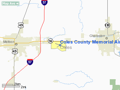
Coles County Memorial Airport (IATA: MTO, ICAO: KMTO) is a public airport located east of the city of Mattoon, in Coles County, Illinois.
Facilities
Coles County Memorial Airport has two paved runways and one grass runway:
- Runway 11/29: 6,501 x 150 ft. (1,982 x 46 m.), Surface: Concrete/grooved, ILS equipped.
- Runway 6/24: 5,799 x 100 ft. (1,768 x 30 m.), Surface: Asphalt
- Runway 18/36: 1,080 x 250 ft. (329 x 76 m.), Surface: Turf
- VOR/DME (MTO): 109.40 MHz automated weather available on VOR
- Airport Steakhouse Restaurant
- FBO Central Illinois Air 217 234-8146
The above content comes from Wikipedia and is published under free licenses – click here to read more.
Location
& QuickFacts
|
FAA
Information Effective: |
2007-07-05 |
|
Airport
Identifier: |
MTO |
|
Airport
Status: |
Operational |
|
Longitude/Latitude: |
088-16-45.2580W/39-28-40.5740N
-88.279238/39.477937 (Estimated) |
|
Elevation: |
722 ft / 220.07 m (Surveyed) |
|
Land: |
1050 acres |
|
From
nearest city: |
4 nautical miles E of Mattoon/charleston,
IL |
|
Location: |
Coles County, IL |
|
Magnetic Variation: |
00E (1985) |
Owner & Manager
|
Ownership: |
Publicly owned |
|
Owner: |
Coles County Airport Authority |
|
Address: |
432 Airport Road
Mattoon, IL 61938 |
|
Phone number: |
217-234-7120 |
|
Manager: |
Andrew Fearn |
|
Address: |
432 Airport Road
Mattoon, IL 61938 |
|
Phone number: |
217-234-7120 |
Airport
Operations and Facilities
|
Airport
Use: |
Open
to public |
|
Wind
indicator: |
Yes |
|
Segmented Circle: |
Yes |
|
Control
Tower: |
No |
|
Lighting
Schedule: |
DUSK-DAWN
HIRL RY 11/29 INTST PRESET TO INCR INTST & ACTVT MALSR
RY 29; MIRL RY 06/24; REILS RYS 06 & 11 & 24 - CTAF. |
|
Beacon
Color: |
Clear-Green (lighted land airport) |
|
Landing
fee charge: |
No |
|
Sectional chart: |
St Louis |
|
Region: |
AGL - Great Lakes |
|
Boundary
ARTCC: |
ZKC - Kansas City |
|
Responsible ARTCC: |
ZAU - Chicago |
|
Tie-in
FSS: |
STL - Saint Louis |
|
FSS
on Airport: |
No |
|
FSS
Phone: |
636-536-2980 |
|
FSS
Toll Free: |
1-800-WX-BRIEF |
|
NOTAMs
Facility: |
MTO (NOTAM-d service avaliable) |
|
Certification type/date: |
IV A U 05/197
24 HR PPR FOR UNSKED ACR OPNS WITH MORE THAN 30 PSGR SEATS;
CALL AMGR 217-234-7120. |
|
Federal Agreements: |
NGY |
Airport Communications
|
CTAF: |
122.700 |
|
Unicom: |
122.700
|
Airport
Services
|
Fuel
available: |
100LLA |
|
Airframe
Repair: |
MAJOR |
|
Power
Plant Repair: |
MAJOR |
|
Bottled
Oxygen: |
NONE |
|
Bulk
Oxygen: |
NONE |
|
Runway Information
Runway 06/24
|
Dimension: |
5799
x 100 ft / 1767.5 x 30.5 m |
|
Surface: |
ASPH, Good Condition |
|
Surface
Treatment: |
Saw-cut or plastic Grooved |
|
Weight
Limit: |
Single wheel: 50000 lbs.
Dual wheel: 70000 lbs.
Dual tandem wheel: 117000 lbs. |
|
Edge
Lights: |
Medium |
|
|
Runway 06 |
Runway 24 |
|
Longitude: |
088-17-17.9820W |
088-16-13.8030W |
|
Latitude: |
39-28-26.9240N |
39-28-55.4000N |
|
Elevation: |
718.00 ft |
711.00 ft |
|
Alignment: |
60 |
127 |
|
Traffic
Pattern: |
Right |
Left |
|
Markings: |
Non-precision instrument, Fair Condition |
Non-precision instrument, Fair Condition |
|
Crossing
Height: |
41.00 ft |
46.00 ft |
|
VASI: |
4-box on left side |
4-box on left side |
|
Visual
Glide Angle: |
3.00° |
3.00° |
|
Runway
End Identifier: |
Yes |
Yes |
|
Centerline
Lights: |
No |
No |
|
Touchdown
Lights: |
No |
No |
|
Obstruction: |
52 ft tree, 2139.0 ft from runway, 103 ft left
of centerline, 37:1 slope to clear |
, 50:1 slope to clear |
|
Runway 11/29
|
Dimension: |
6501
x 150 ft / 1981.5 x 45.7 m |
|
Surface: |
CONC, Good Condition |
|
Surface
Treatment: |
Saw-cut or plastic Grooved |
|
Weight
Limit: |
Single wheel: 100000 lbs.
Dual wheel: 180000 lbs.
Dual tandem wheel: 280000 lbs. |
|
Edge
Lights: |
High |
|
|
Runway 11 |
Runway 29 |
|
Longitude: |
088-17-22.8720W |
088-16-06.5130W |
|
Latitude: |
39-28-52.5600N |
39-28-27.5400N |
|
Elevation: |
714.00 ft |
715.00 ft |
|
Alignment: |
113 |
127 |
|
ILS
Type: |
|
ILS |
|
Traffic
Pattern: |
Right |
Left |
|
Markings: |
Precision instrument, Good Condition |
Precision instrument, Fair Condition |
|
Approach
lights: |
|
MALSR |
|
Runway
End Identifier: |
Yes |
No |
|
Centerline
Lights: |
No |
No |
|
Obstruction: |
, 50:1 slope to clear |
56 ft tree, 2592.0 ft from runway, 780 ft right
of centerline, 42:1 slope to clear |
|
Runway 18/36
|
Dimension: |
1080
x 250 ft / 329.2 x 76.2 m |
|
Surface: |
TURF, |
|
|
Runway 18 |
Runway 36 |
|
Traffic
Pattern: |
Right |
Left |
|
Radio Navigation
Aids
|
ID |
Type |
Name |
Ch |
Freq |
Var |
Dist |
|
MT |
NDB |
Zebre |
|
347.00 |
00E |
5.4 nm |
|
CZB |
NDB |
Casey |
|
359.00 |
00E |
16.5 nm |
|
SYZ |
NDB |
Shelbyville |
|
365.00 |
01E |
26.5 nm |
|
PRG |
NDB |
Paris |
|
341.00 |
01E |
31.0 nm |
|
HMJ |
NDB |
Homer |
|
281.00 |
01E |
36.3 nm |
|
PLX |
NDB |
Palestine |
|
391.00 |
00W |
40.8 nm |
|
HU |
NDB |
Yinno |
|
245.00 |
02W |
41.3 nm |
|
SIV |
NDB |
Sullivan |
|
326.00 |
02W |
44.5 nm |
|
OLY |
NDB |
Olney |
|
272.00 |
00W |
45.9 nm |
|
TAZ |
NDB |
Taylorville |
|
395.00 |
00E |
48.6 nm |
|
FOA |
NDB |
Elm River |
|
353.00 |
00E |
49.3 nm |
|
MTO |
VOR/DME |
Mattoon |
031X |
109.40 |
03E |
0.3 nm |
|
RSV |
VOR/DME |
Robinson |
021X |
108.40 |
02E |
40.3 nm |
|
DEC |
VORTAC |
Decatur |
119X |
117.20 |
03E |
30.9 nm |
|
CMI |
VORTAC |
Champaign |
037X |
110.00 |
03E |
33.5 nm |
|
BIB |
VORTAC |
Bible Grove |
027X |
109.00 |
03E |
34.8 nm |
|
VLA |
VORTAC |
Vandalia |
090X |
114.30 |
04E |
47.1 nm |
|
TTH |
VORTAC |
Terre Haute |
100X |
115.30 |
02E |
47.8 nm |
Remarks
- DEER
& BIRDS ON & INVOF ARPT.
- RY
18/36 NOT AVBL FOR ACR OPNS WITH MORE THAN 30 PSGR SEATS.
Based
Aircraft
|
Aircraft
based on field: |
65 |
|
Single
Engine Airplanes: |
56 |
|
Multi
Engine Airplanes: |
3 |
|
Jet
Engine Airplanes: |
1 |
|
Helicopters: |
2 |
|
Ultralights: |
3 |
Operational Statistics
Time Period: 2006-01-01
- 2006-12-31
|
Aircraft
Operations: |
90/Day |
|
Air
Taxi: |
7.8% |
|
General
Aviation Local: |
58.1% |
|
General
Aviation Itinerant: |
33.6% |
|
Military: |
0.5% |
Coles County Memorial Airport
Address:
Coles County, IL
Tel:
217-234-7120
Images
and information placed above are from
http://www.airport-data.com/airport/MTO/
We
thank them for the data!
| General
Info |
| Country |
United
States |
| State |
ILLINOIS
|
| FAA ID |
MTO |
| Latitude |
39-28-40.574N
|
| Longitude |
088-16-45.258W
|
| Elevation |
722 feet
|
| Near City |
MATTOON/CHARLESTON
|
We don't guarantee the information is fresh and accurate. The data may
be wrong or outdated.
For more up-to-date information please refer to other sources.
|
|


