 |
|
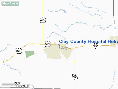
Clay County Hospital Heliport |
Location
& QuickFacts
|
FAA
Information Effective: |
2007-07-05 |
|
Airport
Identifier: |
30IL |
|
Airport
Status: |
Operational |
|
Longitude/Latitude: |
088-28-21.0000W/38-40-46.0000N
-88.472500/38.679444 (Estimated) |
|
Elevation: |
475 ft / 144.78 m (Estimated) |
|
Land: |
0 acres |
|
From
nearest city: |
1 nautical miles NE of Flora, IL |
|
Location: |
Clay County, IL |
|
Magnetic Variation: |
01W (2000) |
Owner
& Manager
|
Ownership: |
Privately
owned |
|
Owner: |
Clay County Hospital |
|
Address: |
Hwy 50 & Standford Rd
Flora, IL 62839 |
|
Phone
number: |
618-662-2131 |
|
Manager: |
John Monnahan |
|
Address: |
Hwy 50 & Standford Rd
Flora, IL 62839 |
|
Phone number: |
618-662-2131 |
Airport Operations and Facilities
|
Airport
Use: |
Private |
|
Segmented Circle: |
No |
|
Control
Tower: |
No |
|
Sectional chart: |
St Louis |
|
Region: |
AGL - Great Lakes |
|
Boundary
ARTCC: |
ZKC - Kansas City |
|
Tie-in
FSS: |
COU - Columbia |
|
FSS
Toll Free: |
1-800-WX-BRIEF |
|
Runway Information
Helipad H1
|
Dimension: |
40
x 40 ft / 12.2 x 12.2 m |
|
Surface: |
CONC, |
|
|
Runway H1 |
Runway |
|
Traffic
Pattern: |
Left |
Left |
|
Radio Navigation
Aids
|
ID |
Type |
Name |
Ch |
Freq |
Var |
Dist |
|
FOA |
NDB |
Elm River |
|
353.00 |
00E |
1.1 nm |
|
OLY |
NDB |
Olney |
|
272.00 |
00W |
14.2 nm |
|
FWC |
NDB |
Wayne County |
|
257.00 |
01E |
18.2 nm |
|
SLO |
NDB |
Salem |
|
400.00 |
01W |
23.3 nm |
|
AJG |
NDB |
Mount Carmel |
|
524.00 |
02W |
35.3 nm |
|
CUL |
NDB |
Carmi |
|
332.00 |
01W |
38.9 nm |
|
OEA |
NDB |
Vincennes |
|
251.00 |
00E |
43.0 nm |
|
CZB |
NDB |
Casey |
|
359.00 |
00E |
43.6 nm |
|
PLX |
NDB |
Palestine |
|
391.00 |
00W |
43.8 nm |
|
SYZ |
NDB |
Shelbyville |
|
365.00 |
01E |
47.0 nm |
|
MT |
NDB |
Zebre |
|
347.00 |
00E |
47.9 nm |
|
SAM |
VOR/DME |
Samsville |
113X |
116.60 |
03E |
21.6 nm |
|
VNN |
VOR/DME |
Mount Vernon |
085X |
113.80 |
02E |
24.7 nm |
|
LWV |
VOR/DME |
Lawrenceville |
025X |
108.80 |
01W |
41.1 nm |
|
RSV |
VOR/DME |
Robinson |
021X |
108.40 |
02E |
43.6 nm |
|
MTO |
VOR/DME |
Mattoon |
031X |
109.40 |
03E |
48.8 nm |
|
BIB |
VORTAC |
Bible Grove |
027X |
109.00 |
03E |
14.5 nm |
|
ENL |
VORTAC |
Centralia |
097X |
115.00 |
04E |
35.8 nm |
|
VLA |
VORTAC |
Vandalia |
090X |
114.30 |
04E |
40.8 nm |
Remarks
- PRVDD
ALL APCHS/DEPS FM 035-045 & 235-245, AREA IS MKD, WIND INDICATOR
MAINTAINED, COMPLY WITH 14CFR SECTION 91.126(B)(2).
Clay County Hospital Heliport
Address:
Clay County, IL
Tel:
618-662-2131
Images
and information placed above are from
http://www.airport-data.com/airport/30IL/
We
thank them for the data!
| General
Info |
| Country |
United
States |
| State |
ILLINOIS
|
| FAA ID |
30IL |
| Latitude |
38-40-46.000N
|
| Longitude |
088-28-21.000W
|
| Elevation |
475 feet
|
| Near City |
FLORA
|
We don't guarantee the information is fresh and accurate. The data may
be wrong or outdated.
For more up-to-date information please refer to other sources.
|
|


