 |
|
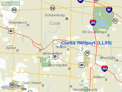
Location
& QuickFacts
|
FAA
Information Effective: |
2007-07-05 |
|
Airport
Identifier: |
LL95 |
|
Airport
Status: |
Operational |
|
Longitude/Latitude: |
088-06-04.2580W/41-59-11.1010N
-88.101183/41.986417 (Estimated) |
|
Elevation: |
805 ft / 245.36 m (Estimated) |
|
Land: |
0 acres |
|
From
nearest city: |
0 nautical miles W of Roselle, IL |
|
Location: |
Du Page County, IL |
|
Magnetic Variation: |
01W (1985) |
Owner
& Manager
|
Ownership: |
Privately
owned |
|
Owner: |
Clarke Environ. Mosquito Mgmt |
|
Address: |
Box 72288, 159 N Garden Av
Roselle, IL 60172 |
|
Phone number: |
630-894-2000 |
|
Manager: |
John L. Clarke, Jr. |
|
Address: |
402 Fairbank
Riverside, IL 60546 |
|
Phone number: |
630-894-2000 |
Airport Operations and Facilities
|
Airport Use: |
Private |
|
Wind indicator: |
Yes |
|
Segmented Circle: |
No |
|
Control Tower: |
No |
|
Landing fee charge: |
No |
|
Sectional chart: |
Chicago |
|
Region: |
AGL - Great Lakes |
|
Boundary ARTCC: |
ZAU - Chicago |
|
Tie-in FSS: |
IKK - Kankakee |
|
FSS on Airport: |
No |
|
FSS Toll Free: |
1-800-WX-BRIEF |
Airport Services
|
Runway Information
Helipad H1
|
Dimension: |
75
x 75 ft / 22.9 x 22.9 m |
|
Surface: |
CONC, |
|
|
Runway H1 |
Runway |
|
Traffic
Pattern: |
Left |
Left |
|
Obstruction: |
18 ft tank, 200.0 ft from runway |
|
|
Radio Navigation
Aids
|
ID |
Type |
Name |
Ch |
Freq |
Var |
Dist |
|
ME |
NDB |
Deana |
|
350.00 |
00E |
3.5 nm |
|
HK |
NDB |
Ermin |
|
332.00 |
01W |
20.0 nm |
|
MX |
NDB |
Kedzi |
|
248.00 |
01W |
23.6 nm |
|
DKB |
NDB |
Dekalb |
|
209.00 |
02W |
27.3 nm |
|
RA |
NDB |
Paser |
|
206.00 |
00E |
42.8 nm |
|
LVV |
NDB |
Lake Lawn |
|
404.00 |
00W |
48.1 nm |
|
ORD |
VOR/DME |
Chicago O'hare |
086X |
113.90 |
02E |
8.8 nm |
|
DPA |
VOR/DME |
Dupage |
021X |
108.40 |
02E |
12.5 nm |
|
OBK |
VOR/DME |
Northbrook |
077X |
113.00 |
02W |
15.6 nm |
|
ENW |
VOR/DME |
Kenosha |
029X |
109.20 |
02W |
37.6 nm |
|
BUU |
VOR/DME |
Burbun |
092X |
114.50 |
01W |
43.2 nm |
|
HRK |
VOR/DME |
Horlick |
124X |
117.70 |
02W |
48.3 nm |
|
JOT |
VORTAC |
Joliet |
070X |
112.30 |
02E |
28.2 nm |
|
CGT |
VORTAC |
Chicago Heights |
089X |
114.20 |
02E |
37.2 nm |
|
EON |
VORTAC |
Peotone |
079X |
113.20 |
02E |
45.3 nm |
|
ORD |
VOT |
Chicago O'hare Intl |
|
112.00 |
|
8.7 nm |
|
MDW |
VOT |
Chicago Midway |
|
111.00 |
|
19.7 nm |
Remarks
- PROVIDED
INGRESS/EGRESS RTES ARE NE, E, SE, S, AND W. ALL OPNS CONDUCTED BLO
TFC PTN & ACFT OPNS AT SCHAUMBURG INTL ARPT.
Based
Aircraft
|
Aircraft
based on field: |
8 |
|
Single
Engine Airplanes: |
3 |
|
Jet
Engine Airplanes: |
2 |
|
Helicopters: |
3 |
Clarke Heliport
Address:
Du Page County, IL
Tel:
630-894-2000
Images
and information placed above are from
http://www.airport-data.com/airport/LL95/
We
thank them for the data!
| General
Info |
| Country |
United
States |
| State |
ILLINOIS
|
| FAA ID |
LL95 |
| Latitude |
41-59-11.101N
|
| Longitude |
088-06-04.258W
|
| Elevation |
805 feet
|
| Near City |
ROSELLE
|
We don't guarantee the information is fresh and accurate. The data may
be wrong or outdated.
For more up-to-date information please refer to other sources.
|
|


