 |
|
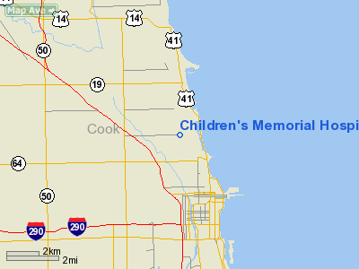
Children's Memorial Hospital Heliport |
Location
& QuickFacts
|
FAA
Information Effective: |
2007-07-05 |
|
Airport
Identifier: |
40IS |
|
Airport
Status: |
Operational |
|
Longitude/Latitude: |
087-38-47.1950W/41-55-32.1160N
-87.646443/41.925588 (Estimated) |
|
Elevation: |
720 ft / 219.46 m (Estimated) |
|
Land: |
0 acres |
|
From
nearest city: |
0 nautical miles N of Chicago, IL |
|
Location: |
Cook County, IL |
|
Magnetic Variation: |
01W (1985) |
Owner & Manager
|
Ownership: |
Privately owned |
|
Owner: |
Children's Memorial Hospital |
|
Address: |
2300 Childrens Plaza
Chicago, IL 60614 |
|
Manager: |
Dennis W. Mestrich |
|
Address: |
2300 Childrens Plaza
Chicago, IL 60614 |
|
Phone number: |
312-880-4448 |
Airport
Operations and Facilities
|
Airport
Use: |
Private
MEDICAL USE. |
|
Wind
indicator: |
Yes |
|
Segmented Circle: |
No |
|
Control
Tower: |
No |
|
Landing
fee charge: |
No |
|
Sectional chart: |
Chicago |
|
Region: |
AGL - Great Lakes |
|
Boundary
ARTCC: |
ZAU - Chicago |
|
Tie-in
FSS: |
IKK - Kankakee |
|
FSS
Toll Free: |
1-800-WX-BRIEF |
|
Runway Information
Helipad H1
|
Dimension: |
40
x 40 ft / 12.2 x 12.2 m |
|
Surface: |
MATS,
ROOFTOP HELIPAD. |
|
|
Runway H1 |
Runway |
|
Traffic
Pattern: |
Left |
Left |
|
Radio Navigation
Aids
|
ID |
Type |
Name |
Ch |
Freq |
Var |
Dist |
|
MX |
NDB |
Kedzi |
|
248.00 |
01W |
11.2 nm |
|
HK |
NDB |
Ermin |
|
332.00 |
01W |
15.1 nm |
|
ME |
NDB |
Deana |
|
350.00 |
00E |
17.2 nm |
|
MGC |
NDB |
Michigan City |
|
203.00 |
01W |
39.4 nm |
|
VP |
NDB |
Sedly |
|
212.00 |
02W |
44.8 nm |
|
RA |
NDB |
Paser |
|
206.00 |
00E |
46.9 nm |
|
IUL |
NDB |
La Porte |
|
356.00 |
03W |
46.9 nm |
|
DKB |
NDB |
Dekalb |
|
209.00 |
02W |
47.4 nm |
|
ORD |
VOR/DME |
Chicago O'hare |
086X |
113.90 |
02E |
12.1 nm |
|
OBK |
VOR/DME |
Northbrook |
077X |
113.00 |
02W |
22.4 nm |
|
DPA |
VOR/DME |
Dupage |
021X |
108.40 |
02E |
31.6 nm |
|
ENW |
VOR/DME |
Kenosha |
029X |
109.20 |
02W |
42.4 nm |
|
CGT |
VORTAC |
Chicago Heights |
089X |
114.20 |
02E |
25.2 nm |
|
JOT |
VORTAC |
Joliet |
070X |
112.30 |
02E |
37.8 nm |
|
EON |
VORTAC |
Peotone |
079X |
113.20 |
02E |
40.0 nm |
|
MDW |
VOT |
Chicago Midway |
|
111.00 |
|
9.6 nm |
|
ORD |
VOT |
Chicago O'hare Intl |
|
112.00 |
|
12.1 nm |
Remarks
- PRVDD
AREA IS MKD; WIND INDICATOR IS MAINTAINED.
Children's Memorial Hospital Heliport
Address:
Cook County, IL
Tel:
312-880-4448
Images
and information placed above are from
http://www.airport-data.com/airport/40IS/
We
thank them for the data!
| General
Info |
| Country |
United
States |
| State |
ILLINOIS
|
| FAA ID |
40IS |
| Latitude |
41-55-32.116N
|
| Longitude |
087-38-47.195W
|
| Elevation |
720 feet
|
| Near City |
CHICAGO
|
We don't guarantee the information is fresh and accurate. The data may
be wrong or outdated.
For more up-to-date information please refer to other sources.
|
|


