|
|
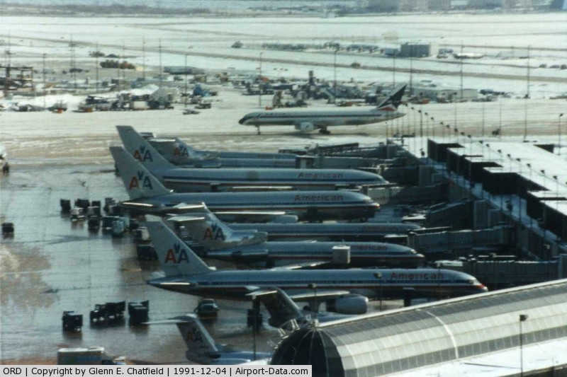
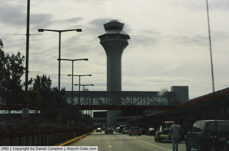
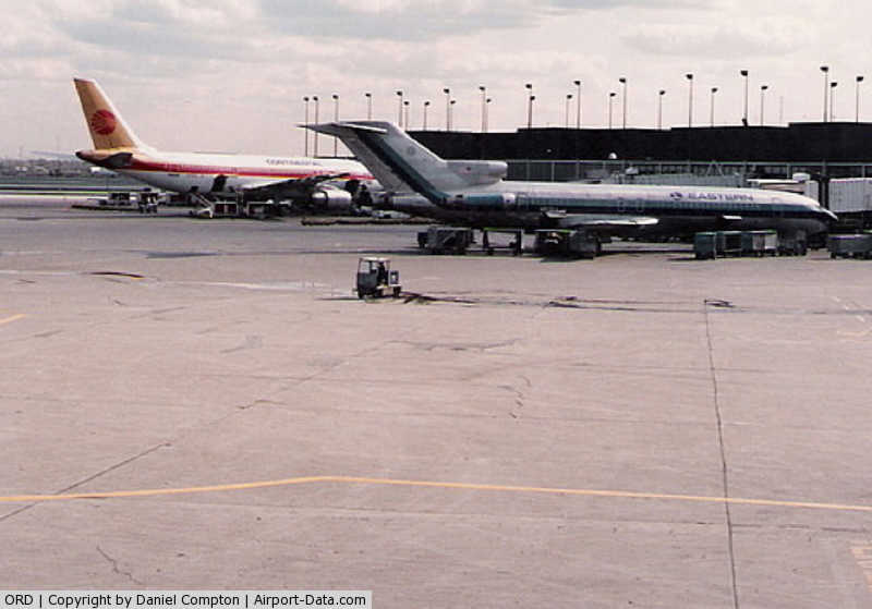
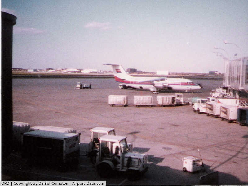
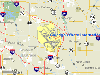
Chicago O'Hare International Airport |
|
 |
(Click on the photo to enlarge) |
|
 |
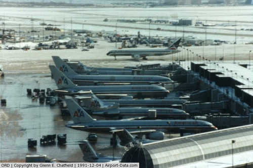
(Click on the photo to enlarge) |
|
 |
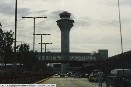
(Click on the photo to enlarge) |
|
 |
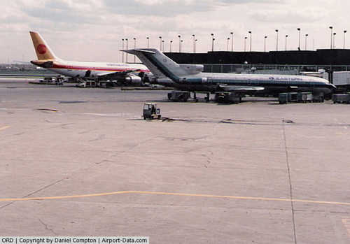
(Click on the photo to enlarge) |
Location
& QuickFacts
|
FAA
Information Effective: |
2007-07-05 |
|
Airport
Identifier: |
ORD |
|
Airport
Status: |
Operational |
|
Longitude/Latitude: |
087-54-17.4290W/41-58-42.9720N
-87.904841/41.978603 (Estimated) |
|
Elevation: |
668 ft / 203.61 m (Surveyed) |
|
Land: |
7280 acres |
|
From
nearest city: |
14 nautical miles NW of Chicago, IL |
|
Location: |
Cook County, IL |
|
Magnetic Variation: |
03W (2010) |
Owner & Manager
|
Ownership: |
Publicly owned |
|
Owner: |
City Of Chicago |
|
Address: |
Box 66142
Chicago, IL 60666 |
|
Phone number: |
773-686-2200 |
|
Manager: |
Nuria I. Ferandez |
|
Address: |
Box 66142
Chicago, IL 60666 |
|
Phone number: |
773-686-2200 |
Airport
Operations and Facilities
|
Airport
Use: |
Open
to public |
|
Wind
indicator: |
Yes |
|
Segmented Circle: |
No |
|
Control
Tower: |
Yes |
|
Lighting
Schedule: |
DUSK-DAWN
OTS INDEFLY. |
|
Beacon
Color: |
Clear-Green (lighted land airport) |
|
Landing
fee charge: |
Yes |
|
Sectional chart: |
Chicago |
|
Region: |
AGL - Great Lakes |
|
Boundary
ARTCC: |
ZAU - Chicago |
|
Tie-in
FSS: |
IKK - Kankakee |
|
FSS
on Airport: |
No |
|
FSS
Toll Free: |
1-800-WX-BRIEF |
|
NOTAMs
Facility: |
ORD (NOTAM-d service avaliable) |
|
Certification type/date: |
I E S 05/1973 |
|
Federal Agreements: |
NGPRY |
Airport
Communications
Airport
Services
|
Fuel
available: |
100LLA1 |
|
Airframe
Repair: |
MAJOR |
|
Power
Plant Repair: |
MAJOR |
|
Bottled
Oxygen: |
HIGH |
|
Bulk
Oxygen: |
HIGH/LOW |
|
Runway Information
Runway 04L/22R
|
Dimension: |
7500
x 150 ft / 2286.0 x 45.7 m |
|
Surface: |
ASPH, Good Condition |
|
Surface
Treatment: |
Saw-cut or plastic Grooved |
|
Weight
Limit: |
Single wheel: 100000 lbs.
Dual wheel: 185000 lbs.
Dual tandem wheel: 350000 lbs. |
|
Edge
Lights: |
High |
|
|
Runway 04L |
Runway 22R |
|
Longitude: |
087-54-50.1033W |
087-53-46.9355W |
|
Latitude: |
41-58-53.9589N |
41-59-51.1339N |
|
Elevation: |
656.00 ft |
648.00 ft |
|
Alignment: |
39 |
127 |
|
ILS
Type: |
LOCALIZER |
ILS |
|
Traffic
Pattern: |
Left |
Left |
|
Markings: |
Precision instrument, Good Condition |
Precision instrument, Good Condition |
|
Crossing
Height: |
0.00 ft |
69.00 ft |
|
VASI: |
|
4-light PAPI on left side |
|
Visual
Glide Angle: |
0.00° |
3.00° |
|
RVR
Equipment: |
touchdown, rollout |
touchdown, rollout |
|
Approach
lights: |
|
MALSR |
|
Runway
End Identifier: |
No |
No |
|
Centerline
Lights: |
Yes |
Yes |
|
Touchdown
Lights: |
No |
Yes |
|
Obstruction: |
29 ft lt std, 1244.0 ft from runway, 411 ft
left of centerline, 36:1 slope to clear |
, 50:1 slope to clear |
|
Runway 04R/22L
|
Dimension: |
8075
x 150 ft / 2461.3 x 45.7 m |
|
Surface: |
ASPH, Good Condition |
|
Surface
Treatment: |
Saw-cut or plastic Grooved |
|
Weight
Limit: |
Single wheel: 100000 lbs.
Dual wheel: 200000 lbs.
Dual tandem wheel: 350000 lbs. |
|
Edge
Lights: |
High |
|
|
Runway 04R |
Runway 22L |
|
Longitude: |
087-53-57.9059W |
087-52-47.0752W |
|
Latitude: |
41-57-11.9786N |
41-58-11.7183N |
|
Elevation: |
661.00 ft |
654.00 ft |
|
Alignment: |
42 |
127 |
|
ILS
Type: |
ILS |
ILS |
|
Traffic
Pattern: |
Left |
Left |
|
Markings: |
Precision instrument, Good Condition |
Precision instrument, Good Condition |
|
RVR
Equipment: |
touchdown, rollout |
touchdown, rollout |
|
Approach
lights: |
MALSR |
MALSR |
|
Runway
End Identifier: |
No |
No |
|
Centerline
Lights: |
Yes |
Yes |
|
Touchdown
Lights: |
Yes |
Yes |
|
Obstruction: |
, 50:1 slope to clear |
109 ft ant, 5424.0 ft from runway, 545 ft left
of centerline, 49:1 slope to clear |
|
Runway 09L/27R
|
Dimension: |
7967
x 150 ft / 2428.3 x 45.7 m |
|
Surface: |
ASPH-CONC, Good Condition |
|
Surface
Treatment: |
Saw-cut or plastic Grooved |
|
Weight
Limit: |
Single wheel: 100000 lbs.
Dual wheel: 210000 lbs.
Dual tandem wheel: 350000 lbs. |
|
Edge
Lights: |
High |
|
|
Runway 09L |
Runway 27R |
|
Longitude: |
087-55-06.0660W |
087-53-20.5836W |
|
Latitude: |
41-59-02.0308N |
41-59-02.0415N |
|
Elevation: |
660.00 ft |
650.00 ft |
|
Alignment: |
90 |
127 |
|
ILS
Type: |
ILS |
ILS/DME |
|
Traffic
Pattern: |
Left |
Left |
|
Markings: |
Precision instrument, Good Condition |
Precision instrument, Good Condition |
|
Crossing
Height: |
74.00 ft |
72.00 ft |
|
VASI: |
4-light PAPI on left side |
4-light PAPI on right side |
|
Visual
Glide Angle: |
3.00° |
3.00° |
|
RVR
Equipment: |
touchdown, midfield, rollout |
touchdown, midfield, rollout |
|
Approach
lights: |
MALSR |
ALSF2 |
|
Runway
End Identifier: |
No |
No |
|
Centerline
Lights: |
Yes |
Yes |
|
Touchdown
Lights: |
Yes |
Yes |
|
Obstruction: |
, 50:1 slope to clear |
24 ft ant, 1105.0 ft from runway, 587 ft left
of centerline, 37:1 slope to clear |
|
Runway 10/28
|
Dimension: |
10144
x 150 ft / 3091.9 x 45.7 m |
|
Surface: |
ASPH-CONC, Good Condition |
|
Surface
Treatment: |
Saw-cut or plastic Grooved |
|
Weight
Limit: |
Single wheel: 100000 lbs.
Dual wheel: 185000 lbs.
Dual tandem wheel: 350000 lbs. |
|
Edge
Lights: |
High |
|
|
Runway 10 |
Runway 28 |
|
Longitude: |
087-55-15.7079W |
087-53-01.4234W |
|
Latitude: |
41-58-08.4466N |
41-58-08.6525N |
|
Elevation: |
666.00 ft |
651.00 ft |
|
Alignment: |
90 |
127 |
|
ILS
Type: |
ILS/DME |
ILS/DME |
|
Traffic
Pattern: |
Left |
Left |
|
Markings: |
Precision instrument, Good Condition |
Precision instrument, Good Condition |
|
Crossing
Height: |
76.00 ft |
69.00 ft |
|
VASI: |
4-light PAPI on right side |
4-light PAPI on left side |
|
Visual
Glide Angle: |
2.90° |
3.00° |
|
RVR
Equipment: |
touchdown, midfield, rollout |
touchdown, midfield, rollout |
|
Approach
lights: |
MALSR |
ALSF2 |
|
Runway
End Identifier: |
No |
No |
|
Centerline
Lights: |
Yes |
Yes |
|
Touchdown
Lights: |
Yes |
Yes |
|
Obstruction: |
, 50:1 slope to clear |
56 ft sign, 2700.0 ft from runway, 723 ft left
of centerline, 44:1 slope to clear |
|
Runway 14L/32R
|
Dimension: |
10005
x 150 ft / 3049.5 x 45.7 m |
|
Surface: |
ASPH, Good Condition |
|
Surface
Treatment: |
Saw-cut or plastic Grooved |
|
Weight
Limit: |
Single wheel: 100000 lbs.
Dual wheel: 185000 lbs.
Dual tandem wheel: 350000 lbs. |
|
Edge
Lights: |
High |
|
|
Runway 14L |
Runway 32R |
|
Longitude: |
087-54-55.3249W |
087-53-30.1660W |
|
Latitude: |
42-00-08.7660N |
41-58-53.0580N |
|
Elevation: |
653.00 ft |
648.00 ft |
|
Alignment: |
127 |
127 |
|
ILS
Type: |
ILS/DME |
ILS |
|
Traffic
Pattern: |
Left |
Left |
|
Markings: |
Precision instrument, Good Condition |
Precision instrument, Good Condition |
|
Crossing
Height: |
75.00 ft |
0.00 ft |
|
Displaced
threshold: |
1998.00 ft |
0.00 ft |
|
VASI: |
4-light PAPI on left side |
|
|
Visual
Glide Angle: |
3.00° |
0.00° |
|
RVR
Equipment: |
touchdown, midfield, rollout |
touchdown, midfield, rollout |
|
Approach
lights: |
ALSF2 |
MALSR |
|
Runway
End Identifier: |
No |
No |
|
Centerline
Lights: |
Yes |
Yes |
|
Touchdown
Lights: |
Yes |
Yes |
|
Obstruction: |
, 50:1 slope to clear
50:1 FROM DISPLACED THRESHOLD. |
43 ft pole, 1785.0 ft from runway, 725 ft left
of centerline, 36:1 slope to clear |
|
Decleard
distances: |
Take off run available 10005.00 ft
Take off distance available 10005.00 ft
Actual stop distance available 10005.00 ft
Landing distance available 8007.00 ft |
Take off run available 10005.00 ft
Take off distance available 10005.00 ft
Actual stop distance available 10005.00 ft
Landing distance available 10005.00 ft |
|
Runway 14R/32L
|
Dimension: |
13000
x 200 ft / 3962.4 x 61.0 m |
|
Surface: |
ASPH-CONC, Good Condition |
|
Surface
Treatment: |
Saw-cut or plastic Grooved |
|
Weight
Limit: |
Single wheel: 100000 lbs.
Dual wheel: 185000 lbs.
Dual tandem wheel: 350000 lbs. |
|
Edge
Lights: |
High |
|
|
Runway 14R |
Runway 32L |
|
Longitude: |
087-55-59.3033W |
087-54-08.6299W |
|
Latitude: |
41-59-25.5667N |
41-57-47.2248N |
|
Elevation: |
666.00 ft |
649.00 ft |
|
Alignment: |
127 |
127 |
|
ILS
Type: |
ILS/DME |
ILS/DME |
|
Traffic
Pattern: |
Left |
Left |
|
Markings: |
Precision instrument, Good Condition |
Precision instrument, Good Condition |
|
Crossing
Height: |
69.00 ft |
0.00 ft |
|
VASI: |
4-light PAPI on right side |
|
|
Visual
Glide Angle: |
3.00° |
0.00° |
|
RVR
Equipment: |
touchdown, midfield, rollout |
touchdown, midfield, rollout |
|
Approach
lights: |
ALSF2 |
|
|
Runway
End Identifier: |
No |
No |
|
Centerline
Lights: |
Yes |
Yes |
|
Touchdown
Lights: |
Yes |
Yes |
|
Obstruction: |
63 ft trees, 3025.0 ft from runway, 56 ft right
of centerline, 44:1 slope to clear |
37 ft pole, 1896.0 ft from runway, 735 ft left
of centerline, 45:1 slope to clear |
|
Helipad H1
|
Dimension: |
200
x 100 ft / 61.0 x 30.5 m |
|
Surface: |
CONC, |
|
|
Runway H1 |
Runway |
|
Traffic
Pattern: |
Left |
Left |
|
Markings: |
Basic, Good Condition |
, |
|
Radio Navigation
Aids
|
ID |
Type |
Name |
Ch |
Freq |
Var |
Dist |
|
ME |
NDB |
Deana |
|
350.00 |
00E |
5.5 nm |
|
HK |
NDB |
Ermin |
|
332.00 |
01W |
15.9 nm |
|
MX |
NDB |
Kedzi |
|
248.00 |
01W |
17.2 nm |
|
DKB |
NDB |
Dekalb |
|
209.00 |
02W |
36.0 nm |
|
RA |
NDB |
Paser |
|
206.00 |
00E |
42.3 nm |
|
ORD |
VOR/DME |
Chicago O'hare |
086X |
113.90 |
02E |
0.5 nm |
|
OBK |
VOR/DME |
Northbrook |
077X |
113.00 |
02W |
14.7 nm |
|
DPA |
VOR/DME |
Dupage |
021X |
108.40 |
02E |
20.6 nm |
|
ENW |
VOR/DME |
Kenosha |
029X |
109.20 |
02W |
37.3 nm |
|
BUU |
VOR/DME |
Burbun |
092X |
114.50 |
01W |
46.2 nm |
|
HRK |
VOR/DME |
Horlick |
124X |
117.70 |
02W |
47.3 nm |
|
CGT |
VORTAC |
Chicago Heights |
089X |
114.20 |
02E |
31.9 nm |
|
JOT |
VORTAC |
Joliet |
070X |
112.30 |
02E |
31.9 nm |
|
EON |
VORTAC |
Peotone |
079X |
113.20 |
02E |
42.9 nm |
|
ORD |
VOT |
Chicago O'hare Intl |
|
112.00 |
|
0.3 nm |
|
MDW |
VOT |
Chicago Midway |
|
111.00 |
|
13.4 nm |
Remarks
- ARPT
NIGHTTIME NOISE ABATEMENT PROCEDURES ARE IN EFFECT FM 2200 TO 0700;
CONTACT AMGR ON 773-686-2255.
- MAGNETIC
DEVIATION POSSIBLE IMMEDIATELY WEST OF TWY M7 & RY 22L APCH ON TWY
M.
- PAEW
NEAR VARIOUS TWYS.
- PERIODIC
FIRE DEPT TRNG AT N SECTOR OF THE ARPT.
- BIRDS
ON & INVOF ARPT. PYROTECHNICS & BIRD CANNONS IN USE FOR BIRD
CONTROL.
- PRIM
RUN-UP LOCATION GROUND RUN UP ENCLOSURE; SECONDARY RUN UP LOCATIONS
AVBL UPON REQ CONTACT CITY OPNS 773-686-2255.
- TAXI
INTO POSITION & HOLD WAIVER IN EFFECT AFTER DARK AT THE FLWG INTXNS;
RY 32L AT TWYS 'T-10' AND TWY 'M', RY 28 AT TWY 'M-6', RY 14L AT TWYS
'U' & 'V' & RY 32R AT TWY 'V'. THESE RYS WILL BE USED FOR DEPS
ONLY WHEN EXERCISING THE PROVISIONS OF THIS WAIVER.
- ALL
PART 91 & UNSKED PART 125, 133 & 135 CHARTER OPERATORS CTC SIGNATURE
FLIGHT SUPPORT AT 773-686-7000 REQARDING NEW SECURITY REGULATIONS PRIOR
TO DEP.
- RY
H1 APCH DEP PATHS ARE E & W.
- B747-400'S
OR A340-600'S CANNOT PASS ON TWYS 'A' & 'B' INSUFFICIENT WINGTIP
CLNC.
- BE
ALERT: THAT PORTION OF TWY 'Y' BTN TWY 'T' & THE UNITED AIRLINES
HANGAR IS NOT VSBL FROM ATCT.
- GENERAL
AVIATION RAMP AND FBO LOCATED AT THE NORTH EAST RAMP VICINITY OF 27R
APPROACH
- BE
ALERT: WAIVERED AIR TRAFFIC SEPARATION STANDARDS IN EFFECT FOR TRAFFIC
LANDING RY 14R & DEPARTING RY 28, WHEREBY LANDING TFC ON RY 14R
WILL BE PAST THE LANDING THLD AS RY 28 DEPARTURES PASS THROUGH THE INTERSECTION
OF THE TWO RYS.
- TWY
'K1' OUTBOUND OR EASTBOUND ONLY, TWY 'K2' IN BOUND OR WESTBOUND ONLY
& TWY 'Q' NORTHBOUND ONLY EXITING RY, TWY 'V' WESTBOUND ONLY BTN
TWY 'GG' & 'KK'; TWY 'LL'NORTHBOUND ONLY BTN RY 14L/32R & TWY
'MM'.
- ATCT
IS AUZD TO CONDUCT ARRS TO RYS 14L & 14R WHILE CONDUCTING SIMUL
OPPOSITE DIRECTION DEPS OFF OF RYS 09L & 28 DURG IFR WEATHER CONDS.
ATCT IS AUZD TO CONDUCT SIMUL CONVERGING INST APCHS TO RYS 14R &
22R WHILE CONDUCTING SIMUL OPPOSITE DIRECTION DEPS OFF OF RYS 09L &
28 DURG IFR WEATHER CONDS.
- RWY
18/36 CLOSED INDEFINITELY, TEMPORARILY RE-DESIGNATED AS TWY GG.
- TWY
V RESTRICTED TO ACFT LESS THAN 117 FT WINGSPAN OR WHEELBASE LESS THAN
30 FT (DESIGN GROUP 4-5-6) BTWN TWY KK & TWY LL.
- TWY
V CLSD BTN TWY KK & LL FOR LARGE ACFT.
- ATCT
IS AUZD TO CONDUCT SIMUL OPPOSITE DIRECTION DEPS ON RYS 09L AND 28 DURG
INSTRUMENT FLIGHT RULES (IFR) WX CONDS.
- ACFT
WITH WINGSPAN GREATER THAN 170 FT; OTHER THAN B-747 RQR 48 HRS PPR -
CALL 773-686-2255.
- SEE
LAND AND HOLD SHORT OPERATIONS SECTION.
- DURING
PERIODS OF COLD WEATHER; THE APP END OF RY 32R MAY NOT BE VISIBLE FM
THE ATCT DUE TO STEAM PLUME FM ARPT HEATING PLANT.
- BE
ALERT: OF DUPLICATE ALPHA-NUMERIC TWY DESIGNATORS & TERMINAL GATE
DESIGNATIONS INVOLVING THE LETTERS G, H, K L & M.
Major
Carriers Serving This Airport
|
United Air Lines Inc. |
25.6% |
|
American Eagle Airlines Inc. |
25.0% |
|
American Airlines Inc. |
20.0% |
|
Skywest Airlines Inc. |
13.5% |
|
Mesa Airlines Inc. |
7.3% |
|
US Airways Inc. |
2.2% |
|
Northwest Airlines Inc. |
2.0% |
|
Continental Air Lines Inc. |
1.4% |
|
Delta Air Lines Inc. |
1.0% |
|
Expressjet Airlines Inc. |
0.9% |
Most Popular Destinations
|
La
Guardia (LGA) |
3.1% |
|
Minneapolis-st Paul Intl/wold-chamberlain/ (MSP) |
2.6% |
|
Dallas/fort Worth Intl (DFW) |
2.4% |
|
Los
Angeles Intl (LAX) |
2.1% |
|
Newark
Liberty Intl (EWR) |
2.1% |
|
Detroit Metropolitan Wayne County (DTW) |
2.0% |
|
General Edward Lawrence Logan Intl (BOS) |
2.0% |
|
Ronald Reagan Washington National (DCA) |
2.0% |
|
Cleveland-hopkins
Intl (CLE) |
1.9% |
|
Philadelphia
Intl (PHL) |
1.8% |
Most Popular Aircraft
|
000000 |
0.6% |
|
N933JN |
0.3% |
|
N662EH |
0.3% |
|
N610AE |
0.3% |
|
N941LT |
0.3% |
|
N922AE |
0.3% |
|
N619AE |
0.3% |
|
N683AE |
0.3% |
|
N908AE |
0.3% |
|
N618AE |
0.3% |
Operational Statistics
Time Period: 2005-01-01
- 2005-12-31
|
Aircraft
Operations: |
2664/Day |
|
Commerical: |
63.9% |
|
Air
Taxi: |
33.5% |
|
General
Aviation Itinerant: |
2.6% |
|
Military: |
0.0% |
Chicago O'hare International
Address:
Cook County, IL
Tel:
773-686-2200
Images
and information placed above are from
http://www.airport-data.com/airport/ORD/
We
thank them for the data!
| General
Info |
| Country |
United
States |
| State |
ILLINOIS
|
| FAA ID |
ORD |
| Latitude |
41-58-46.542N
|
| Longitude |
087-54-16.071W
|
| Elevation |
668 feet
|
| Near City |
CHICAGO
|
We don't guarantee the information is fresh and accurate. The data may
be wrong or outdated.
For more up-to-date information please refer to other sources.
|
|