 |
|
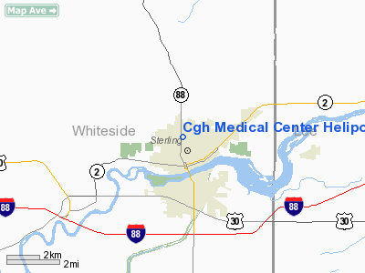
Cgh Medical Center Heliport |
|
|
Location
& QuickFacts
|
FAA
Information Effective: |
2007-07-05 |
|
Airport
Identifier: |
IS46 |
|
Airport
Status: |
Operational |
|
Longitude/Latitude: |
089-41-50.3910W/41-48-17.1100N
-89.697331/41.804753 (Estimated) |
|
Elevation: |
646 ft / 196.90 m (Estimated) |
|
Land: |
0 acres |
|
From
nearest city: |
0 nautical miles NW of Sterling, IL |
|
Location: |
Whiteside County, IL |
|
Magnetic Variation: |
01E (1985) |
Owner
& Manager
|
Ownership: |
Privately
owned |
|
Owner: |
Cgh Medical Center |
|
Address: |
100 E. Lefevre Road
Sterling, IL 61081-1279 |
|
Phone
number: |
815-625-0400 |
|
Manager: |
Darryl Wahler, C.e.o. |
|
Address: |
100 E. Lefevre Road
Sterling, IL 61081-1279 |
|
Phone number: |
815-625-0400 |
Airport Operations and Facilities
|
Airport
Use: |
Private
MEDICAL USE. |
|
Wind
indicator: |
Yes |
|
Segmented Circle: |
No |
|
Control
Tower: |
No |
|
Lighting
Schedule: |
PHONE REQ
FOR ROTATING BCN PHONE 815-625-0400. |
|
Beacon
Color: |
Clear-Green-Yellow (heliport) |
|
Sectional chart: |
Chicago |
|
Region: |
AGL - Great Lakes |
|
Boundary
ARTCC: |
ZAU - Chicago |
|
Tie-in
FSS: |
IKK - Kankakee |
|
FSS
on Airport: |
No |
|
FSS
Toll Free: |
1-800-WX-BRIEF |
|
Runway Information
Helipad H1
|
Dimension: |
80
x 80 ft / 24.4 x 24.4 m |
|
Surface: |
CONC, |
|
|
Runway H1 |
Runway |
|
Traffic
Pattern: |
Left |
Left |
|
Radio Navigation
Aids
|
ID |
Type |
Name |
Ch |
Freq |
Var |
Dist |
|
BOZ |
NDB |
Whiteside |
|
254.00 |
01E |
6.9 nm |
|
FEP |
NDB |
Freeport |
|
335.00 |
00E |
27.0 nm |
|
CWI |
NDB |
Clinton |
|
377.00 |
01E |
28.3 nm |
|
VYS |
NDB |
Valley |
|
230.00 |
00W |
36.6 nm |
|
EZI |
NDB |
Kewanee |
|
245.00 |
01E |
38.1 nm |
|
DKB |
NDB |
Dekalb |
|
209.00 |
02W |
45.0 nm |
|
OIX |
NDB |
Ottawa |
|
266.00 |
01E |
46.3 nm |
|
OQW |
NDB |
Maquoketa |
|
386.00 |
02E |
49.0 nm |
|
PLL |
VOR/DME |
Polo |
049X |
111.20 |
03E |
12.4 nm |
|
RFD |
VOR/DME |
Rockford |
045X |
110.80 |
01E |
33.7 nm |
|
CVA |
VORTAC |
Davenport |
085X |
113.80 |
04E |
35.7 nm |
|
BDF |
VORTAC |
Bradford |
094X |
114.70 |
00E |
39.1 nm |
|
DVN |
VOT |
Davenport Municipal |
|
111.80 |
|
41.5 nm |
Remarks
- PRVDD
INGRESS/EGRESS RTES ARE ESTABD TO/FROM THE NORTH & PRVDD THAT NO
PARKING IS PMTD ON EITHER SIDE OF EAST MILLER ROAD IN PROXIMITY TO THE
HELI.
Cgh Medical Center Heliport
Address:
Whiteside County, IL
Tel:
815-625-0400
Images
and information placed above are from
http://www.airport-data.com/airport/IS46/
We
thank them for the data!
| General
Info |
| Country |
United
States |
| State |
ILLINOIS
|
| FAA ID |
IS46 |
| Latitude |
41-48-17.110N
|
| Longitude |
089-41-50.391W
|
| Elevation |
646 feet
|
| Near City |
STERLING
|
We don't guarantee the information is fresh and accurate. The data may
be wrong or outdated.
For more up-to-date information please refer to other sources.
|
|


