 |
|
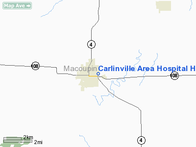
Carlinville Area Hospital Heliport |
Location
& QuickFacts
|
FAA
Information Effective: |
2007-07-05 |
|
Airport
Identifier: |
44LL |
|
Airport
Status: |
Operational |
|
Longitude/Latitude: |
089-52-10.3560W/39-16-52.1720N
-89.869543/39.281159 (Estimated) |
|
Elevation: |
620 ft / 188.98 m (Estimated) |
|
Land: |
0 acres |
|
From
nearest city: |
0 nautical miles of Carlinville, IL |
|
Location: |
Macoupin County, IL |
|
Magnetic Variation: |
01E (1985) |
Owner
& Manager
|
Ownership: |
Privately
owned |
|
Owner: |
Carlinville Area Hospital |
|
Address: |
Morgan & Orient Streets
Carlinville, IL 62626 |
|
Phone
number: |
217-854-3141 |
|
Manager: |
Robert W. Porteus |
|
Address: |
Morgan & Orient Streets
Carlinville, IL 62626 |
|
Phone number: |
217-854-3141 |
Airport Operations and Facilities
|
Airport
Use: |
Private
MEDICAL USE. |
|
Segmented Circle: |
No |
|
Control
Tower: |
No |
|
Sectional chart: |
St Louis |
|
Region: |
AGL - Great Lakes |
|
Boundary
ARTCC: |
ZKC - Kansas City |
|
Tie-in
FSS: |
STL - Saint Louis |
|
FSS
on Airport: |
No |
|
FSS
Phone: |
636-536-2980 |
|
FSS
Toll Free: |
1-800-WX-BRIEF |
|
Runway Information
Helipad H1
|
Dimension: |
30
x 30 ft / 9.1 x 9.1 m |
|
Surface: |
CONC, |
|
|
Runway H1 |
Runway |
|
Traffic
Pattern: |
Left |
Left |
|
Radio Navigation
Aids
|
ID |
Type |
Name |
Ch |
Freq |
Var |
Dist |
|
LTD |
NDB |
Litchfield |
|
371.00 |
01E |
11.4 nm |
|
CVM |
NDB |
Civic Memorial |
|
263.00 |
02E |
24.9 nm |
|
TAZ |
NDB |
Taylorville |
|
395.00 |
00E |
29.6 nm |
|
SP |
NDB |
Huskk |
|
382.00 |
01W |
30.0 nm |
|
LQ |
NDB |
Licol |
|
375.00 |
01W |
39.9 nm |
|
LM |
NDB |
Oblio |
|
338.00 |
00E |
40.4 nm |
|
PPQ |
NDB |
Pittsfield |
|
344.00 |
02E |
47.6 nm |
|
SYZ |
NDB |
Shelbyville |
|
365.00 |
01E |
48.3 nm |
|
BL |
NDB |
Belleville |
|
362.00 |
02E |
49.4 nm |
|
SKE |
TACAN |
Scott |
059X |
|
02E |
44.2 nm |
|
IJX |
VOR/DME |
Jacksonville |
023X |
108.60 |
02E |
34.3 nm |
|
CSX |
VOR/DME |
Cardinal |
111Y |
116.45 |
00E |
39.2 nm |
|
TOY |
VORTAC |
Troy |
107X |
116.00 |
04E |
32.7 nm |
|
SPI |
VORTAC |
Spinner |
74X |
112.70 |
01W |
34.7 nm |
|
VLA |
VORTAC |
Vandalia |
090X |
114.30 |
04E |
34.8 nm |
|
STL |
VORTAC |
St Louis |
121X |
117.40 |
01E |
38.2 nm |
|
CAP |
VORTAC |
Capital |
074X |
112.70 |
04E |
38.4 nm |
|
STL |
VOT |
St Louis Lambert |
|
111.00 |
|
39.4 nm |
Remarks
- PRVDD
INGRESS/EGRESS RTES ARE ESTBD ONLY ON BRGS FM HELI 090 OR 180 DEG PRVDD
A RGT-HAND APCH IS MADE FM THE SE AVOIDING 3-STORY HOUSE 450'S OF PAD
& A LEFT-HAND TURN ON DPTR PRIOR TO REACHING THE 3-STORY HOUSE.
Carlinville Area Hospital Heliport
Address:
Macoupin County, IL
Tel:
217-854-3141
Images
and information placed above are from
http://www.airport-data.com/airport/44LL/
We
thank them for the data!
| General
Info |
| Country |
United
States |
| State |
ILLINOIS
|
| FAA ID |
44LL |
| Latitude |
39-16-52.172N
|
| Longitude |
089-52-10.356W
|
| Elevation |
620 feet
|
| Near City |
CARLINVILLE
|
We don't guarantee the information is fresh and accurate. The data may
be wrong or outdated.
For more up-to-date information please refer to other sources.
|
|


