 |
|
| Campbell Airport |
| IATA: none â ICAO: none â FAA LID: C81 |
| Summary |
| Airport type |
Public |
| Owner |
Kane Illinois Properties |
| Serves |
Grayslake, Illinois |
| Elevation AMSL |
788 ft / 240 m |
| Coordinates |
42°19â²29â³N 088°04â²27â³W / 42.32472°N 88.07417°W / 42.32472; -88.07417 |
| Runways |
| Direction |
Length |
Surface |
| ft |
m |
| 9/27 |
3,270 |
997 |
Asphalt |
| 6/24 |
3,573 |
1,089 |
Asphalt/Turf |
| Statistics (2006) |
| Aircraft operations |
30,000 |
| Based aircraft |
93 |
| Source: Federal Aviation Administration |
Campbell Airport (FAA LID: C81) is a public-use airport located two miles (3 km) southwest of the central business district of Grayslake, a village in Lake County, Illinois, United States. It is privately owned by Kane Illinois Properties, Inc.
Facilities and aircraft
Campbell Airport covers an area of 243 acres (98 ha) which contains two runways: 9/27 with a 3,270 x 40 ft (997 x 12 m) asphalt pavement and 6/24 with a 3,573 x 40 ft (1,089 x 12 m) asphalt and turf surface.
For the 12-month period ending December 31, 2006, the airport had 30,000 general aviation aircraft operations, an average of 82 per day. There are 93 aircraft based at this airport: 94% single-engine, 5% multi-engine and 1% helicopter.
The above content comes from Wikipedia and is published under free licenses – click here to read more.
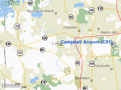
Location
& QuickFacts
|
FAA
Information Effective: |
2007-07-05 |
|
Airport
Identifier: |
C81 |
|
Airport
Status: |
Operational |
|
Longitude/Latitude: |
088-04-26.7170W/42-19-28.6000N
-88.074088/42.324611 (Estimated) |
|
Elevation: |
788 ft / 240.18 m (Surveyed) |
|
Land: |
243 acres |
|
From
nearest city: |
2 nautical miles SW of Grayslake, IL |
|
Location: |
Lake County, IL |
|
Magnetic Variation: |
02W (1995) |
Owner
& Manager
|
Ownership: |
Privately
owned |
|
Owner: |
Kane Ill Properties |
|
Address: |
1925 N Clybourn Ave Suite 201
Chicago, IL 60614-4946 |
|
Phone number: |
773-248-0031
X13 |
|
Manager: |
Gary Campbell & Jim Tahaney |
|
Address: |
Po Box 324
Grayslake, IL 60030 |
|
Phone number: |
847-223-2200 |
Airport
Operations and Facilities
|
Airport
Use: |
Open
to public |
|
Wind
indicator: |
Yes |
|
Segmented Circle: |
No |
|
Control
Tower: |
No |
|
Lighting
Schedule: |
DUSK-DAWN |
|
Beacon
Color: |
Clear-Green (lighted land airport) |
|
Landing
fee charge: |
No |
|
Sectional chart: |
Chicago |
|
Region: |
AGL - Great Lakes |
|
Traffic
Pattern Alt: |
800 ft |
|
Boundary
ARTCC: |
ZAU - Chicago |
|
Tie-in
FSS: |
IKK - Kankakee |
|
FSS
on Airport: |
No |
|
FSS
Toll Free: |
1-800-WX-BRIEF |
|
NOTAMs
Facility: |
IKK (NOTAM-d service avaliable) |
|
Federal Agreements: |
N |
Airport Communications
|
CTAF: |
122.700 |
|
Unicom: |
122.700
|
Airport
Services
|
Fuel
available: |
100LL |
|
Airframe
Repair: |
MAJOR |
|
Power
Plant Repair: |
MAJOR |
|
Bottled
Oxygen: |
NONE |
|
Bulk
Oxygen: |
NONE |
|
Runway Information
Runway 06/24
|
Dimension: |
3573 x 40 ft / 1089.1 x 12.2 m
SW 1000 FT PORTION TURF-GRVL. |
|
Surface: |
ASPH-TURF, Good Condition
PAVEMENT HAS SEVERAL AREAS OF LOOSE DEBRIS, CRACKS & DEPRESSIONS.
RY
EDGES DROP OFF IN EXCESS OF 2 INCHES. |
|
|
Runway 06 |
Runway 24 |
|
Longitude: |
088-04-47.3150W |
088-04-06.6050W |
|
Latitude: |
42-19-21.2110N |
42-19-39.8430N |
|
Elevation: |
779.00 ft |
778.00 ft |
|
Alignment: |
58 |
127 |
|
Traffic
Pattern: |
Left |
Left |
|
Displaced
threshold: |
0.00 ft |
301.00 ft
RWY 24 NSTD DSPLCD THLD WHITE STRIPE MKGS ONLY. MARKED FOR
RY 06 ON SW BEGINNING OF PAVED SURFACE. |
|
Runway
End Identifier: |
No |
No |
|
Centerline
Lights: |
No |
No |
|
Touchdown
Lights: |
No |
No |
|
Obstruction: |
66 ft trees, 1513.0 ft from runway, 95 ft right
of centerline, 22:1 slope to clear |
76 ft tree, 1511.0 ft from runway, 188L/ ft
right of centerline, 17:1 slope to clear
APCH RATIO 23:1 AT DSPLCD THLD.
+15' ROAD ADJ RY END L & R. |
|
Runway 09/27
|
Dimension: |
3270 x 40 ft / 996.7 x 12.2 m
SW 1000 FT PORTION TURF-GRVL. |
|
Surface: |
ASPH, Fair Condition
PAVEMENT HAS SEVERAL AREAS OF LOOSE DEBRIS, CRACKS & DEPRESSIONS.
RY
EDGES DROP OFF IN EXCESS OF 2 INCHES. |
|
Edge
Lights: |
Non-standard lighting system
RWY 09/27 NSTD LIRL; SPACING & LGT INTST VARIES. |
|
|
Runway 09 |
Runway 27 |
|
Longitude: |
088-04-48.2110W |
088-04-04.6870W |
|
Latitude: |
42-19-26.5280N |
42-19-26.4390N |
|
Elevation: |
777.00 ft |
788.00 ft |
|
Alignment: |
90 |
127 |
|
Traffic
Pattern: |
Left |
Left |
|
Markings: |
None, |
None, |
|
VASI: |
tri-color on left side |
tri-color on left side |
|
Visual
Glide Angle: |
4.00° |
3.50° |
|
Runway
End Identifier: |
No |
No |
|
Centerline
Lights: |
No |
No |
|
Touchdown
Lights: |
No |
No |
|
Obstruction: |
29 ft trees, 683.0 ft from runway, 135L/ ft
right of centerline, 16:1 slope to clear |
88 ft tree, 3657.0 ft from runway, 188 ft left
of centerline, 39:1 slope to clear |
|
Radio Navigation
Aids
|
ID |
Type |
Name |
Ch |
Freq |
Var |
Dist |
|
ME |
NDB |
Deana |
|
350.00 |
00E |
21.6 nm |
|
RA |
NDB |
Paser |
|
206.00 |
00E |
22.9 nm |
|
LVV |
NDB |
Lake Lawn |
|
404.00 |
00W |
32.2 nm |
|
GM |
NDB |
Teels |
|
242.00 |
02W |
35.2 nm |
|
DKB |
NDB |
Dekalb |
|
209.00 |
02W |
36.7 nm |
|
HK |
NDB |
Ermin |
|
332.00 |
01W |
37.9 nm |
|
MX |
NDB |
Kedzi |
|
248.00 |
01W |
39.0 nm |
|
UES |
NDB |
Waukesha |
|
359.00 |
01W |
43.9 nm |
|
BL |
NDB |
Yanks |
|
260.00 |
02W |
45.1 nm |
|
JVL |
NDB |
Janesville |
|
375.00 |
03E |
46.3 nm |
|
OBK |
VOR/DME |
Northbrook |
077X |
113.00 |
02W |
8.2 nm |
|
ENW |
VOR/DME |
Kenosha |
029X |
109.20 |
02W |
17.7 nm |
|
ORD |
VOR/DME |
Chicago O'hare |
086X |
113.90 |
02E |
21.6 nm |
|
BUU |
VOR/DME |
Burbun |
092X |
114.50 |
01W |
24.1 nm |
|
HRK |
VOR/DME |
Horlick |
124X |
117.70 |
02W |
28.7 nm |
|
DPA |
VOR/DME |
Dupage |
021X |
108.40 |
02E |
28.9 nm |
|
LJT |
VOR/DME |
Timmerman |
072X |
112.50 |
02W |
47.2 nm |
|
JVL |
VOR/DME |
Janesville |
090X |
114.30 |
03E |
47.8 nm |
|
JOT |
VORTAC |
Joliet |
070X |
112.30 |
02E |
48.0 nm |
|
BAE |
VORTAC |
Badger |
111X |
116.40 |
02E |
48.5 nm |
|
ORD |
VOT |
Chicago O'hare Intl |
|
112.00 |
|
21.9 nm |
|
MDW |
VOT |
Chicago Midway |
|
111.00 |
|
35.4 nm |
|
MKE |
VOT |
Milwaukee |
|
109.00 |
|
38.3 nm |
Remarks
- NO
TOUCH & GO LNDG PERMITTED.
- UNLGTD
POWER LINES 167 FT AGL 3/4 MILE S OF RY 09/27.
- BE
ALERT MODEL AIRCRAFT FLYING 1/2 MILE SE OF RY 27 THRSHLD.
- RY
09/27 PARALELL TWY POOR, LOOSE DEBRIS, CRACKS & DEPRESSIONS.
Based
Aircraft
|
Aircraft
based on field: |
93 |
|
Single
Engine Airplanes: |
87 |
|
Multi
Engine Airplanes: |
5 |
|
Helicopters: |
1 |
Operational Statistics
Time Period: 2005-01-01
- 2005-12-31
|
Aircraft
Operations: |
83/Day |
|
General
Aviation Local: |
33.3% |
|
General
Aviation Itinerant: |
66.7% |
Campbell Airport
Address:
Lake County, IL
Tel:
773-248-0031, 847-223-2200
Images
and information placed above are from
http://www.airport-data.com/airport/C81/
We
thank them for the data!
| General
Info |
| Country |
United
States |
| State |
ILLINOIS
|
| FAA ID |
C81 |
| Latitude |
42-19-28.600N
|
| Longitude |
088-04-26.717W
|
| Elevation |
788 feet
|
| Near City |
GRAYSLAKE
|
We don't guarantee the information is fresh and accurate. The data may
be wrong or outdated.
For more up-to-date information please refer to other sources.
|
|


