 |
|
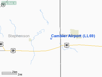
Location
& QuickFacts
|
FAA
Information Effective: |
2007-07-05 |
|
Airport
Identifier: |
LL69 |
|
Airport
Status: |
Operational |
|
Longitude/Latitude: |
089-25-17.4060W/42-17-59.0700N
-89.421502/42.299742 (Estimated) |
|
Elevation: |
800 ft / 243.84 m (Estimated) |
|
Land: |
0 acres |
|
From
nearest city: |
1 nautical miles E of Ridott, IL |
|
Location: |
Stephenson County, IL |
|
Magnetic Variation: |
00E (1985) |
Owner
& Manager
|
Ownership: |
Privately
owned |
|
Owner: |
Louis G. Cambier, Jr |
|
Address: |
141 N Farwell Bridge Rd
Pecatonica, IL 61063 |
|
Phone number: |
815-239-1521 |
|
Address: |
|
Airport Operations and Facilities
|
Airport Use: |
Private |
|
Wind indicator: |
Yes |
|
Segmented Circle: |
No |
|
Control Tower: |
No |
|
Landing fee charge: |
No |
|
Sectional chart: |
Chicago |
|
Region: |
AGL - Great Lakes |
|
Boundary ARTCC: |
ZAU - Chicago |
|
Tie-in FSS: |
IKK - Kankakee |
|
FSS on Airport: |
No |
|
FSS Toll Free: |
1-800-WX-BRIEF |
Airport Services
|
Airframe
Repair: |
NONE |
|
Power
Plant Repair: |
NONE |
|
Runway Information
Runway 09/27
|
Dimension: |
2300
x 150 ft / 701.0 x 45.7 m |
|
Surface: |
TURF, |
|
|
Runway 09 |
Runway 27 |
|
Traffic
Pattern: |
Right |
Right |
|
Radio Navigation
Aids
|
ID |
Type |
Name |
Ch |
Freq |
Var |
Dist |
|
FEP |
NDB |
Freeport |
|
335.00 |
00E |
8.0 nm |
|
JVL |
NDB |
Janesville |
|
375.00 |
03E |
25.4 nm |
|
DKB |
NDB |
Dekalb |
|
209.00 |
02W |
38.7 nm |
|
BOZ |
NDB |
Whiteside |
|
254.00 |
01E |
38.9 nm |
|
LVV |
NDB |
Lake Lawn |
|
404.00 |
00W |
43.9 nm |
|
MS |
NDB |
Monah |
|
400.00 |
00E |
46.0 nm |
|
CWI |
NDB |
Clinton |
|
377.00 |
01E |
49.4 nm |
|
RFD |
VOR/DME |
Rockford |
045X |
110.80 |
01E |
10.8 nm |
|
PLL |
VOR/DME |
Polo |
049X |
111.20 |
03E |
20.6 nm |
|
JVL |
VOR/DME |
Janesville |
090X |
114.30 |
03E |
20.9 nm |
Based
Aircraft
|
Aircraft
based on field: |
2 |
|
Single
Engine Airplanes: |
2 |
Cambier Airport
Address:
Stephenson County, IL
Tel:
815-239-1521
Images
and information placed above are from
http://www.airport-data.com/airport/LL69/
We
thank them for the data!
| General
Info |
| Country |
United
States |
| State |
ILLINOIS
|
| FAA ID |
LL69 |
| Latitude |
42-17-59.070N
|
| Longitude |
089-25-17.406W
|
| Elevation |
800 feet
|
| Near City |
RIDOTT
|
We don't guarantee the information is fresh and accurate. The data may
be wrong or outdated.
For more up-to-date information please refer to other sources.
|
|


