 |
|
|
|
|
|
Location
& QuickFacts
|
FAA
Information Effective: |
2007-07-05 |
|
Airport
Identifier: |
CIR |
|
Airport
Status: |
Operational |
|
Longitude/Latitude: |
089-13-10.6000W/37-03-52.1000N
-89.219611/37.064472 (Estimated) |
|
Elevation: |
321 ft / 97.84 m (Surveyed) |
|
Land: |
470 acres |
|
From
nearest city: |
4 nautical miles NW of Cairo, IL |
|
Location: |
Alexander County, IL |
|
Magnetic Variation: |
00E (1995) |
Owner
& Manager
|
Ownership: |
Publicly
owned |
|
Owner: |
Alexander County Airport |
|
Address: |
Po Box 26
Cairo, IL 62914 |
|
Phone
number: |
618-734-0600 |
|
Manager: |
Chairman
DON TURNER, CHRMN OF ARPT AUTH, IS INTERIM MGR. |
|
Address: |
P O Box 26
Cairo, IL 62914 |
|
Phone number: |
618-734-0600 |
Airport Operations and Facilities
|
Airport
Use: |
Open
to public |
|
Wind
indicator: |
Yes |
|
Segmented Circle: |
Yes |
|
Control
Tower: |
No |
|
Lighting
Schedule: |
DUSK-DAWN
MIRL RY 14/32 PRESET LOW INTST; TO INCR INTST ACTVT - CTAF.
MIRL RY 02/20 BY PRIOR REQ ONLY CALL 618-734-0600. |
|
Beacon
Color: |
Clear-Green (lighted land airport) |
|
Landing
fee charge: |
No |
|
Sectional chart: |
St Louis |
|
Region: |
AGL - Great Lakes |
|
Boundary
ARTCC: |
ZME - Memphis |
|
Tie-in
FSS: |
STL - Saint Louis |
|
FSS
on Airport: |
No |
|
FSS
Phone: |
636-536-2980 |
|
FSS
Toll Free: |
1-800-WX-BRIEF |
|
NOTAMs
Facility: |
CIR (NOTAM-d service avaliable) |
|
Federal Agreements: |
NGY |
Airport Communications
|
CTAF: |
122.800 |
|
Unicom: |
122.800
|
Airport
Services
|
Fuel
available: |
100LL
SELF SVC FUEL AVBL 24 HRS. |
|
Bottled
Oxygen: |
NONE |
|
Bulk
Oxygen: |
NONE |
|
Runway Information
Runway 02/20
|
Dimension: |
3201
x 60 ft / 975.7 x 18.3 m |
|
Surface: |
ASPH, Good Condition |
|
Weight
Limit: |
Single wheel: 6000 lbs. |
|
Edge
Lights: |
Medium |
|
|
Runway 02 |
Runway 20 |
|
Longitude: |
089-13-09.0811W |
089-12-54.6747W |
|
Latitude: |
37-03-34.5545N |
37-04-04.0256N |
|
Elevation: |
318.00 ft |
319.00 ft |
|
Alignment: |
21 |
127 |
|
Traffic
Pattern: |
Left |
Left |
|
Markings: |
Basic, Good Condition |
Basic, Good Condition |
|
Runway
End Identifier: |
No |
No |
|
Centerline
Lights: |
No |
No |
|
Touchdown
Lights: |
No |
No |
|
Obstruction: |
104 ft tree, 2414.0 ft from runway, 137 ft
right of centerline, 21:1 slope to clear |
35 ft tree, 986.0 ft from runway, 105 ft left
of centerline, 22:1 slope to clear |
|
Runway 14/32
|
Dimension: |
4003
x 100 ft / 1220.1 x 30.5 m |
|
Surface: |
ASPH, Fair Condition |
|
Weight
Limit: |
Single wheel: 30000 lbs.
Dual wheel: 35000 lbs. |
|
Edge
Lights: |
Medium |
|
|
Runway 14 |
Runway 32 |
|
Longitude: |
089-13-32.5010W |
089-13-01.6990W |
|
Latitude: |
37-04-07.6970N |
37-03-36.7580N |
|
Elevation: |
314.00 ft |
319.00 ft |
|
Alignment: |
127 |
127 |
|
Traffic
Pattern: |
Left |
Left |
|
Markings: |
Non-precision instrument, Fair Condition |
Non-precision instrument, Fair Condition |
|
Crossing
Height: |
25.00 ft |
0.00 ft |
|
VASI: |
4-light PAPI on left side |
|
|
Visual
Glide Angle: |
3.00° |
0.00° |
|
Runway
End Identifier: |
Yes |
No |
|
Centerline
Lights: |
No |
No |
|
Touchdown
Lights: |
No |
No |
|
Obstruction: |
25 ft tree, 700.0 ft from runway, 63 ft right
of centerline, 20:1 slope to clear |
77 ft tree, 2060.0 ft from runway, 159 ft left
of centerline, 24:1 slope to clear |
|
Radio Navigation
Aids
|
ID |
Type |
Name |
Ch |
Freq |
Var |
Dist |
|
CIR |
NDB |
Cairo |
|
397.00 |
00E |
0.2 nm |
|
CHQ |
NDB |
Charleston |
|
208.00 |
01E |
14.7 nm |
|
BDD |
NDB |
Bellgrade |
|
254.00 |
00E |
26.8 nm |
|
GGK |
NDB |
Mayfield |
|
401.00 |
00E |
37.6 nm |
|
DXE |
NDB |
Dexter |
|
423.00 |
00E |
38.4 nm |
|
UC |
NDB |
Obion |
|
212.00 |
00E |
47.4 nm |
|
CGI |
VOR/DME |
Cape Girardeau |
076X |
112.90 |
01E |
19.5 nm |
|
MWA |
VOR/DME |
Marion |
041X |
110.40 |
04E |
42.6 nm |
|
CNG |
VORTAC |
Cunningham |
078X |
113.10 |
03E |
18.7 nm |
|
MAW |
VORTAC |
Malden |
049X |
111.20 |
03E |
45.2 nm |
Remarks
- PARACHUTE
JUMPING ON WEEKENDS.
Based
Aircraft
|
Aircraft
based on field: |
17 |
|
Single
Engine Airplanes: |
14 |
|
Multi
Engine Airplanes: |
2 |
|
Ultralights: |
1 |
Operational Statistics
Time Period: 2004-06-01
- 2005-05-31
|
Aircraft
Operations: |
174/Week |
|
General
Aviation Local: |
55.6% |
|
General
Aviation Itinerant: |
38.9% |
|
Military: |
5.6% |
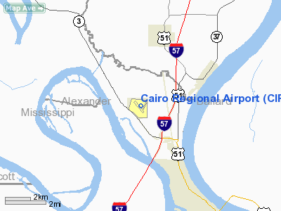
Cairo Regional Airport
Address:
Alexander County, IL
Tel:
618-734-0600
Images
and information placed above are from
http://www.airport-data.com/airport/CIR/
We
thank them for the data!
| General
Info |
| Country |
United
States |
| State |
ILLINOIS
|
| FAA ID |
CIR |
| Latitude |
37-03-52.100N
|
| Longitude |
089-13-10.600W
|
| Elevation |
321 feet
|
| Near City |
CAIRO
|
We don't guarantee the information is fresh and accurate. The data may
be wrong or outdated.
For more up-to-date information please refer to other sources.
|
|


