 |
|
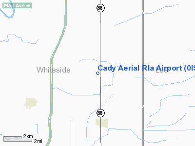
Location
& QuickFacts
|
FAA
Information Effective: |
2007-07-05 |
|
Airport
Identifier: |
0IS3 |
|
Airport
Status: |
Operational |
|
Longitude/Latitude: |
089-41-37.0000W/41-39-39.0000N
-89.693611/41.660833 (Estimated) |
|
Elevation: |
630 ft / 192.02 m (Estimated) |
|
Land: |
0 acres |
|
From
nearest city: |
3 nautical miles N of Deer Grove, IL |
|
Location: |
Whiteside County, IL |
|
Magnetic Variation: |
00W (1995) |
Owner & Manager
|
Ownership: |
Privately owned |
|
Owner: |
Neil Cady |
|
Address: |
Box 21
Deer Grove, IL 61243 |
|
Phone number: |
815-438-3591 |
|
Manager: |
Neil Cady |
|
Address: |
Box 21
Deer Grove, IL 61243 |
|
Phone number: |
815-438-3591 |
Airport
Operations and Facilities
|
Airport
Use: |
Private |
|
Wind
indicator: |
Yes |
|
Segmented Circle: |
No |
|
Control
Tower: |
No |
|
Sectional chart: |
Chicago |
|
Region: |
AGL - Great Lakes |
|
Boundary
ARTCC: |
ZAU - Chicago |
|
Tie-in
FSS: |
IKK - Kankakee |
|
FSS
Toll Free: |
1-800-WX-BRIEF |
|
Runway Information
Runway 18/36
|
Dimension: |
2500
x 60 ft / 762.0 x 18.3 m |
|
Surface: |
TURF-GRVL, |
|
|
Runway 18 |
Runway 36 |
|
Traffic
Pattern: |
Left |
Left |
|
Radio Navigation
Aids
|
ID |
Type |
Name |
Ch |
Freq |
Var |
Dist |
|
BOZ |
NDB |
Whiteside |
|
254.00 |
01E |
5.1 nm |
|
EZI |
NDB |
Kewanee |
|
245.00 |
01E |
30.1 nm |
|
CWI |
NDB |
Clinton |
|
377.00 |
01E |
30.2 nm |
|
VYS |
NDB |
Valley |
|
230.00 |
00W |
30.7 nm |
|
FEP |
NDB |
Freeport |
|
335.00 |
00E |
35.5 nm |
|
OIX |
NDB |
Ottawa |
|
266.00 |
01E |
41.8 nm |
|
DKB |
NDB |
Dekalb |
|
209.00 |
02W |
47.1 nm |
|
PLL |
VOR/DME |
Polo |
049X |
111.20 |
03E |
19.8 nm |
|
RFD |
VOR/DME |
Rockford |
045X |
110.80 |
01E |
40.5 nm |
|
BDF |
VORTAC |
Bradford |
094X |
114.70 |
00E |
30.5 nm |
|
CVA |
VORTAC |
Davenport |
085X |
113.80 |
04E |
35.6 nm |
|
MZV |
VORTAC |
Moline |
091X |
114.40 |
05E |
47.2 nm |
|
DVN |
VOT |
Davenport Municipal |
|
111.80 |
|
40.2 nm |
Remarks
- PRVDD
SPONSOR USES 800 FT TPA.
Based
Aircraft
|
Aircraft
based on field: |
3 |
|
Single
Engine Airplanes: |
3 |
Cady Aerial Rla Airport
Address:
Whiteside County, IL
Tel:
815-438-3591
Images
and information placed above are from
http://www.airport-data.com/airport/0IS3/
We
thank them for the data!
| General
Info |
| Country |
United
States |
| State |
ILLINOIS
|
| FAA ID |
0IS3 |
| Latitude |
41-39-39.000N
|
| Longitude |
089-41-37.000W
|
| Elevation |
630 feet
|
| Near City |
DEER GROVE
|
We don't guarantee the information is fresh and accurate. The data may
be wrong or outdated.
For more up-to-date information please refer to other sources.
|
|


