 |
|
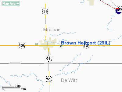
Location
& QuickFacts
|
FAA
Information Effective: |
2007-07-05 |
|
Airport
Identifier: |
29IL |
|
Airport
Status: |
Operational |
|
Longitude/Latitude: |
088-57-04.0000W/40-18-40.0000N
-88.951111/40.311111 (Estimated) |
|
Elevation: |
790 ft / 240.79 m (Estimated) |
|
Land: |
0 acres |
|
From
nearest city: |
1 nautical miles E of Heyworth, IL |
|
Location: |
Mc Lean County, IL |
|
Magnetic Variation: |
() |
Owner
& Manager
|
Ownership: |
Privately
owned |
|
Owner: |
Michael Brown |
|
Address: |
16469 E 200 N Road
Heyworth, IL 61745 |
|
Phone
number: |
309-473-9204 |
|
Manager: |
Michael Brown |
|
Address: |
16469 E 200 N Road
Heyworth, IL 61745 |
|
Phone number: |
309-473-9204 |
Airport Operations and Facilities
|
Airport
Use: |
Private |
|
Wind
indicator: |
Yes |
|
Control
Tower: |
No |
|
Sectional chart: |
Chicago |
|
Region: |
AGL - Great Lakes |
|
Boundary
ARTCC: |
ZAU - Chicago |
|
Tie-in
FSS: |
IKK - Kankakee |
|
FSS
Toll Free: |
1-800-WX-BRIEF |
|
Runway Information
Helipad H1
|
Dimension: |
100
x 100 ft / 30.5 x 30.5 m |
|
Surface: |
TURF, Good Condition |
|
|
Runway H1 |
Runway |
|
Traffic
Pattern: |
Left |
Left |
|
Radio Navigation
Aids
|
ID |
Type |
Name |
Ch |
Freq |
Var |
Dist |
|
AAA |
NDB |
Abraham |
|
329.00 |
00E |
19.9 nm |
|
PI |
NDB |
Tungg |
|
356.00 |
01E |
34.3 nm |
|
LQ |
NDB |
Licol |
|
375.00 |
01W |
38.4 nm |
|
HMJ |
NDB |
Homer |
|
281.00 |
01E |
48.9 nm |
|
SP |
NDB |
Huskk |
|
382.00 |
01W |
49.3 nm |
|
TAZ |
NDB |
Taylorville |
|
395.00 |
00E |
49.6 nm |
|
BMI |
VOR/DME |
Bloomington |
019X |
108.20 |
03E |
10.2 nm |
|
PNT |
VOR/DME |
Pontiac |
033X |
109.60 |
03E |
32.2 nm |
|
RBS |
VOR/DME |
Roberts |
115X |
116.80 |
02E |
39.5 nm |
|
DEC |
VORTAC |
Decatur |
119X |
117.20 |
03E |
34.8 nm |
|
CMI |
VORTAC |
Champaign |
037X |
110.00 |
03E |
35.2 nm |
|
CAP |
VORTAC |
Capital |
074X |
112.70 |
04E |
39.9 nm |
|
SPI |
VORTAC |
Spinner |
74X |
112.70 |
01W |
43.8 nm |
|
PIA |
VORTAC |
Peoria |
099X |
115.20 |
04E |
44.4 nm |
Remarks
- 298
FT RADIO TWR 4860 FT SE OF PAD.
- PRVDD
ALL APCH/DEP FROM 085 TO 095 DEGAND FR 325 TO 335 DEG; AREA IS MARKED;
WIND INDICATOR IS MAINTAINED; COMPLY WITH 14 CFR 91.126(B)(2).
Based
Aircraft
|
Aircraft
based on field: |
1 |
|
Helicopters: |
1 |
Brown Heliport
Address:
Mc Lean County, IL
Tel:
309-473-9204
Images
and information placed above are from
http://www.airport-data.com/airport/29IL/
We
thank them for the data!
We don't guarantee the information is fresh and accurate. The data may
be wrong or outdated.
For more up-to-date information please refer to other sources.
|
|


