 |
|
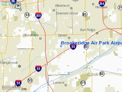
Brookeridge Air Park Airport |
|
|
Location
& QuickFacts
|
FAA
Information Effective: |
2007-07-05 |
|
Airport
Identifier: |
LL22 |
|
Airport
Status: |
Operational |
|
Longitude/Latitude: |
087-59-57.3800W/41-43-57.8800N
-87.999272/41.732744 (Estimated) |
|
Elevation: |
750 ft / 228.60 m (Estimated) |
|
Land: |
23 acres |
|
From
nearest city: |
3 nautical miles S of Downers Grove, IL |
|
Location: |
Du Page County, IL |
|
Magnetic Variation: |
01W (1985) |
Owner
& Manager
|
Ownership: |
Privately
owned |
|
Owner: |
Brookeridge Aero Assoc Inc |
|
Address: |
760 86th St
Downers Grove, IL 60516 |
|
Phone
number: |
630-985-3837 |
|
Manager: |
Nick Dispensa |
|
Address: |
8331 Millbrook Dr
Downers Grove, IL 60516 |
|
Phone number: |
630-771-1833 |
Airport Operations and Facilities
|
Airport Use: |
Private |
|
Wind indicator: |
Yes |
|
Segmented Circle: |
No |
|
Control Tower: |
No |
|
Lighting Schedule: |
DUSK-DAWN |
|
Landing fee charge: |
No |
|
Sectional chart: |
Chicago |
|
Region: |
AGL - Great Lakes |
|
Boundary ARTCC: |
ZAU - Chicago |
|
Tie-in FSS: |
IKK - Kankakee |
|
FSS on Airport: |
No |
|
FSS Toll Free: |
1-800-WX-BRIEF |
Airport Services
|
Airframe
Repair: |
NONE |
|
Power
Plant Repair: |
NONE |
|
Runway Information
Runway 09/27
|
Dimension: |
2800
x 40 ft / 853.4 x 12.2 m |
|
Surface: |
ASPH, |
|
Edge
Lights: |
Medium |
|
|
Runway 09 |
Runway 27 |
|
Traffic
Pattern: |
Left |
Left |
|
Displaced
threshold: |
463.00 ft |
337.00 ft |
|
Runway 18/36
|
Dimension: |
1940
x 25 ft / 591.3 x 7.6 m |
|
Surface: |
ASPH, |
|
|
Runway 18 |
Runway 36 |
|
Traffic
Pattern: |
Left |
Left |
|
Displaced
threshold: |
80.00 ft |
180.00 ft |
|
Radio Navigation
Aids
|
ID |
Type |
Name |
Ch |
Freq |
Var |
Dist |
|
HK |
NDB |
Ermin |
|
332.00 |
01W |
7.4 nm |
|
MX |
NDB |
Kedzi |
|
248.00 |
01W |
13.9 nm |
|
ME |
NDB |
Deana |
|
350.00 |
00E |
14.2 nm |
|
DKB |
NDB |
Dekalb |
|
209.00 |
02W |
33.9 nm |
|
OIX |
NDB |
Ottawa |
|
266.00 |
01E |
44.4 nm |
|
ORD |
VOR/DME |
Chicago O'hare |
086X |
113.90 |
02E |
15.9 nm |
|
DPA |
VOR/DME |
Dupage |
021X |
108.40 |
02E |
18.4 nm |
|
OBK |
VOR/DME |
Northbrook |
077X |
113.00 |
02W |
29.5 nm |
|
IKK |
VOR/DME |
Kankakee |
053X |
111.60 |
00E |
40.1 nm |
|
JOT |
VORTAC |
Joliet |
070X |
112.30 |
02E |
18.2 nm |
|
CGT |
VORTAC |
Chicago Heights |
089X |
114.20 |
02E |
23.4 nm |
|
EON |
VORTAC |
Peotone |
079X |
113.20 |
02E |
29.4 nm |
|
MDW |
VOT |
Chicago Midway |
|
111.00 |
|
11.5 nm |
|
ORD |
VOT |
Chicago O'hare Intl |
|
112.00 |
|
15.6 nm |
Based
Aircraft
|
Aircraft
based on field: |
89 |
|
Single
Engine Airplanes: |
69 |
|
Multi
Engine Airplanes: |
20 |
Brookeridge Air Park Airport
Address:
Du Page County, IL
Tel:
630-985-3837,
630-771-1833
Images
and information placed above are from
http://www.airport-data.com/airport/LL22/
We
thank them for the data!
| General
Info |
| Country |
United
States |
| State |
ILLINOIS
|
| FAA ID |
LL22 |
| Latitude |
41-43-57.880N
|
| Longitude |
087-59-57.380W
|
| Elevation |
750 feet
|
| Near City |
DOWNERS
GROVE |
We don't guarantee the information is fresh and accurate. The data may
be wrong or outdated.
For more up-to-date information please refer to other sources.
|
|


