 |
|
|
|
|
|
Location
& QuickFacts
|
FAA
Information Effective: |
2007-07-05 |
|
Airport
Identifier: |
C82 |
|
Airport
Status: |
Operational |
|
Longitude/Latitude: |
089-06-05.3320W/41-45-45.1090N
-89.101481/41.762530 (Estimated) |
|
Elevation: |
769 ft / 234.39 m (Surveyed) |
|
Land: |
12 acres |
|
From
nearest city: |
4 nautical miles N of Compton, IL |
|
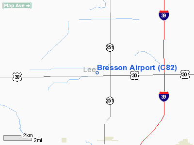
Location: |
Lee County, IL |
|
Magnetic Variation: |
00E (1985) |
Owner & Manager
|
Ownership: |
Privately owned |
|
Owner: |
Mark Bresson |
|
Address: |
2764 Hwy 30
Compton, IL 61318 |
|
Phone number: |
815-628-7111 |
|
Manager: |
Mark Bresson |
|
Address: |
2764 Hwy 30
Compton, IL 61318 |
|
Phone number: |
815-628-7111 |
Airport
Operations and Facilities
|
Airport
Use: |
Open
to public |
|
Wind
indicator: |
Yes |
|
Segmented Circle: |
No |
|
Control
Tower: |
No |
|
Lighting
Schedule: |
PHONE REQ
FOR LIRL RY 18/36 CALL 815-628-7111/7431. |
|
Landing
fee charge: |
No |
|
Sectional chart: |
Chicago |
|
Region: |
AGL - Great Lakes |
|
Traffic
Pattern Alt: |
800 ft |
|
Boundary
ARTCC: |
ZAU - Chicago |
|
Tie-in
FSS: |
IKK - Kankakee |
|
FSS
on Airport: |
No |
|
FSS
Toll Free: |
1-800-WX-BRIEF |
|
NOTAMs
Facility: |
IKK (NOTAM-d service avaliable) |
Airport Communications
|
CTAF: |
123.000 |
|
Unicom: |
123.000 |
|
Runway Information
Runway 18/36
|
Dimension: |
2590
x 184 ft / 789.4 x 56.1 m |
|
Surface: |
TURF, Good Condition |
|
Edge
Lights: |
Non-standard lighting system
NSTD LIRL DUE TO NON-FRANGIBLE MOUNTINGS; SPACING AND INTENSITY. |
|
|
Runway 18 |
Runway 36 |
|
Longitude: |
089-06-06.3400W |
089-06-06.3300W |
|
Latitude: |
41-45-59.3700N |
41-45-33.8100N |
|
Elevation: |
769.00 ft |
769.00 ft |
|
Traffic
Pattern: |
Left |
Left |
|
Displaced
threshold: |
292.00 ft
& 36 DSPLCD THLDS MKD WITH TIRES & LGTS. |
320.00 ft |
|
Runway
End Identifier: |
No |
No |
|
Centerline
Lights: |
No |
No |
|
Touchdown
Lights: |
No |
No |
|
Obstruction: |
7 ft dike, 40.0 ft from runway, 5:1 slope to
clear
APCH RATIO 47:1 AT DSPLCD THR. |
15 ft road, 35.0 ft from runway, 2:1 slope
to clear
APCH RATIO 23:1 AT DSPLCD THR. |
|
Radio Navigation
Aids
|
ID |
Type |
Name |
Ch |
Freq |
Var |
Dist |
|
DKB |
NDB |
Dekalb |
|
209.00 |
02W |
20.4 nm |
|
VYS |
NDB |
Valley |
|
230.00 |
00W |
24.6 nm |
|
OIX |
NDB |
Ottawa |
|
266.00 |
01E |
26.5 nm |
|
BOZ |
NDB |
Whiteside |
|
254.00 |
01E |
30.8 nm |
|
FEP |
NDB |
Freeport |
|
335.00 |
00E |
36.2 nm |
|
ME |
NDB |
Deana |
|
350.00 |
00E |
49.7 nm |
|
PLL |
VOR/DME |
Polo |
049X |
111.20 |
03E |
22.5 nm |
|
RFD |
VOR/DME |
Rockford |
045X |
110.80 |
01E |
28.2 nm |
|
DPA |
VOR/DME |
Dupage |
021X |
108.40 |
02E |
34.5 nm |
|
JVL |
VOR/DME |
Janesville |
090X |
114.30 |
03E |
47.8 nm |
|
JOT |
VORTAC |
Joliet |
070X |
112.30 |
02E |
37.5 nm |
|
BDF |
VORTAC |
Bradford |
094X |
114.70 |
00E |
42.3 nm |
Based
Aircraft
|
Aircraft
based on field: |
3 |
|
Single
Engine Airplanes: |
1 |
|
Ultralights: |
2 |
Operational Statistics
Time Period: 2005-01-01
- 2005-12-31
|
Aircraft
Operations: |
97/Week |
|
General
Aviation Local: |
60.0% |
|
General
Aviation Itinerant: |
40.0% |
Bresson Airport
Address:
Lee County, IL
Tel:
815-628-7111
Images
and information placed above are from
http://www.airport-data.com/airport/C82/
We
thank them for the data!
| General
Info |
| Country |
United
States |
| State |
ILLINOIS
|
| FAA ID |
C82 |
| Latitude |
41-45-45.109N
|
| Longitude |
089-06-05.332W
|
| Elevation |
769 feet
|
| Near City |
COMPTON
|
We don't guarantee the information is fresh and accurate. The data may
be wrong or outdated.
For more up-to-date information please refer to other sources.
|
|


