 |
|
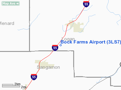
Location
& QuickFacts
|
FAA
Information Effective: |
2007-07-05 |
|
Airport
Identifier: |
3LS7 |
|
Airport
Status: |
Operational |
|
Longitude/Latitude: |
089-30-42.0000W/39-59-11.0000N
-89.511667/39.986389 (Estimated) |
|
Elevation: |
592 ft / 180.44 m () |
|
Land: |
0 acres |
|
From
nearest city: |
0 nautical miles of Williamsville, IL |
|
Location: |
Logan County, IL |
|
Magnetic Variation: |
00E (1995) |
Owner & Manager
|
Ownership: |
Privately owned |
|
Owner: |
Roger Bock |
|
Address: |
Rr 1 Box 68
Williamsville, IL 62693 |
|
Phone number: |
217-566-3867 |
|
Manager: |
Roger Bock |
|
Address: |
Rr 1 Box 68
Williamsville, IL 62693 |
|
Phone number: |
217-566-3867 |
Airport
Operations and Facilities
|
Airport
Use: |
Private |
|
Segmented Circle: |
No |
|
Control
Tower: |
No |
|
Sectional chart: |
Kansas City |
|
Region: |
AGL - Great Lakes |
|
Boundary
ARTCC: |
ZAU - Chicago |
|
Tie-in
FSS: |
STL - Saint Louis |
|
FSS
Phone: |
636-536-2980 |
|
FSS
Toll Free: |
1-800-WX-BRIEF |
|
Runway Information
Runway 18/36
|
Dimension: |
1725
x 105 ft / 525.8 x 32.0 m |
|
Surface: |
TURF, |
|
|
Runway 18 |
Runway 36 |
|
Traffic
Pattern: |
Left |
Left |
|
Obstruction: |
64 ft pline, 900.0 ft from runway |
|
|
Radio Navigation
Aids
|
ID |
Type |
Name |
Ch |
Freq |
Var |
Dist |
|
LQ |
NDB |
Licol |
|
375.00 |
01W |
6.1 nm |
|
AAA |
NDB |
Abraham |
|
329.00 |
00E |
13.2 nm |
|
SP |
NDB |
Huskk |
|
382.00 |
01W |
17.2 nm |
|
TAZ |
NDB |
Taylorville |
|
395.00 |
00E |
28.4 nm |
|
PI |
NDB |
Tungg |
|
356.00 |
01E |
37.4 nm |
|
CTK |
NDB |
Canton |
|
236.00 |
02E |
43.4 nm |
|
SYZ |
NDB |
Shelbyville |
|
365.00 |
01E |
46.6 nm |
|
LTD |
NDB |
Litchfield |
|
371.00 |
01E |
49.9 nm |
|
IJX |
VOR/DME |
Jacksonville |
023X |
108.60 |
02E |
35.8 nm |
|
BMI |
VOR/DME |
Bloomington |
019X |
108.20 |
03E |
39.9 nm |
|
CAP |
VORTAC |
Capital |
074X |
112.70 |
04E |
7.7 nm |
|
SPI |
VORTAC |
Spinner |
74X |
112.70 |
01W |
11.7 nm |
|
DEC |
VORTAC |
Decatur |
119X |
117.20 |
03E |
33.7 nm |
|
PIA |
VORTAC |
Peoria |
099X |
115.20 |
04E |
43.6 nm |
Remarks
- DUE
TO PUBLIC RD TO THE SOUTH PENETRATING THE OFZ & 55 FT PLINE (64
FT ABEAM ARPT) TO THE S.
Bock Farms Airport
Address:
Logan County, IL
Tel:
217-566-3867
Images
and information placed above are from
http://www.airport-data.com/airport/3LS7/
We
thank them for the data!
| General
Info |
| Country |
United
States |
| State |
ILLINOIS
|
| FAA ID |
3LS7 |
| Latitude |
39-59-11.000N
|
| Longitude |
089-30-42.000W
|
| Elevation |
592 feet
|
| Near City |
WILLIAMSVILLE
|
We don't guarantee the information is fresh and accurate. The data may
be wrong or outdated.
For more up-to-date information please refer to other sources.
|
|


