 |
|
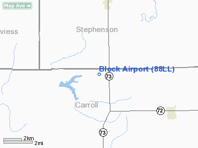
Location
& QuickFacts
|
FAA
Information Effective: |
2007-07-05 |
|
Airport
Identifier: |
88LL |
|
Airport
Status: |
Operational |
|
Longitude/Latitude: |
089-50-17.4320W/42-11-30.0770N
-89.838176/42.191688 (Estimated) |
|
Elevation: |
917 ft / 279.50 m (Surveyed) |
|
Land: |
0 acres |
|
From
nearest city: |
5 nautical miles S of Pearl City, IL |
|
Location: |
Carroll County, IL |
|
Magnetic Variation: |
01E (1985) |
Owner & Manager
|
Ownership: |
Privately owned |
|
Owner: |
Messrs Douglas & Thomas Block |
|
Address: |
Rr 2
Pearl City, IL 61062 |
|
Phone number: |
815-864-2789 |
|
Manager: |
Messrs Douglas & Thomas Block |
|
Address: |
Rr 2
Pearl City, IL 61062 |
|
Phone number: |
815-864-2789 |
Airport
Operations and Facilities
|
Airport
Use: |
Private |
|
Segmented Circle: |
No |
|
Control
Tower: |
No |
|
Sectional chart: |
Chicago |
|
Region: |
AGL - Great Lakes |
|
Boundary
ARTCC: |
ZAU - Chicago |
|
Tie-in
FSS: |
IKK - Kankakee |
|
FSS
on Airport: |
No |
|
FSS
Toll Free: |
1-800-WX-BRIEF |
|
Runway
Information
Runway N/S
|
Dimension: |
1600
x 70 ft / 487.7 x 21.3 m |
|
Surface: |
TURF, |
|
|
Runway N |
Runway S |
|
Traffic
Pattern: |
Left |
Left |
|
Radio Navigation
Aids
|
ID |
Type |
Name |
Ch |
Freq |
Var |
Dist |
|
FEP |
NDB |
Freeport |
|
335.00 |
00E |
11.7 nm |
|
BOZ |
NDB |
Whiteside |
|
254.00 |
01E |
29.0 nm |
|
CWI |
NDB |
Clinton |
|
377.00 |
01E |
30.9 nm |
|
PVB |
NDB |
Platteville |
|
203.00 |
01E |
39.9 nm |
|
OQW |
NDB |
Maquoketa |
|
386.00 |
02E |
41.1 nm |
|
JVL |
NDB |
Janesville |
|
375.00 |
03E |
43.6 nm |
|
MRJ |
NDB |
Mineral Point |
|
365.00 |
00W |
45.3 nm |
|
PLL |
VOR/DME |
Polo |
049X |
111.20 |
03E |
19.5 nm |
|
RFD |
VOR/DME |
Rockford |
045X |
110.80 |
01E |
28.5 nm |
|
JVL |
VOR/DME |
Janesville |
090X |
114.30 |
03E |
39.3 nm |
|
DBQ |
VORTAC |
Dubuque |
105X |
115.80 |
04E |
40.7 nm |
|
CVA |
VORTAC |
Davenport |
085X |
113.80 |
04E |
40.9 nm |
|
DVN |
VOT |
Davenport Municipal |
|
111.80 |
|
48.3 nm |
Remarks
- E111:PROVIDED
ALL TRAFFIC PATTERN OPERATIONS ARE CONDUCTED EAST OF THE RWY.
Based
Aircraft
|
Aircraft
based on field: |
2 |
|
Single
Engine Airplanes: |
2 |
Block Airport
Address:
Carroll County, IL
Tel:
815-864-2789
Images
and information placed above are from
http://www.airport-data.com/airport/88LL/
We
thank them for the data!
| General
Info |
| Country |
United
States |
| State |
ILLINOIS
|
| FAA ID |
88LL |
| Latitude |
42-11-30.077N
|
| Longitude |
089-50-17.432W
|
| Elevation |
917 feet
|
| Near City |
PEARL
CITY |
We don't guarantee the information is fresh and accurate. The data may
be wrong or outdated.
For more up-to-date information please refer to other sources.
|
|


