 |
|
Blessing Hospital At 11th St Heliport |
|
|
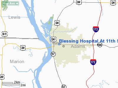
Location
& QuickFacts
|
FAA
Information Effective: |
2007-07-05 |
|
Airport
Identifier: |
0IS8 |
|
Airport
Status: |
Operational |
|
Longitude/Latitude: |
091-23-56.5400W/39-56-11.1650N
-91.399039/39.936435 (Estimated) |
|
Elevation: |
650 ft / 198.12 m (Estimated) |
|
Land: |
0 acres |
|
From
nearest city: |
0 nautical miles N of Quincy, IL |
|
Location: |
Adams County, IL |
|
Magnetic Variation: |
02E (1985) |
Owner
& Manager
|
Ownership: |
Privately
owned |
|
Owner: |
Blessing Hospital At 14th St |
|
Address: |
Po Box 7005
Quincy, IL 62305-7005 |
|
Phone number: |
217-223-8400 |
|
Manager: |
John Bozarth |
|
Address: |
Po Box 7005
Quincy, IL 62305-7005 |
|
Phone number: |
217-223-8400 |
Airport
Operations and Facilities
|
Airport
Use: |
Private
MEDICAL USE. |
|
Wind
indicator: |
Yes |
|
Segmented Circle: |
No |
|
Control
Tower: |
No |
|
Lighting
Schedule: |
24 HRS |
|
Beacon
Color: |
Clear-Green-Yellow (heliport) |
|
Landing
fee charge: |
No |
|
Sectional chart: |
Kansas City |
|
Region: |
AGL - Great Lakes |
|
Boundary
ARTCC: |
ZKC - Kansas City |
|
Tie-in
FSS: |
STL - Saint Louis |
|
FSS
on Airport: |
No |
|
FSS
Phone: |
636-536-2980 |
|
FSS
Toll Free: |
1-800-WX-BRIEF |
|
Runway Information
Helipad H1
|
Dimension: |
40
x 40 ft / 12.2 x 12.2 m |
|
Surface: |
CONC,
HI ROOFTOP/H2 SFC PAD.. |
|
|
Runway H1 |
Runway |
|
Traffic
Pattern: |
Left |
Left |
|
Helipad H2
|
Dimension: |
40
x 40 ft / 12.2 x 12.2 m |
|
Surface: |
CONC,
HI ROOFTOP/H2 SFC PAD.. |
|
|
Runway H2 |
Runway |
|
Traffic
Pattern: |
Left |
Left |
|
Radio Navigation
Aids
|
ID |
Type |
Name |
Ch |
Freq |
Var |
Dist |
|
UI |
NDB |
Quincy |
|
293.00 |
02E |
7.3 nm |
|
HAE |
NDB |
Hannibal |
|
411.00 |
03E |
12.8 nm |
|
EOK |
NDB |
Keokuk |
|
366.00 |
02E |
31.8 nm |
|
PPQ |
NDB |
Pittsfield |
|
344.00 |
02E |
33.6 nm |
|
UIN |
VORTAC |
Quincy |
083X |
113.60 |
05E |
7.7 nm |
Remarks
- APP/DEP
OPERATIONS ARE CONDUCTED IN AN AREA FROM 360 DEGS TO 30 DEGS, FROM 120
DEGS TO 170 DEGS, AND FROM 190 DEGS TO 240 DEGS CLOCKWISE; AREA IS APPROPRIATELY
MARKED; WIND INDICATOR IS MAINTAINED.
Based
Aircraft
|
Aircraft
based on field: |
1 |
|
Ultralights: |
1 |
Blessing Hospital At 11th St Heliport
Address:
Adams County, IL
Tel:
217-223-8400
Images
and information placed above are from
http://www.airport-data.com/airport/0IS8/
We
thank them for the data!
| General
Info |
| Country |
United
States |
| State |
ILLINOIS
|
| FAA ID |
0IS8 |
| Latitude |
39-56-11.165N
|
| Longitude |
091-23-56.540W
|
| Elevation |
650 feet
|
| Near City |
QUINCY
|
We don't guarantee the information is fresh and accurate. The data may
be wrong or outdated.
For more up-to-date information please refer to other sources.
|
|


