 |
|
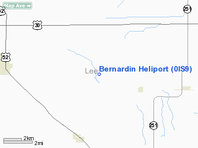
Location
& QuickFacts
|
FAA
Information Effective: |
2007-07-05 |
|
Airport
Identifier: |
0IS9 |
|
Airport
Status: |
Operational |
|
Longitude/Latitude: |
089-12-10.3310W/41-42-30.1150N
-89.202870/41.708365 (Estimated) |
|
Elevation: |
830 ft / 252.98 m (Estimated) |
|
Land: |
0 acres |
|
From
nearest city: |
4 nautical miles NW of West Brooklyn, IL |
|
Location: |
Lee County, IL |
|
Magnetic Variation: |
00E (1985) |
Owner
& Manager
|
Ownership: |
Privately
owned |
|
Owner: |
Marvin Bernardin |
|
Address: |
2240 Shaw Road
West Brooklyn, IL 61378 |
|
Phone
number: |
815-628-3431 |
|
Manager: |
Marvin Bernardin |
|
Address: |
2240 Shaw Road
West Brooklyn, IL 61378 |
|
Phone number: |
815-628-3431 |
Airport Operations and Facilities
|
Airport
Use: |
Private |
|
Wind
indicator: |
Yes |
|
Segmented Circle: |
No |
|
Control
Tower: |
No |
|
Landing
fee charge: |
No |
|
Sectional chart: |
Chicago |
|
Region: |
AGL - Great Lakes |
|
Boundary
ARTCC: |
ZAU - Chicago |
|
Tie-in
FSS: |
IKK - Kankakee |
|
FSS
on Airport: |
No |
|
FSS
Toll Free: |
1-800-WX-BRIEF |
|
Runway Information
Helipad H1
|
Dimension: |
500
x 500 ft / 152.4 x 152.4 m |
|
Surface: |
TURF, |
|
|
Runway H1 |
Runway |
|
Traffic
Pattern: |
Left |
Left |
|
Radio Navigation
Aids
|
ID |
Type |
Name |
Ch |
Freq |
Var |
Dist |
|
VYS |
NDB |
Valley |
|
230.00 |
00W |
21.4 nm |
|
DKB |
NDB |
Dekalb |
|
209.00 |
02W |
26.0 nm |
|
OIX |
NDB |
Ottawa |
|
266.00 |
01E |
26.0 nm |
|
BOZ |
NDB |
Whiteside |
|
254.00 |
01E |
26.1 nm |
|
FEP |
NDB |
Freeport |
|
335.00 |
00E |
36.5 nm |
|
EZI |
NDB |
Kewanee |
|
245.00 |
01E |
45.7 nm |
|
PLL |
VOR/DME |
Polo |
049X |
111.20 |
03E |
21.1 nm |
|
RFD |
VOR/DME |
Rockford |
045X |
110.80 |
01E |
31.1 nm |
|
DPA |
VOR/DME |
Dupage |
021X |
108.40 |
02E |
39.7 nm |
|
BDF |
VORTAC |
Bradford |
094X |
114.70 |
00E |
37.3 nm |
|
JOT |
VORTAC |
Joliet |
070X |
112.30 |
02E |
40.9 nm |
Remarks
- ALL
APP/DEP OPERATIONS ARE CONDUCTED IN AN AREA FROM 170 DEGS CLOCKWISE
TO 360 DEGS; AREA IS APPROPRIATELY MARKED; WIND INDICATOR IS MAINTAINED.
Bernardin Heliport
Address:
Lee County, IL
Tel:
815-628-3431
Images
and information placed above are from
http://www.airport-data.com/airport/0IS9/
We
thank them for the data!
| General
Info |
| Country |
United
States |
| State |
ILLINOIS
|
| FAA ID |
0IS9 |
| Latitude |
41-42-30.115N
|
| Longitude |
089-12-10.331W
|
| Elevation |
830 feet
|
| Near City |
WEST BROOKLYN
|
We don't guarantee the information is fresh and accurate. The data may
be wrong or outdated.
For more up-to-date information please refer to other sources.
|
|


