 |
|
|
|
|
|
Location
& QuickFacts
|
FAA
Information Effective: |
2007-07-05 |
|
Airport
Identifier: |
5LL0 |
|
Airport
Status: |
Operational |
|
Longitude/Latitude: |
087-50-15.1080W/38-24-30.1700N
-87.837530/38.408381 (Estimated) |
|
Elevation: |
424 ft / 129.24 m (Estimated) |
|
Land: |
10 acres |
|
From
nearest city: |
3 nautical miles W of Mount Carmel, IL |
|
Location: |
Wabash County, IL |
|
Magnetic Variation: |
00W (1985) |
Owner
& Manager
|
Ownership: |
Privately
owned |
|
Owner: |
Marguerite Beckerman |
|
Address: |
12336 East 840 Road
Mount Carmel, IL 62863 |
|
Phone
number: |
618-262-4718 |
|
Manager: |
George Beckerman |
|
Address: |
12336 East 840 Road
Mount Carmel, IL 62863 |
|
Phone number: |
618-262-4718 |
Airport Operations and Facilities
|
Airport Use: |
Private |
|
Wind indicator: |
No |
|
Segmented Circle: |
No |
|
Control Tower: |
No |
|
Landing fee charge: |
No |
|
Sectional chart: |
St Louis |
|
Region: |
AGL - Great Lakes |
|
Boundary ARTCC: |
ZID - Indianapolis |
|
Tie-in FSS: |
COU - Columbia |
|
FSS on Airport: |
No |
|
FSS Toll Free: |
1-800-WX-BRIEF |
Airport Services
|
Airframe
Repair: |
NONE |
|
Power
Plant Repair: |
NONE |
|
Bottled
Oxygen: |
NONE |
|
Bulk
Oxygen: |
NONE |
|
Runway Information
Runway 18/36
|
Dimension: |
1940
x 100 ft / 591.3 x 30.5 m |
|
Surface: |
TURF, |
|
|
Runway 18 |
Runway 36 |
|
Traffic
Pattern: |
Left |
Left |
|
Radio Navigation
Aids
|
ID |
Type |
Name |
Ch |
Freq |
Var |
Dist |
|
AJG |
NDB |
Mount Carmel |
|
524.00 |
02W |
13.3 nm |
|
OEA |
NDB |
Vincennes |
|
251.00 |
00E |
21.6 nm |
|
CUL |
NDB |
Carmi |
|
332.00 |
01W |
23.1 nm |
|
OLY |
NDB |
Olney |
|
272.00 |
00W |
24.4 nm |
|
PDW |
NDB |
Evansville |
|
284.00 |
00E |
26.4 nm |
|
FWC |
NDB |
Wayne County |
|
257.00 |
01E |
27.0 nm |
|
FOA |
NDB |
Elm River |
|
353.00 |
00E |
32.9 nm |
|
GVA |
NDB |
Geneva |
|
224.00 |
01W |
36.5 nm |
|
DCY |
NDB |
Washington |
|
212.00 |
03W |
37.4 nm |
|
PLX |
NDB |
Palestine |
|
391.00 |
00W |
37.5 nm |
|
SIV |
NDB |
Sullivan |
|
326.00 |
02W |
46.2 nm |
|
FNZ |
NDB |
Ferdinand |
|
239.00 |
00E |
48.1 nm |
|
HSB |
NDB |
Harrisburg-raleigh |
|
230.00 |
00E |
49.1 nm |
|
SAM |
VOR/DME |
Samsville |
113X |
116.60 |
03E |
12.6 nm |
|
LWV |
VOR/DME |
Lawrenceville |
025X |
108.80 |
01W |
24.3 nm |
|
RSV |
VOR/DME |
Robinson |
021X |
108.40 |
02E |
37.7 nm |
|
HNB |
VOR/DME |
Huntingburg |
029X |
109.20 |
00E |
42.6 nm |
|
VNN |
VOR/DME |
Mount Vernon |
085X |
113.80 |
02E |
45.8 nm |
|
PXV |
VORTAC |
Pocket City |
080X |
113.30 |
03E |
29.1 nm |
|
BIB |
VORTAC |
Bible Grove |
027X |
109.00 |
03E |
43.1 nm |
Based
Aircraft
|
Aircraft
based on field: |
1 |
|
Single
Engine Airplanes: |
1 |
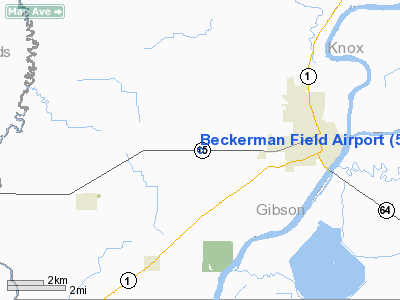
Beckerman Field Airport
Address:
Wabash County, IL
Tel:
618-262-4718
Images
and information placed above are from
http://www.airport-data.com/airport/5LL0/
We
thank them for the data!
| General
Info |
| Country |
United
States |
| State |
ILLINOIS
|
| FAA ID |
5LL0 |
| Latitude |
38-24-30.170N
|
| Longitude |
087-50-15.108W
|
| Elevation |
424 feet
|
| Near City |
MOUNT
CARMEL |
We don't guarantee the information is fresh and accurate. The data may
be wrong or outdated.
For more up-to-date information please refer to other sources.
|
|


