 |
|
Location
& QuickFacts
|
FAA
Information Effective: |
2007-07-05 |
|
Airport
Identifier: |
IS25 |
|
Airport
Status: |
Operational |
|
Longitude/Latitude: |
087-51-34.2240W/41-56-29.1100N
-87.859507/41.941419 (Estimated) |
|
Elevation: |
649 ft / 197.82 m (Estimated) |
|
Land: |
0 acres |
|
From
nearest city: |
0 nautical miles N of Franklin Park, IL |
|
Location: |
Cook County, IL |
|
Magnetic Variation: |
01W (1985) |
Owner
& Manager
|
Ownership: |
Privately
owned |
|
Owner: |
Pamisuru Corp |
|
Address: |
9300 King St
Franklin Park, IL 60131 |
|
Phone
number: |
847-678-3232 |
|
Manager: |
Don Fortney |
|
Address: |
9300 King St
Franklin Park, IL 60131 |
|
Phone number: |
847-678-3232 |
Airport Operations and Facilities
|
Airport
Use: |
Private |
|
Wind
indicator: |
No |
|
Segmented Circle: |
No |
|
Control
Tower: |
No |
|
Landing
fee charge: |
No |
|
Sectional chart: |
Chicago |
|
Region: |
AGL - Great Lakes |
|
Boundary
ARTCC: |
ZAU - Chicago |
|
Tie-in
FSS: |
IKK - Kankakee |
|
FSS
on Airport: |
No |
|
FSS
Toll Free: |
1-800-WX-BRIEF |
|
Runway Information
Helipad H1
|
Dimension: |
45
x 45 ft / 13.7 x 13.7 m |
|
Surface: |
TURF,
HELIPAD ON ROOFTOP SFC TYPE UNKNOWN. |
|
|
Runway H1 |
Runway |
|
Traffic
Pattern: |
Left |
Left |
|
Radio Navigation
Aids
|
ID |
Type |
Name |
Ch |
Freq |
Var |
Dist |
|
ME |
NDB |
Deana |
|
350.00 |
00E |
7.6 nm |
|
HK |
NDB |
Ermin |
|
332.00 |
01W |
13.4 nm |
|
MX |
NDB |
Kedzi |
|
248.00 |
01W |
14.2 nm |
|
DKB |
NDB |
Dekalb |
|
209.00 |
02W |
37.9 nm |
|
RA |
NDB |
Paser |
|
206.00 |
00E |
44.6 nm |
|
MGC |
NDB |
Michigan City |
|
203.00 |
01W |
48.8 nm |
|
ORD |
VOR/DME |
Chicago O'hare |
086X |
113.90 |
02E |
3.4 nm |
|
OBK |
VOR/DME |
Northbrook |
077X |
113.00 |
02W |
17.3 nm |
|
DPA |
VOR/DME |
Dupage |
021X |
108.40 |
02E |
22.2 nm |
|
ENW |
VOR/DME |
Kenosha |
029X |
109.20 |
02W |
39.7 nm |
|
BUU |
VOR/DME |
Burbun |
092X |
114.50 |
01W |
49.1 nm |
|
HRK |
VOR/DME |
Horlick |
124X |
117.70 |
02W |
49.4 nm |
|
CGT |
VORTAC |
Chicago Heights |
089X |
114.20 |
02E |
29.0 nm |
|
JOT |
VORTAC |
Joliet |
070X |
112.30 |
02E |
31.4 nm |
|
EON |
VORTAC |
Peotone |
079X |
113.20 |
02E |
40.5 nm |
|
ORD |
VOT |
Chicago O'hare Intl |
|
112.00 |
|
3.3 nm |
|
MDW |
VOT |
Chicago Midway |
|
111.00 |
|
10.5 nm |
Remarks
- E111:
INGRESS/EGRESS ROUTES ARE LIMITED TO 050-080 DEGS; 190-210 DEGS; AND
270-340 DEGS USING THE HELIPAD AS THE CENTER OF A COMPASS ROSE.
Based
Aircraft
|
Aircraft
based on field: |
1 |
|
Helicopters: |
1 |
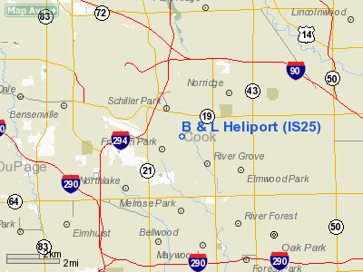
B And L Heliport
Address:
Cook County, IL
Tel:
847-678-3232
Images
and information placed above are from
http://www.airport-data.com/airport/IS25/
We
thank them for the data!
| General
Info |
| Country |
United
States |
| State |
ILLINOIS
|
| FAA ID |
IS25 |
| Latitude |
41-56-29.110N
|
| Longitude |
087-51-34.224W
|
| Elevation |
649 feet
|
| Near City |
FRANKLIN
PARK |
We don't guarantee the information is fresh and accurate. The data may
be wrong or outdated.
For more up-to-date information please refer to other sources.
|
|


