 |
|
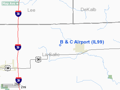
Location
& QuickFacts
|
FAA
Information Effective: |
2007-07-05 |
|
Airport
Identifier: |
IL99 |
|
Airport
Status: |
Operational |
|
Longitude/Latitude: |
088-58-02.3000W/41-35-34.1110N
-88.967306/41.592809 (Estimated) |
|
Elevation: |
715 ft / 217.93 m (Estimated) |
|
Land: |
0 acres |
|
From
nearest city: |
2 nautical miles W of Earlville, IL |
|
Location: |
La Salle County, IL |
|
Magnetic Variation: |
00W (1990) |
Owner
& Manager
|
Ownership: |
Privately
owned |
|
Owner: |
Robert M. Doughty |
|
Address: |
Rt 1 4550th Rd
Earlville, IL 60518 |
|
Phone
number: |
815-246-3988 |
|
Manager: |
Robert M. Doughty |
|
Address: |
Rt 1 4550th Rd
Earlville, IL 60518 |
|
Phone number: |
815-246-3988 |
Airport Operations and Facilities
|
Airport
Use: |
Private |
|
Wind
indicator: |
Yes |
|
Segmented Circle: |
No |
|
Control
Tower: |
No |
|
Sectional chart: |
Chicago |
|
Region: |
AGL - Great Lakes |
|
Boundary
ARTCC: |
ZAU - Chicago |
|
Tie-in
FSS: |
IKK - Kankakee |
|
FSS
Toll Free: |
1-800-WX-BRIEF |
|
Runway Information
Runway 09/27
|
Dimension: |
2200
x 70 ft / 670.6 x 21.3 m |
|
Surface: |
TURF, |
|
|
Runway 09 |
Runway 27 |
|
Traffic
Pattern: |
Left |
Left |
|
Radio Navigation
Aids
|
ID |
Type |
Name |
Ch |
Freq |
Var |
Dist |
|
OIX |
NDB |
Ottawa |
|
266.00 |
01E |
14.7 nm |
|
VYS |
NDB |
Valley |
|
230.00 |
00W |
16.5 nm |
|
DKB |
NDB |
Dekalb |
|
209.00 |
02W |
23.6 nm |
|
BOZ |
NDB |
Whiteside |
|
254.00 |
01E |
37.4 nm |
|
ME |
NDB |
Deana |
|
350.00 |
00E |
47.8 nm |
|
FEP |
NDB |
Freeport |
|
335.00 |
00E |
48.0 nm |
|
DPA |
VOR/DME |
Dupage |
021X |
108.40 |
02E |
33.0 nm |
|
PLL |
VOR/DME |
Polo |
049X |
111.20 |
03E |
33.5 nm |
|
RFD |
VOR/DME |
Rockford |
045X |
110.80 |
01E |
39.4 nm |
|
PNT |
VOR/DME |
Pontiac |
033X |
109.60 |
03E |
47.6 nm |
|
JOT |
VORTAC |
Joliet |
070X |
112.30 |
02E |
29.3 nm |
|
BDF |
VORTAC |
Bradford |
094X |
114.70 |
00E |
38.2 nm |
Remarks
- OBS
REMOVED/LOWERED OR THRS DSPLCD TO PROVIDE 20:1 SLOPES; 125' EITHER SIDE
OF CNTRLN & 200' EITHER END ARE CLEAR OF OBS; TFC PATTERNS REMAIN
N OF RY.
Based
Aircraft
|
Aircraft
based on field: |
1 |
|
Single
Engine Airplanes: |
1 |
B And C Airport
Address:
La Salle County, IL
Tel:
815-246-3988
Images
and information placed above are from
http://www.airport-data.com/airport/IL99/
We
thank them for the data!
| General
Info |
| Country |
United
States |
| State |
ILLINOIS
|
| FAA ID |
IL99 |
| Latitude |
41-35-34.111N
|
| Longitude |
088-58-02.300W
|
| Elevation |
715 feet
|
| Near City |
EARLVILLE
|
We don't guarantee the information is fresh and accurate. The data may
be wrong or outdated.
For more up-to-date information please refer to other sources.
|
|


