 |
|
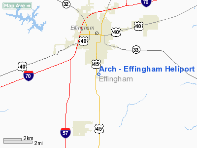
Arch - Effingham Heliport |
Location
& QuickFacts
|
FAA
Information Effective: |
2007-07-05 |
|
Airport
Identifier: |
77IL |
|
Airport
Status: |
Operational |
|
Longitude/Latitude: |
088-32-39.0000W/39-04-48.0000N
-88.544167/39.080000 (Estimated) |
|
Elevation: |
585 ft / 178.31 m (Estimated) |
|
Land: |
0 acres |
|
From
nearest city: |
2 nautical miles S of Effingham, IL |
|
Location: |
Effingham County, IL |
|
Magnetic Variation: |
() |
Owner
& Manager
|
Ownership: |
Privately
owned |
|
Owner: |
Arch Air Medical Services Inc |
|
Address: |
2207 Scott Ave
St Louis, MO 63103 |
|
Phone number: |
314-655-4031 |
|
Manager: |
Ryan Kostel |
|
Address: |
306 Professional Park
Effingham, IL 62401 |
|
Phone number: |
314-655-4100 |
Airport
Operations and Facilities
|
Airport
Use: |
Private |
|
Wind
indicator: |
Yes |
|
Control
Tower: |
No |
|
Lighting
Schedule: |
DUSK-DAWN |
|
Sectional chart: |
St Louis |
|
Region: |
AGL - Great Lakes |
|
Boundary
ARTCC: |
ZKC - Kansas City |
|
Tie-in
FSS: |
STL - Saint Louis |
|
FSS
Phone: |
636-536-2980 |
|
FSS
Toll Free: |
1-800-WX-BRIEF |
|
Runway Information
Helipad H1
|
Dimension: |
15
x 15 ft / 4.6 x 4.6 m |
|
Surface: |
CONC, |
|
|
Runway H1 |
Runway |
|
Traffic
Pattern: |
Left |
Left |
|
Radio Navigation
Aids
|
ID |
Type |
Name |
Ch |
Freq |
Var |
Dist |
|
SYZ |
NDB |
Shelbyville |
|
365.00 |
01E |
24.1 nm |
|
FOA |
NDB |
Elm River |
|
353.00 |
00E |
25.1 nm |
|
MT |
NDB |
Zebre |
|
347.00 |
00E |
27.8 nm |
|
OLY |
NDB |
Olney |
|
272.00 |
00W |
27.8 nm |
|
CZB |
NDB |
Casey |
|
359.00 |
00E |
28.7 nm |
|
SLO |
NDB |
Salem |
|
400.00 |
01W |
32.8 nm |
|
PLX |
NDB |
Palestine |
|
391.00 |
00W |
42.4 nm |
|
FWC |
NDB |
Wayne County |
|
257.00 |
01E |
42.5 nm |
|
TAZ |
NDB |
Taylorville |
|
395.00 |
00E |
45.5 nm |
|
AJG |
NDB |
Mount Carmel |
|
524.00 |
02W |
47.5 nm |
|
MTO |
VOR/DME |
Mattoon |
031X |
109.40 |
03E |
26.8 nm |
|
SAM |
VOR/DME |
Samsville |
113X |
116.60 |
03E |
41.7 nm |
|
RSV |
VOR/DME |
Robinson |
021X |
108.40 |
02E |
42.0 nm |
|
VNN |
VOR/DME |
Mount Vernon |
085X |
113.80 |
02E |
44.9 nm |
|
LWV |
VOR/DME |
Lawrenceville |
025X |
108.80 |
01W |
47.8 nm |
|
BIB |
VORTAC |
Bible Grove |
027X |
109.00 |
03E |
10.0 nm |
|
VLA |
VORTAC |
Vandalia |
090X |
114.30 |
04E |
28.9 nm |
|
DEC |
VORTAC |
Decatur |
119X |
117.20 |
03E |
42.1 nm |
|
ENL |
VORTAC |
Centralia |
097X |
115.00 |
04E |
49.0 nm |
Remarks
- PRVDD
ALL APCHS/DEP FM 175-105 & 305-315, AREA MKD & WIND INDICATOR
IS MAINTAINED, AND COMPLY WITH FAR PART 91.126(B)(2).
Based
Aircraft
|
Aircraft
based on field: |
1 |
|
Helicopters: |
1 |
Arch - Effingham Heliport
Address:
Effingham County, IL
Tel:
314-655-4031, 314-655-4100
Images
and information placed above are from
http://www.airport-data.com/airport/77IL/
We
thank them for the data!
We don't guarantee the information is fresh and accurate. The data may
be wrong or outdated.
For more up-to-date information please refer to other sources.
|
|


