 |
|
Location
& QuickFacts
|
FAA
Information Effective: |
2007-07-05 |
|
Airport
Identifier: |
41IL |
|
Airport
Status: |
Operational |
|
Longitude/Latitude: |
089-02-00.3570W/42-04-10.0930N
-89.033433/42.069470 (Estimated) |
|
Elevation: |
780 ft / 237.74 m (Estimated) |
|
Land: |
0 acres |
|
From
nearest city: |
1 nautical miles NW of Lindenwood, IL |
|
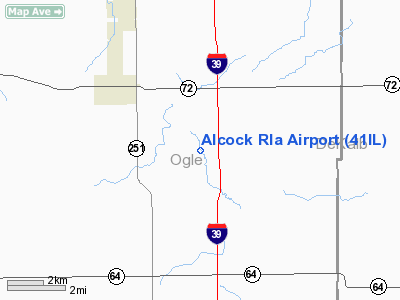
Location: |
Ogle County, IL |
|
Magnetic Variation: |
00E (1985) |
Owner & Manager
|
Ownership: |
Privately owned |
|
Owner: |
William Alcock |
|
Address: |
Lindenwood, IL 61049 |
|
Address: |
|
|
Phone number: |
815-645-2796 |
Airport Operations and Facilities
|
Airport Use: |
Private |
|
Wind indicator: |
Yes |
|
Segmented Circle: |
No |
|
Control Tower: |
No |
|
Landing fee charge: |
No |
|
Sectional chart: |
Chicago |
|
Region: |
AGL - Great Lakes |
|
Boundary ARTCC: |
ZAU - Chicago |
|
Tie-in FSS: |
IKK - Kankakee |
|
FSS on Airport: |
No |
|
FSS Toll Free: |
1-800-WX-BRIEF |
Airport Services
|
Airframe
Repair: |
NONE |
|
Power
Plant Repair: |
NONE |
|
Runway Information
Runway E/W
|
Dimension: |
1200
x 50 ft / 365.8 x 15.2 m |
|
Surface: |
TURF, |
|
|
Runway E |
Runway W |
|
Traffic
Pattern: |
Left |
Left |
|
Runway N/S
|
Dimension: |
1600
x 50 ft / 487.7 x 15.2 m |
|
Surface: |
TURF, |
|
|
Runway N |
Runway S |
|
Traffic
Pattern: |
Left |
Left |
|
Radio Navigation
Aids
|
ID |
Type |
Name |
Ch |
Freq |
Var |
Dist |
|
DKB |
NDB |
Dekalb |
|
209.00 |
02W |
16.7 nm |
|
FEP |
NDB |
Freeport |
|
335.00 |
00E |
26.8 nm |
|
JVL |
NDB |
Janesville |
|
375.00 |
03E |
32.8 nm |
|
BOZ |
NDB |
Whiteside |
|
254.00 |
01E |
40.0 nm |
|
LVV |
NDB |
Lake Lawn |
|
404.00 |
00W |
42.6 nm |
|
OIX |
NDB |
Ottawa |
|
266.00 |
01E |
43.2 nm |
|
VYS |
NDB |
Valley |
|
230.00 |
00W |
43.3 nm |
|
ME |
NDB |
Deana |
|
350.00 |
00E |
45.4 nm |
|
RFD |
VOR/DME |
Rockford |
045X |
110.80 |
01E |
11.9 nm |
|
PLL |
VOR/DME |
Polo |
049X |
111.20 |
03E |
22.8 nm |
|
JVL |
VOR/DME |
Janesville |
090X |
114.30 |
03E |
29.5 nm |
|
DPA |
VOR/DME |
Dupage |
021X |
108.40 |
02E |
32.4 nm |
|
OBK |
VOR/DME |
Northbrook |
077X |
113.00 |
02W |
49.1 nm |
|
BUU |
VOR/DME |
Burbun |
092X |
114.50 |
01W |
49.4 nm |
|
JOT |
VORTAC |
Joliet |
070X |
112.30 |
02E |
44.9 nm |
Remarks
- (E137-1)
ONE RWY MAINT AT ANY ONE TIME/DEPENDING ON TIME OF YEAR AND CROP ROTATION
ON THE FARM.
Alcock Rla Airport
Address:
Ogle County, IL
Tel:
815-645-2796
Images
and information placed above are from
http://www.airport-data.com/airport/41IL/
We
thank them for the data!
| General
Info |
| Country |
United
States |
| State |
ILLINOIS
|
| FAA ID |
41IL |
| Latitude |
42-04-10.093N
|
| Longitude |
089-02-00.357W
|
| Elevation |
780 feet
|
| Near City |
LINDENWOOD
|
We don't guarantee the information is fresh and accurate. The data may
be wrong or outdated.
For more up-to-date information please refer to other sources.
|
|


